MyTopo
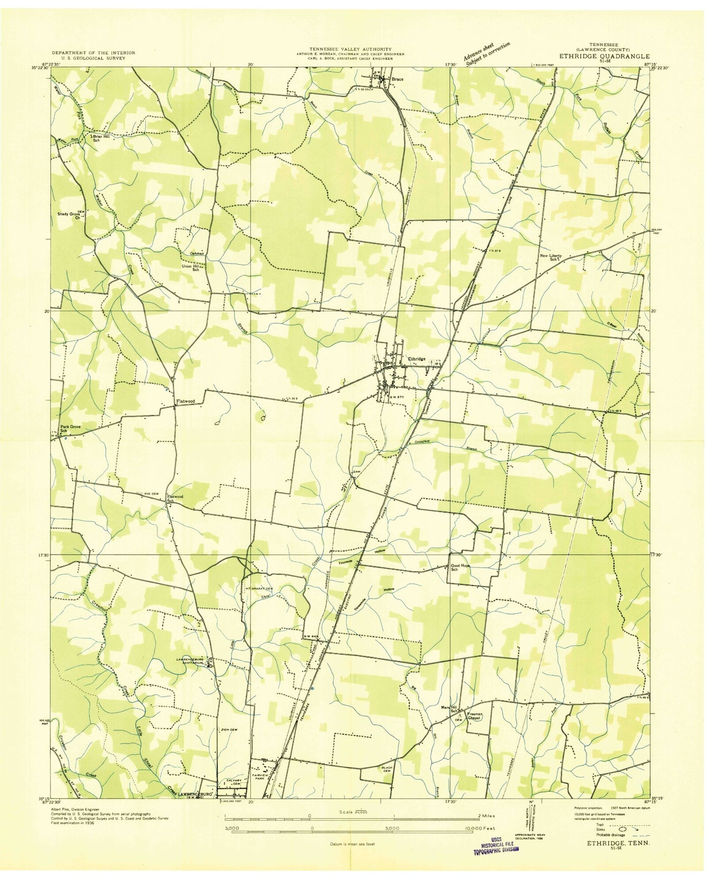
Classic USGS Ethridge Tennessee 7.5'x7.5' Topo Map
Couldn't load pickup availability
Historical USGS topographic quad map of Ethridge in the state of Tennessee. Map scale may vary for some years, but is generally around 1:24,000. Print size is approximately 24" x 27"
This quadrangle is in the following counties: Lawrence.
The map contains contour lines, roads, rivers, towns, and lakes. Printed on high-quality waterproof paper with UV fade-resistant inks, and shipped rolled.
Contains the following named places: Alexander Cemetery, Belmont, Bethel Cemetery, Big Dry Branch, Black Cemetery, Brace, Brace Baptist Church, Briar Hill School, Brier Hill, Buffalo River, Calvary Cemetery, Clearview Heights, Commissioner District 14, Commissioner District 17, Commissioner District 9, Crawfish Branch, Crawfish Creek, Crawfish Valley Community Center, Crawfish Valley Fire Rescue Squad, Crossfield Branch, Crossroads, David Crockett Lake, David Crockett Lake Dam, David Crockett State Park, Eastside School, Ethridge, Ethridge Baptist Church, Ethridge Cemetery, Ethridge Division, Ethridge Elementary School, Ethridge Methodist Church, Ethridge Police Department, Ethridge Post Office, Ethridge Volunteer Fire Department, Fairview Park, Flatwood School, Flatwoods, Flatwoods Baptist church, Flatwoods Church of Christ, Fleming Spring, Fort Corckett Village Shopping Center, Fourmile Hollow, Freedom Hill Church, Freeman Chapel, Good Hope School, Harmony Cemetery, Harmony Church, Hudson Spring, Kidd Cemetery, Lawrence County Farm, Lawrence County High School, Lawrence County Home, Lawrence County Memorial Gardens, Lawrence County Vocational Center, Lawrenceburg Fire Department Station 2, Lawrenceburg Plaza Shopping Center, Lawrenceburg Sanitarium and Hospital, Lawrenceburg Speedway and Dragstrip, Lay Cemetery, Mars Hill, Mars Hill Baptist Church, Mars Hill Methodist Cemetery, Mars Hill School, Meadowview, Meadowview Baptist Church, Middle School, Mount Ararat Cemetery, Mount Ararat Cumberland Presbyterian Church, New Liberty School, Oehmen Branch, Old County Farm Spring, Park Grove, Park Grove School, Shady Grove Cemetery, Shady Grove Church, Staggs Spring, Tanyard Spring, Tennessee Highway Patrol District Seven Headquarters, Three Oaks, Threemile Hollow, Town of Ethridge, Union Hill Church, Union Hill School, Wayne Station, WDXE-AM (Lawrenceburg), WDXE-FM (Lawrenceburg), Webber City, Westside School, Yoder Cemetery, Zion Cemetery, ZIP Code: 38456