MyTopo
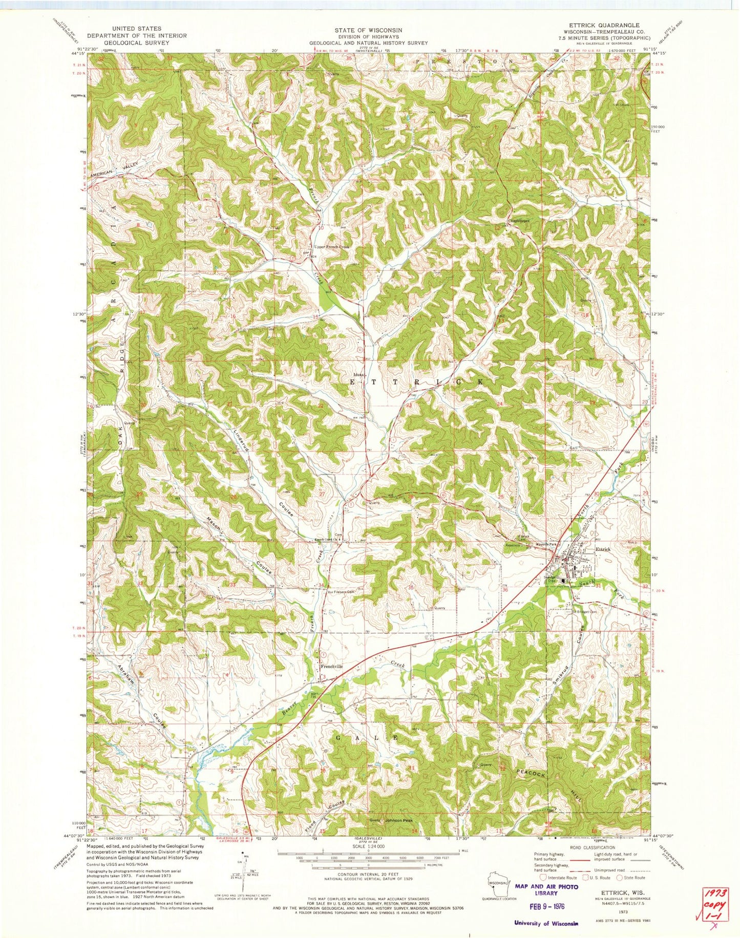
Classic USGS Ettrick Wisconsin 7.5'x7.5' Topo Map
Couldn't load pickup availability
Historical USGS topographic quad map of Ettrick in the state of Wisconsin. Map scale may vary for some years, but is generally around 1:24,000. Print size is approximately 24" x 27"
This quadrangle is in the following counties: Trempealeau.
The map contains contour lines, roads, rivers, towns, and lakes. Printed on high-quality waterproof paper with UV fade-resistant inks, and shipped rolled.
Contains the following named places: Abraham Coulee, Berean Christian School, Bidwell Creek, Chapultepec School, Chapultepee, Ettrick, Ettrick Cemetery, Ettrick Elementary School, Ettrick Post Office, Ettrick Volunteer Fire Department, French Creek, French Creek Church, Frenchville, Frenchville School, Iduna, Johnson Peak, Linderund Coulee, Mais Creek, Mason Coulee, North Fork Beaver Creek, Oak Ridge School, Saint Bridget Cemetery, Smikrud Coulee, Smith Creek, Smith School, South Fork Beaver Creek, Upper French Creek, Upper French Creek School, Village of Ettrick, Vor Frelsers Cemetery, Wayside School