MyTopo
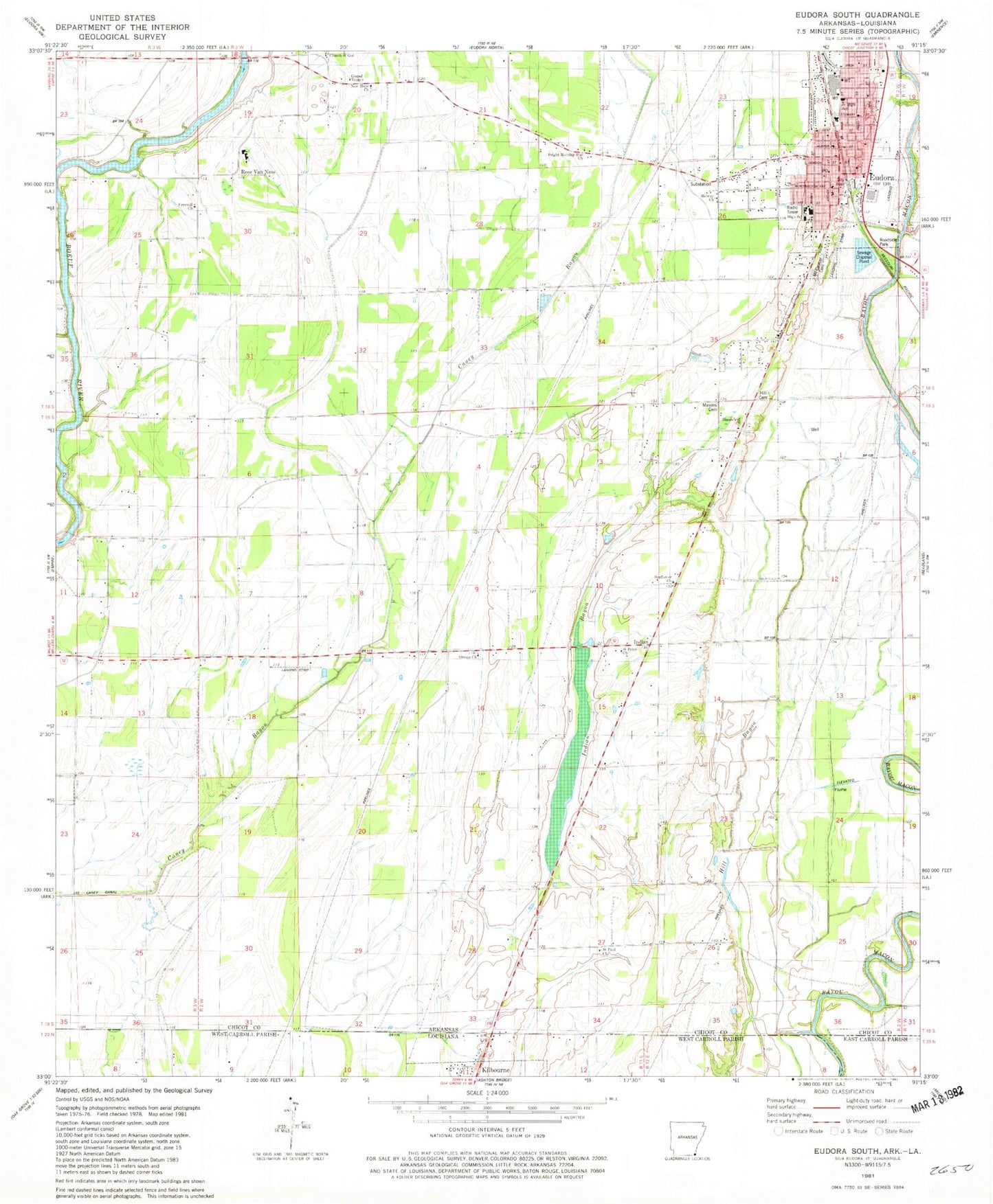
Classic USGS Eudora South Arkansas 7.5'x7.5' Topo Map
Couldn't load pickup availability
Historical USGS topographic quad map of Eudora South in the state of Arkansas. Map scale may vary for some years, but is generally around 1:24,000. Print size is approximately 24" x 27"
This quadrangle is in the following counties: Chicot, East Carroll, West Carroll.
The map contains contour lines, roads, rivers, towns, and lakes. Printed on high-quality waterproof paper with UV fade-resistant inks, and shipped rolled.
Contains the following named places: Baker Flying Service Airport, Ball Lake, Ball Lake Dam Number Two, Bloomfield Church, Bright Morning Star Church, Brown Crossing, Church of God, City of Eudora, Elite Medical Services, Eudora, Eudora City Hall, Eudora Elementary School, Eudora High School, Eudora Junior High School, Eudora Police Department, Eudora Post Office, Eudora Volunteer Fire Station, First Baptist Church, Freewill Church, G C Johns Elementary School, G C Johns Lower Elementary School, Gospel Temple, Hanna, Hill Cemetery, Holly School, Indian, Indian Bayou, Masons Cemetery, Midway Church, Mount Carmel Cemetery, New Hope Church, Omega Church, Ross Van Ness, Ross Van Ness School, Saint Paul Church, Saint Peter Church, Sunflower Church, Township of Bayou Mason, Ward's Airport, Wellford, ZIP Code: 71640