MyTopo
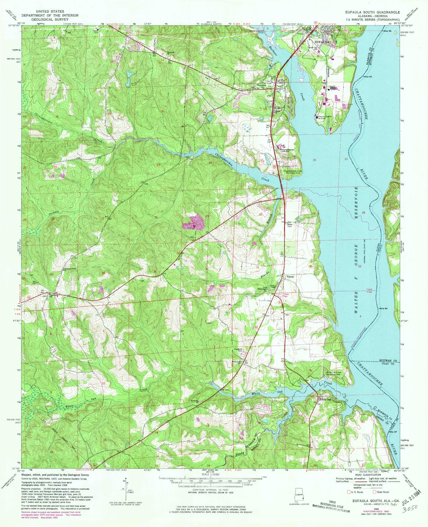
Classic USGS Eufaula South Alabama 7.5'x7.5' Topo Map
Couldn't load pickup availability
Historical USGS topographic quad map of Eufaula South in the state of Alabama. Map scale may vary for some years, but is generally around 1:24,000. Print size is approximately 24" x 27"
This quadrangle is in the following counties: Barbour, Clay, Henry, Quitman.
The map contains contour lines, roads, rivers, towns, and lakes. Printed on high-quality waterproof paper with UV fade-resistant inks, and shipped rolled.
Contains the following named places: Alexanders Landing, Alexanders Mill, Barbour Creek, Barbour Creek Landing Recreational Facility, Blacks Branch, Bluff City Elementary School, Chauncy Sparks Termina, Chauncy Sparks Trade School, Cheneyhatchee Creek, Cheneyhatchee Creek Recreation Area, Chipola Creek, Christian Grove Church, Epworth United Methodist Church, Espy School, Eufaula Church, Eufaula Fire and Rescue Southside Station, Eufaula Fire and Rescue Westside Station, Freemont Junior High School, Freemount African Methodist Episcopal Church, Friendship Church, Grantham Creek, Jernigans Mill, Jones Chapel, McCarrols Mill, Millers Woodyard Landing, Sandville Church, Sandy Creek, Sardis Cemetery, Sardis Church, Screamer Volunteer Fire Department Station 3, Terese, White Oak, White Oak Church, White Oak Creek, White Oak Creek Recreation Area, White Oak Volunteer Fire Department, Woods School