MyTopo
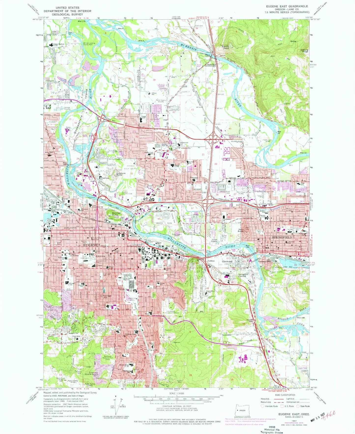
Classic USGS Eugene East Oregon 7.5'x7.5' Topo Map
Couldn't load pickup availability
Historical USGS topographic quad map of Eugene East in the state of Oregon. Typical map scale is 1:24,000, but may vary for certain years, if available. Print size: 24" x 27"
This quadrangle is in the following counties: Lane.
The map contains contour lines, roads, rivers, towns, and lakes. Printed on high-quality waterproof paper with UV fade-resistant inks, and shipped rolled.
Contains the following named places: Adams Elementary School, Amazon City Park, Armitage County Park, Ascot City Park, Berkshire Slough, Brattain Elementary School, Centennial Elementary School, Children Hospital School (historical), Coast Fork Willamette River, College Hill, Lane Community College (historical), Condon School (historical), Coryell Pass, Country Lane City Park, Crest Drive Elementary School, Dedrick Slough, Dodson Slough, Opportunity Center, Edgewood City Park, Edgewood Community Elementary School, Edison Elementary School, Eugene, Sacred Heart Medical Center University District, Eugene Junior Academy (historical), Fairmount City Park, Ferry Street Bridge, Franklin City Park, Friendly City Park, Gamebird Park, Gateway City Park, Gilham Elementary School, Gillespie Butte, Gillespie Cemetery, Goodpasture Island (historical), Martin Luther King Junior City Park, Hamlin Middle School, Camas Ridge Community School, Hendricks City Park, Island Park, Madison Middle School, James Park, Arts and Technology Academy, Judkins Point, Kelly Butte, Kincaid City Park, Kiwanis Park, Lane Community College (historical), Laurel Hill Cemetery, Laurel Hill City Park, Laurel Hill School (historical), Guy Lee Elementary School, Lincoln School (historical), Magladry School (historical), Meadowlark Elementary School, Meadow Park, Menlo Park, Milton City Park, Moffitt Elementary School, Monroe Middle School, Monroe City Park, Northwest Christian University, Oakmont City Park, Owens Rose Garden City Park, Oxley Slough, Elizabeth Page Elementary School, Parker Elementary School, Cesar E Chavez Elementary School, Patterson Slough, Eugene Pioneer Cemetery, Maurie Jacobs City Park, Resthaven Memorial Park, River Road/ - El Camino del Rio Elementary School, Riverwood Park, Guy Lee Park, Robin Park, Russel Creek, Saint Alice School (historical), O'Hara Catholic School, Saint Marys School (historical), Saint Paul Parish School, Sheldon High School, Skinner Butte, Skyline Park, Sladden City Park, Tugman City Park, South Eugene High School, Spencer Butte Middle School, Springfield, Springfield Junction, Sunset Hills Memorial Gardens, Roosevelt Middle School, University of Oregon Housing, University of Oregon, University City Park, Valley Lane Hospital (historical), Washburne City Park, Washington City Park, Holt Elementary School, Whiteaker Elementary School (historical), Willakenzie School (historical), Willamalane Park, Willamette Heights Park, Ridgeline Montessori Public Charter School, Wilson Junior High School (historical), Cal Young Middle School, Skinners Bar, Q Street Canal, Old Springfield IOOF Cemetery, Two Sisters Bar, KRVM-FM, KSND-FM, KUGN-FM, KZEL-FM, KLCC - FM, KORE-AM, KVAL-TV, KEED-AM, Bohemia Incorporated Airfield (historical), Sacred Heart Medical Center Heliport, Eugene Masonic Cemetery, Mount Calvary Catholic Cemetery, Glenwood, Judkins, Whitely Landing County Park, Middle Fork Willamette River, Willagillespie Elementary School, Mill Race, Alton Baker City Park, Jefferson City Park, Spores Point, KWAX-FM, KWAX-FM, KEZI-TV, KPNW-FM, KQDQ-AM, KASH-AM, Lane Community College Main Campus, University of Oregon Autzen Stadium, Eugene Country Club, Laurelwood Municipal Golf Course, Oakway Golf Course, Coburg IOOF Cemetery, East Springfield (historical), Maple Island (historical), Merriams Slough (historical), Royal Delle Park, Springfield IOOF Cemetery, Stumptown (historical), Westmoreland City Park, College Crest Post Office (historical), Eugene Post Office, Fairmount Post Office (historical), Southside Post Office, Springfield Post Office, University Post Office, McKenzie Post Office (historical), Willamette Forks Post Office (historical), Blair (historical), Chestnut (historical), Amazon Ball Fields, Amazon Pool, Eugene Civic Stadium, Dorris Ranch Living History Farm, Moon Mountain, Hamlin Sports Complex, Greenway Bike Bridge, Knickerbocker Bike Bridge, Owosso Bike Bridge, East Bank City Park, Blanton Ridge City Park, Bloomberg City Park, Bond Lane City Park, Campbell Senior Center, Charnel Mulligan City Park, Condon Hall - University of Oregon, Crescent City Park, Crest Heights City Park, Day Island, Delta Ponds City Park, Eugene City Hall, Eugene Mall, Garfield City Park, Gilham City Park, Glen Oak City Park, Kelly Butte Park and Overlook, Lafferty City Park, Lane County Courthouse, Lane County Fairgrounds, Lane County Juvenile Court Detention Center, Marche Chase City Park, Wayne Morse Ranch City Park, Skinner Butte City Park, Sorrel Way City Park, South Ridge City Park, Springfield City Hall, Tandy Turn City Park, Valley River Center, West Bank City Park, West University City Park, Willis City Park, E and S Crossing (historical), E and S Crossing (historical), P E and E Crossing (historical), McKenzie - Willamette Medical Center, McKenzie - Willamette Hospital Heliport, McKenzie Ditch, Osprey Bay, Armitage (historical), North Springfield, Willamette National Forest Headquarters, Brewer City Park, Cal Young Sports Park, Gillespie Butte City Park, Lincoln School City Park, Mission City Park, Moon Mountain City Park, River House, Scobert Gardens City Park, Shadow Wood City Park, Sheldon Sports Park, Washington/Jefferson City Park, Alton Baker/Eastgate Woodlands, By-Gully Bike/Jog Path, Harvest Landing, Millrace Park, Page Park, City of Eugene, Academy of Arts and Academics, Springfield Middle School (historical), Springfield High School, Creative Minds Alternative School, Eugene Christian School, Gateways High School, Lane Community College Downtown Center, Marist High School, Network Charter School


