MyTopo
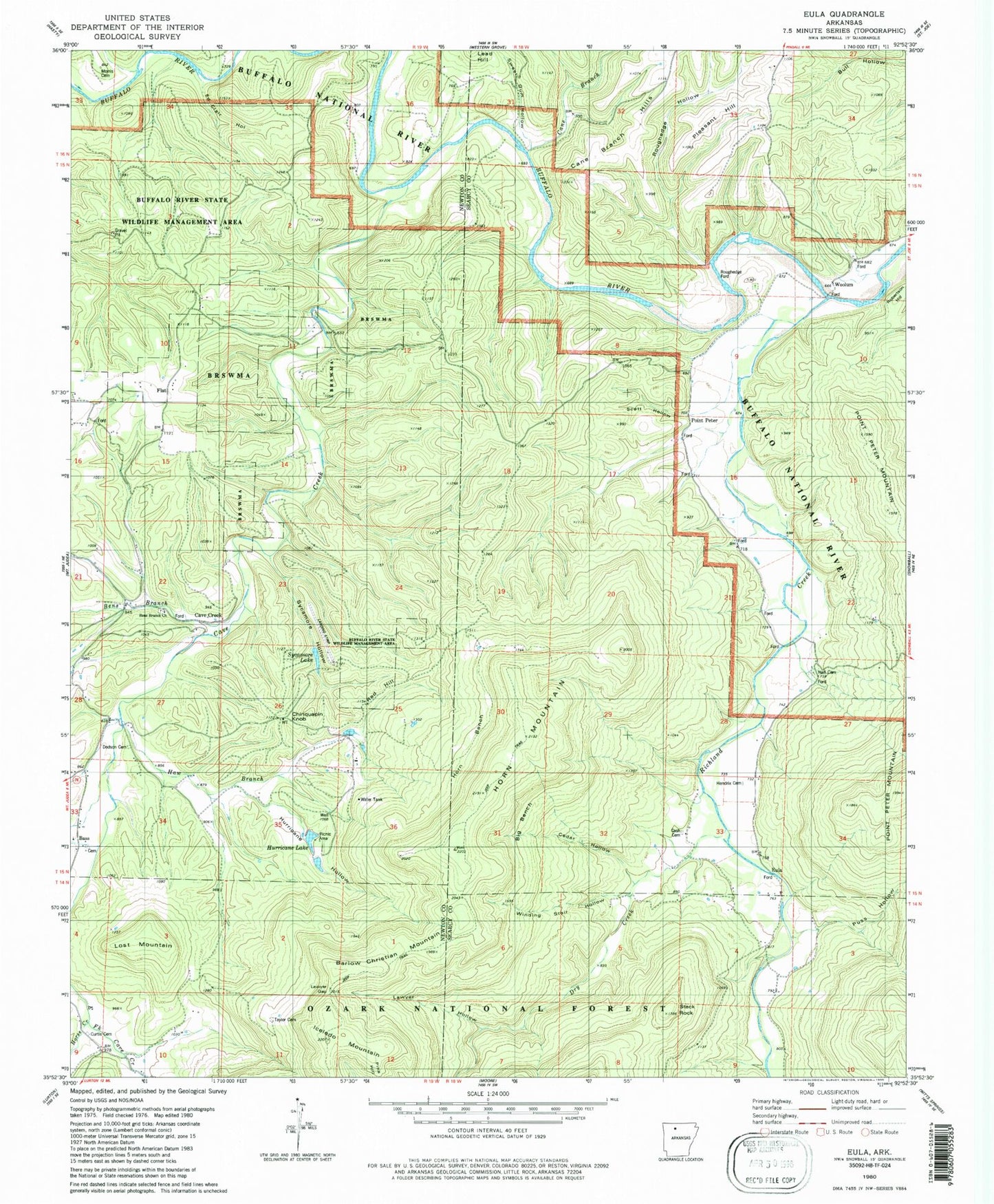
Classic USGS Eula Arkansas 7.5'x7.5' Topo Map
Couldn't load pickup availability
Historical USGS topographic quad map of Eula in the state of Arkansas. Typical map scale is 1:24,000, but may vary for certain years, if available. Print size: 24" x 27"
This quadrangle is in the following counties: Newton, Searcy.
The map contains contour lines, roads, rivers, towns, and lakes. Printed on high-quality waterproof paper with UV fade-resistant inks, and shipped rolled.
Contains the following named places: Hurricane Lake, Sycamore Lake, Morris Cemetery, Horse Creek, Hall Cemetery, Township of Richland (historical), Township of Polk, Dry Creek (historical), Hall (historical), Horn Mountain (historical), Barlow Christian Mountain, Bass, Bass School, Bens Branch, Bens Branch School, Big Bench, Cane Branch, Cane Branch Hills, Cane Branch School, Cash Cemetery, Cave Creek, Cedar Hollow, Chinquapin Knob, Curtis Cemetery, Dodson Cemetery, Dry Creek, Dry Creek School, Ed Clair Hollow, Eula, Flat, Hall School, Haw Branch, Hendrix Cemetery, Horn Bench, Horn Mountain, Horn Mountain School, Hurricane Hollow, Iceledo Mountain, Juanita School, Lawyer Gap, Lawyer Hollow, Lost Mountain, Pine Hill, Pleasant Hill, Pleasant Hill Church, Point Peter, Puss Hollow, Red Hill, Richland Creek, Roughedge Ford, Roughedge Hollow, Scott Hollow, Stack Rock, Sweet Gum Hollow, Sycamore Hollow, Taylor Cemetery, Winding Star Hollow, Woolum, Buffalo National River, Bens Branch Church of Christ, Stack Rock Scenic Area, Cave Creek, Lake Sycamore Dam, Lower Hurricane Lake Dam, Clair Bluff, Cane Bluff, Hensley Cemetery, John Reddell Bluff, The Narrows, Lost Mountain Wilderness Retreat Airport (historical), Bass Post Office, Old Dodson Cemetery, Ben's Branch Cemetery, Richland Creek Airport, Hamilton Cemetery, Nars Cemetery, Sullivan Cemetery