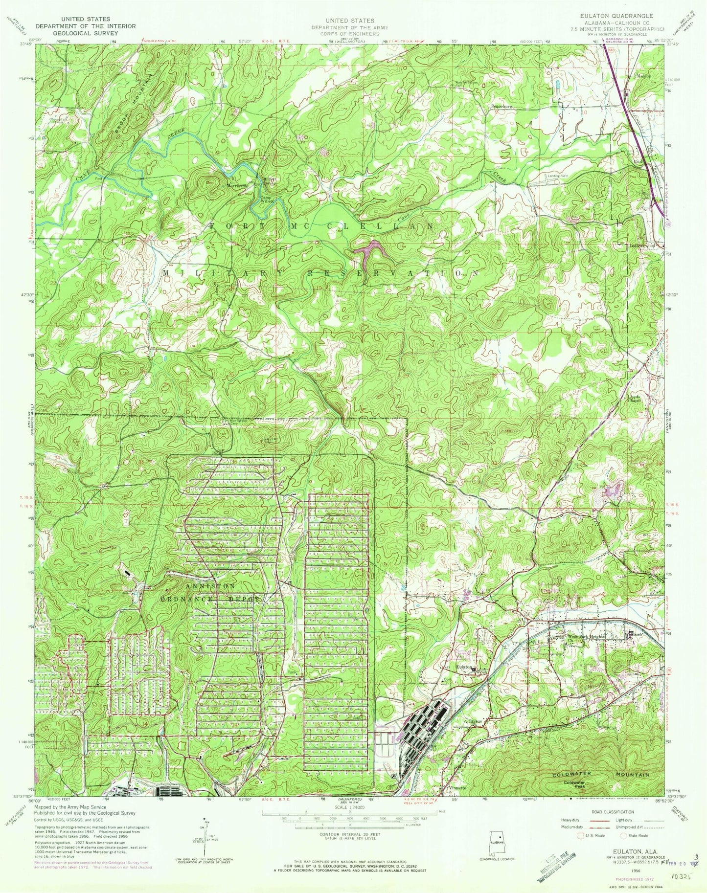
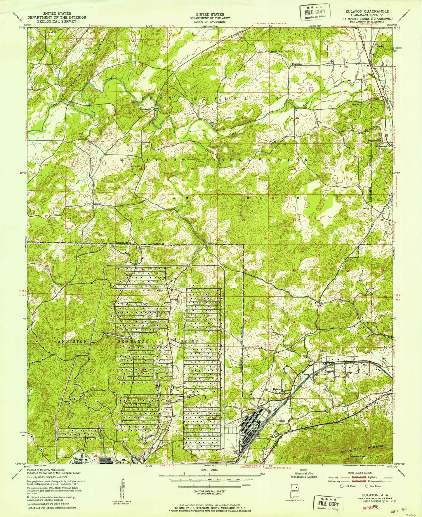
MyTopo
Classic USGS Eulaton Alabama 7.5'x7.5' Topo Map
Couldn't load pickup availability
Historical USGS topographic quad map of Eulaton in the state of Alabama. Typical map scale is 1:24,000, but may vary for certain years, if available. Print size: 24" x 27"
This quadrangle is in the following counties: Calhoun.
The map contains contour lines, roads, rivers, towns, and lakes. Printed on high-quality waterproof paper with UV fade-resistant inks, and shipped rolled.
Contains the following named places: Anniston Memorial Gardens, Camp Willett, Coldwater Peak, Eulaton, New Bethel Cemetery, New Mount Sellers Cemetery, Tarsus, Willett Spring, Cone Reservoir Dam, Lake Contreras, Pelham Range Dam, Aderhold Acres (historical), Bera (historical), Cane Creek, Eulaton Baptist Church, Eulaton Elementary School, Eulaton United Methodist Church, Four Square Church, Leatherwood Baptist Church, Lloyds Chapel Cemetery, Meade (historical), Morrisville Baptist Church, Mount Limited Church, New Liberty Baptist Church, Wellborn, Wellborn Elementary School, Zula (historical), Clarkes Gap, Coker Mountain, Hampton Cemetery, Hurds Gap, Leatherwood Slough, Lloyds School House (historical), New Mount Silla Baptist Church (historical), Peaceburg School (historical), Leatherwood, Lloyds Chapel Baptist Church, West Park Heights Baptist Church, Bush, Mahlep, Morrisville, Peaceburg, Coldwater Mountain, Vinnette, Walter Wellborn High School, Polkville (historical), Polkville Post Office (historical), Cobb Town, Anniston Army Depot, Canebreak Farms, Freedom Riders National Monument