MyTopo
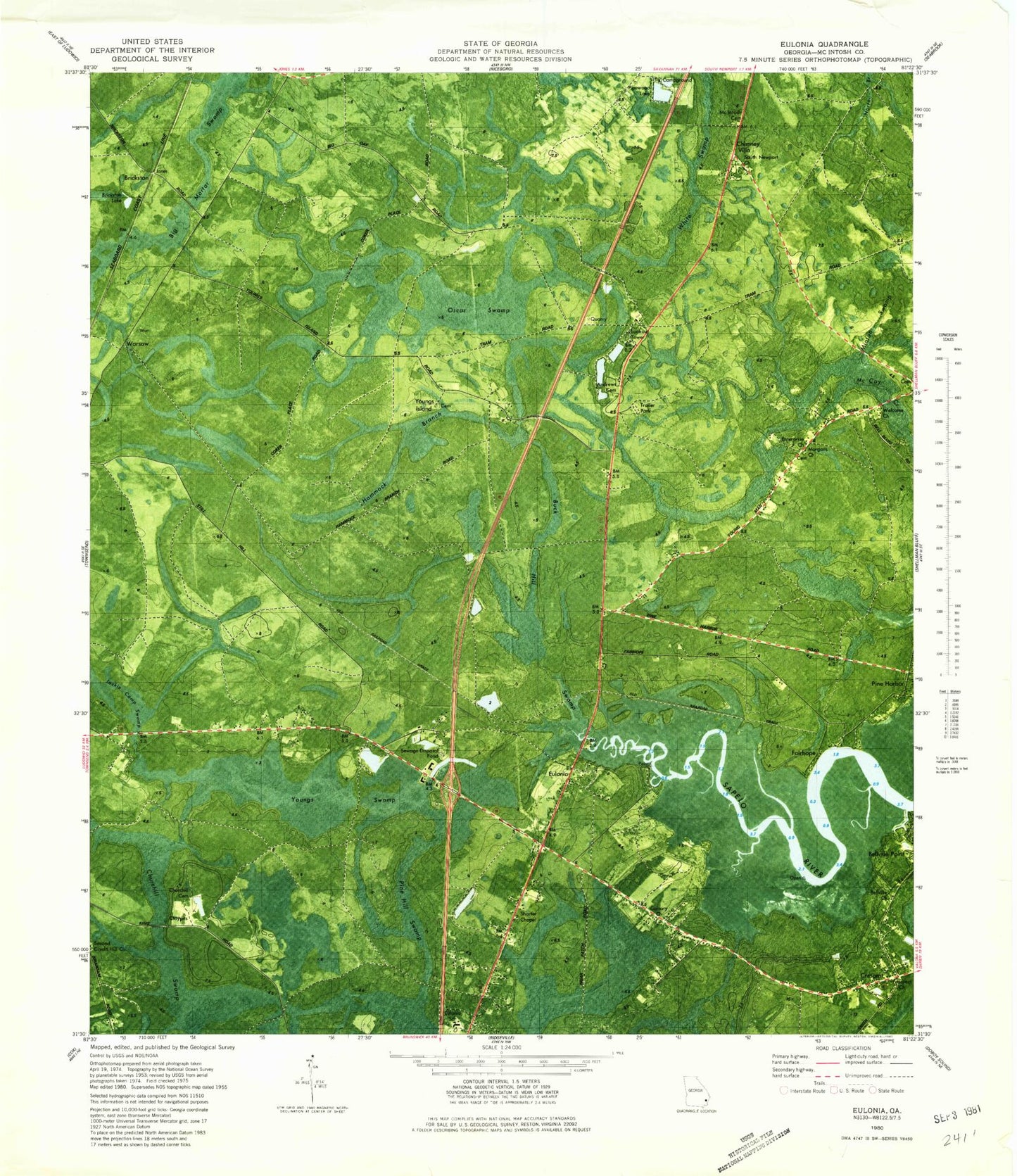
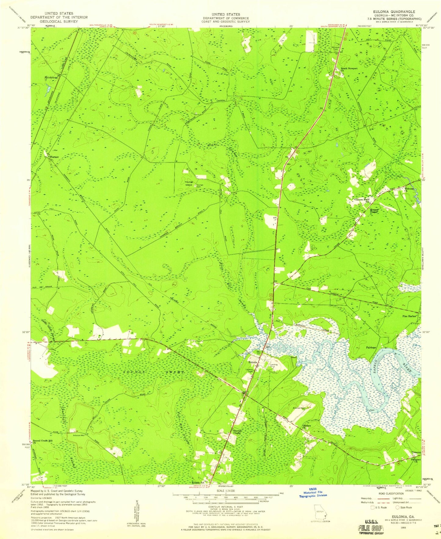
Classic USGS Eulonia Georgia 7.5'x7.5' Topo Map
Couldn't load pickup availability
Historical USGS topographic quad map of Eulonia in the state of Georgia. Map scale may vary for some years, but is generally around 1:24,000. Print size is approximately 24" x 27"
This quadrangle is in the following counties: McIntosh.
The map contains contour lines, roads, rivers, towns, and lakes. Printed on high-quality waterproof paper with UV fade-resistant inks, and shipped rolled.
Contains the following named places: Andrews Cemetery, Beasons Landing Strip, Bellville Church, Brickston, Buck Hill Swamp, Calvary Church, Cannon Bluff School, Chimney Villa, Church of God, Churchill Cemetery, Churchill Swamp, Cornerstone Christian School, Creddick Hill School, Crescent Census Designated Place, Crescent Post Office, Daniel Grove Church, Enterprise Church, Eulonia, Eulonia Census Designated Place, Eulonia School, Fairhope, Jackie Camp Swamp, McIntosh Cemetery, McIntosh County Fire Department Eulonia Station, McIntosh County Volunteer Fire Department Eulonia Station, Morgan Chapel, Oscar Swamp, Pine Harbor, Pine Hill Swamp, Prospect Church, R and M Water and Sewer Water Pollution Control Plant, Second Credit Hill Church, Shorter Chapel, South Newport Church, Townsend Division, Townsend Post Office, Warsaw, Welcome Church, Young Island Church, Youngs Cemetery, Youngs Island, Youngs Swamp, ZIP Code: 31331