MyTopo
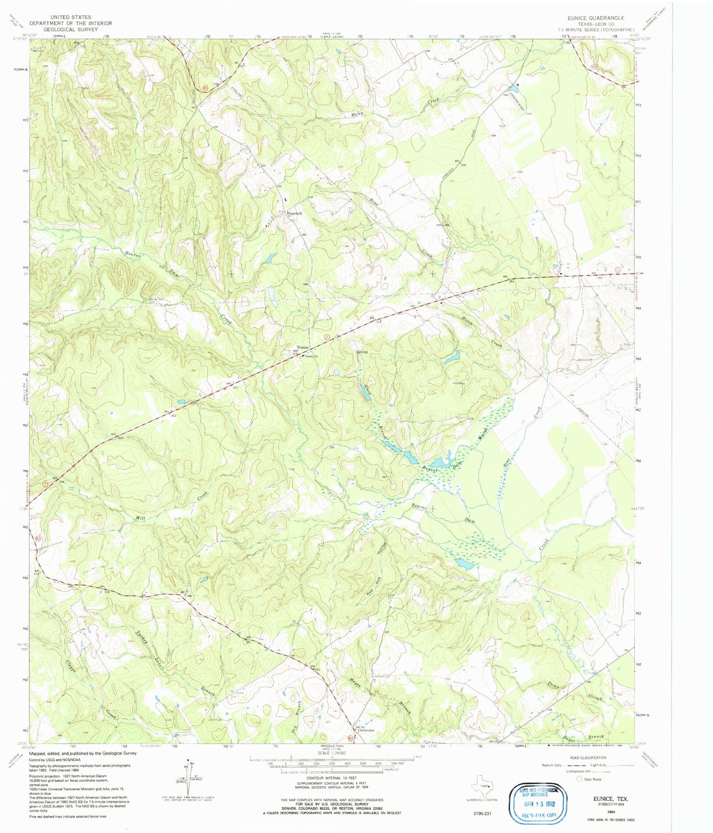
Classic USGS Eunice Texas 7.5'x7.5' Topo Map
Couldn't load pickup availability
Historical USGS topographic quad map of Eunice in the state of Texas. Map scale may vary for some years, but is generally around 1:24,000. Print size is approximately 24" x 27"
This quadrangle is in the following counties: Leon.
The map contains contour lines, roads, rivers, towns, and lakes. Printed on high-quality waterproof paper with UV fade-resistant inks, and shipped rolled.
Contains the following named places: Beaver Dam Cemetery, Beaver Dam Marsh, Black Branch, Centerview, Dillard Ranch Airport, Dixon Creek, Eunice, Fort Bend County Law Library, Fort Bend County Libraries, Hayes Branch, Hopewell, Hurricane Creek, KBHT-FM (Crockett), Mill Creek, Pine Creek, Red Oak Hollow, Tubb Lake, Tubb Lake Dam, Victory Church, ZIP Code: 75833