MyTopo
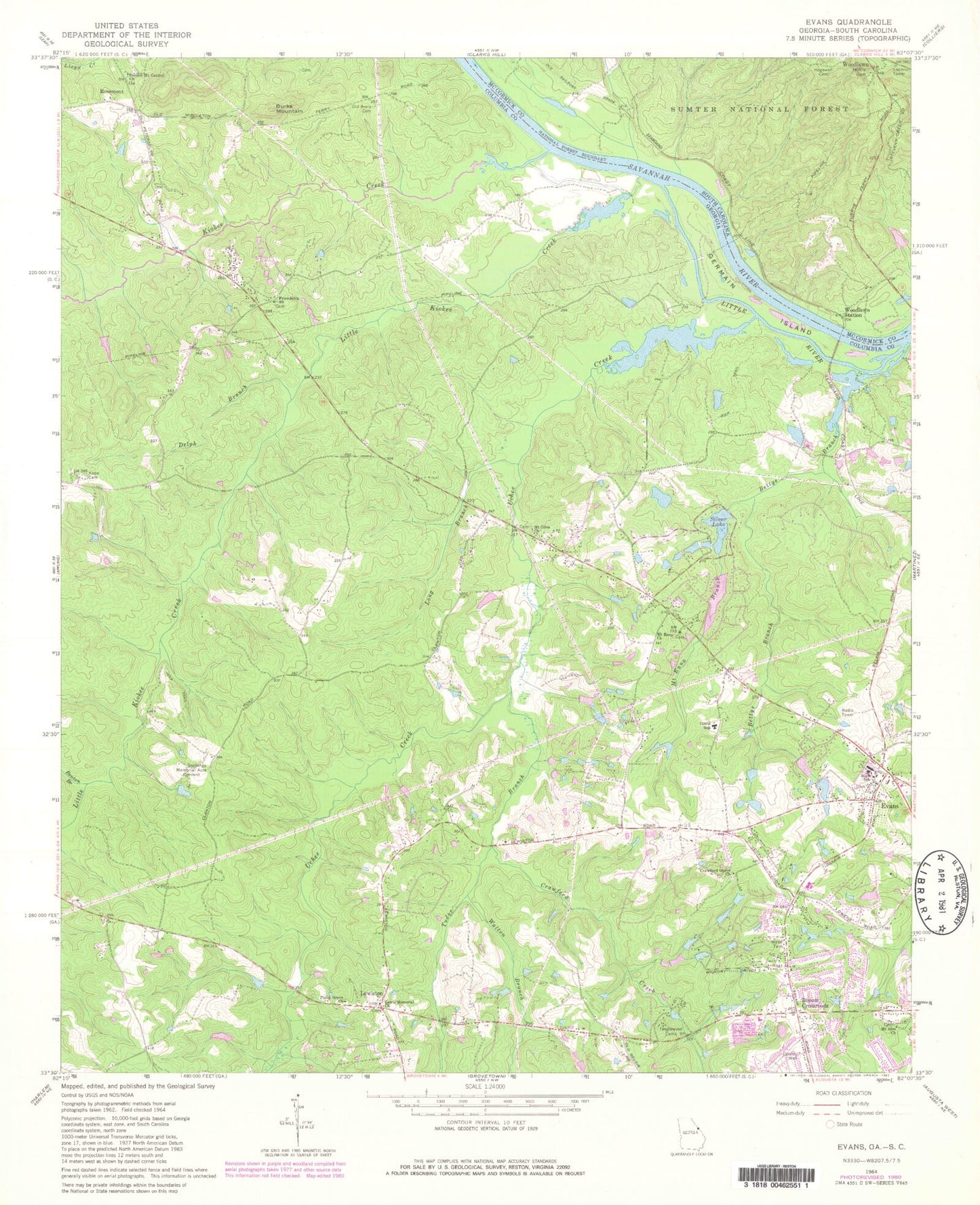
Classic USGS Evans Georgia 7.5'x7.5' Topo Map
Couldn't load pickup availability
Historical USGS topographic quad map of Evans in the states of Georgia, South Carolina. Map scale may vary for some years, but is generally around 1:24,000. Print size is approximately 24" x 27"
This quadrangle is in the following counties: Columbia, McCormick.
The map contains contour lines, roads, rivers, towns, and lakes. Printed on high-quality waterproof paper with UV fade-resistant inks, and shipped rolled.
Contains the following named places: Bel Air Elementary School, Benton Branch, Bettys Branch, Bolgla Lake, Bolgla Lake Dam, Burks Mountain, Burks Mountain Barrens, Calloway Woods, Camelot, Camelot Lake, Camelot Lake Dam, Chimney Hill, Clanttian Grove School, Columbia County Fire Rescue Station 2, Columbia County Marshal's Department, Columbia County Sheriff's Office Substation, Columbia Fire Rescue Station 6, Columbia Land Corporation Lake, Columbia Land Corporation Lake Dam, Country Place, Crawford Creek, Crawford Grove Church, Deerwood Acres, Deerwood Estates, Delph Branch, Enoch School, Evans, Evans Census Designated Place, Evans Division, Evans Elementary School, Evans High School, Evans Middle School, Evans Post Office, Evans Village Shopping Center, Evanston, Fairington Estates, Fanglewood Camp, Friendship Church, German Island, Glennwood, Gold Branch, Greenbrier Elementary School, Greenbrier High School, Greenbrier Middle School, Hardys Lake, Harvey Mill, Highview Acres, Hillbrook, Hopewell Cemetery, Idlewylde Lake, Idlewylde Lake Dam, Idylwilde, Johnsons Spur, Kiokee, Kiokee Creek, Knox Cemetery, Lake Cumberland West, Lewis Memorial Church, Lewiston, Lewiston Elementary School, Little Kiokee Creek, Long Branch, Martinez - Columbia Fire Rescue Station 5, McKie Cemetery, McManus Ponds, Meadowview, Mill Branch, Mobile Home Park Lake A, Mobile Home Park Lake B, Mobile Home Park Lake Dam A, Mobile Home Park Lake Dam B, Mount Enna Branch, Mount Enna Church, Mount Olive Church, Mount Olive Lake, Mount Olive Lake Dam, Mount Zion Church, Old Avery Cemetery, Pinewood, Piney Grove Church, Riverside Elementary School, Ropers Crossroads, Rosemont, Second Mount Carmel Church, Sedgefield, Shadowmoor, Shady Grove Estates, Silver Lake, Silver Lake Dam, Smith Lake, Smith Lake Dam, Smithwyck, Snellings Memorial Acre, South Carolina Noname 35007 D-0638 Dam, Tanglewood Camp, Trinity Church, Tudor Branch, Uchee Creek, Walton Branch, Whispering Pine Mobile Home Park, Windmill Plantation, Woodbridge, Woodbridge Lake, Woodbridge Lake Dam, Woodlawn Lookout Tower, Woodlawn Station, Wymberly, ZIP Code: 30809