MyTopo
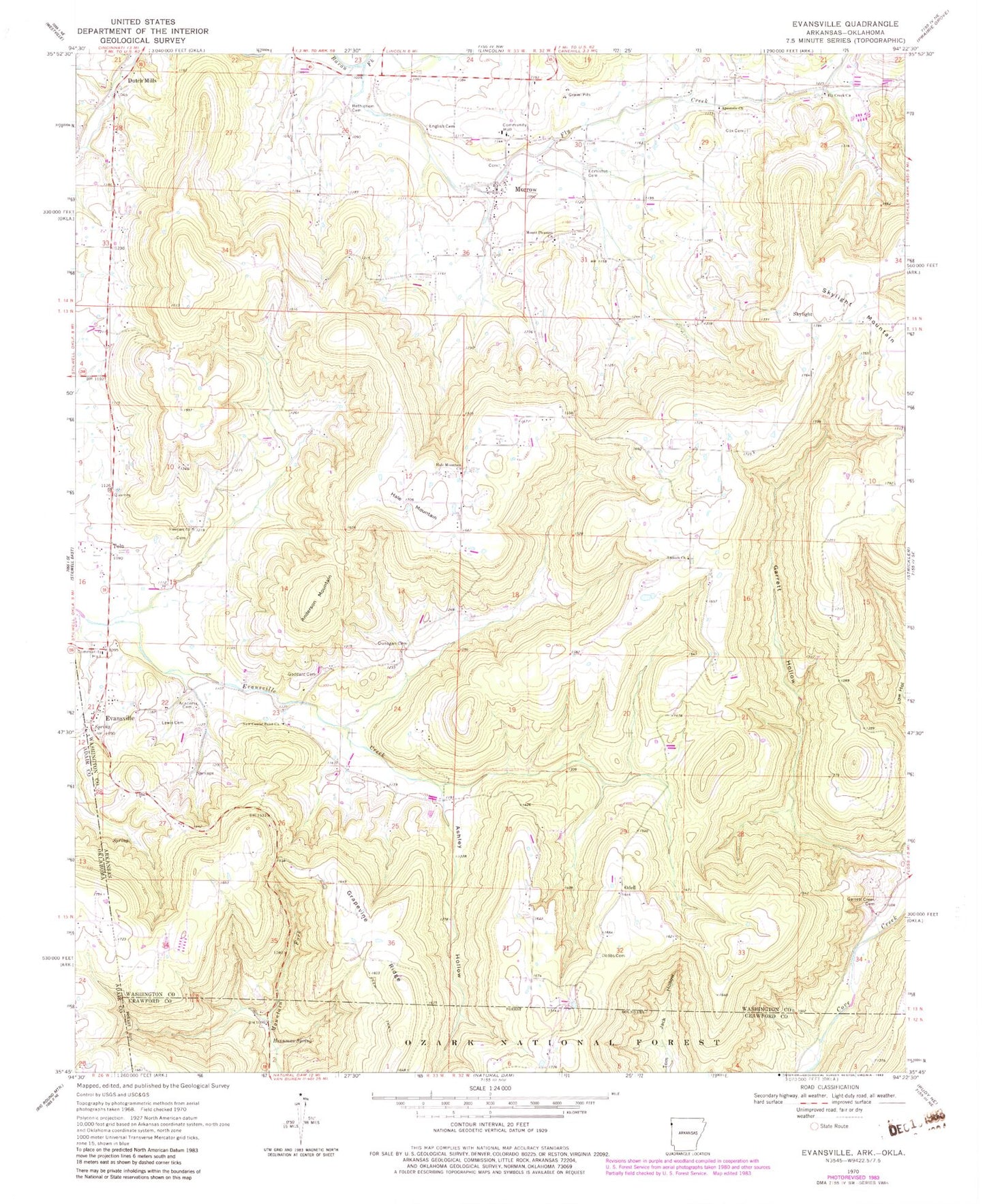
Classic USGS Evansville Arkansas 7.5'x7.5' Topo Map
Couldn't load pickup availability
Historical USGS topographic quad map of Evansville in the state of Arkansas. Map scale may vary for some years, but is generally around 1:24,000. Print size is approximately 24" x 27"
This quadrangle is in the following counties: Adair, Crawford, Washington.
The map contains contour lines, roads, rivers, towns, and lakes. Printed on high-quality waterproof paper with UV fade-resistant inks, and shipped rolled.
Contains the following named places: Academy Cemetery, Anderson Mountain, Antioch Church, Apostolic Church, Ashley Hollow, Bethlehem Cemetery, Cox Cemetery, Dobbs Cemetery, Dunagan Cemetery, Edmiston Cemetery, English Cemetery, Evansville, Evansville Census Designated Place, Evansville Fire Department, Evansville Post Office, Fly Creek, Fly Creek Church, Garrett Creek Cemetery, Garrett Hollow, Goddard Cemetery, Hale Mountain, Hale Mountain Church, Hennman Spring, Lewis Cemetery, Low Gap Hollow, Morrow, Morrow Census Designated Place, Morrow Fire Department, Morrow Post Office, Mount Pleasant Church, New Center Point Church, Odell, Skylight, Skylight Mountain, Stop, Tolu, Tolu Post Office, Township of Boston, Township of Morrow, Township of Vineyard, Vineyard Church, ZIP Codes: 72717, 72729, 72749