
MyTopo
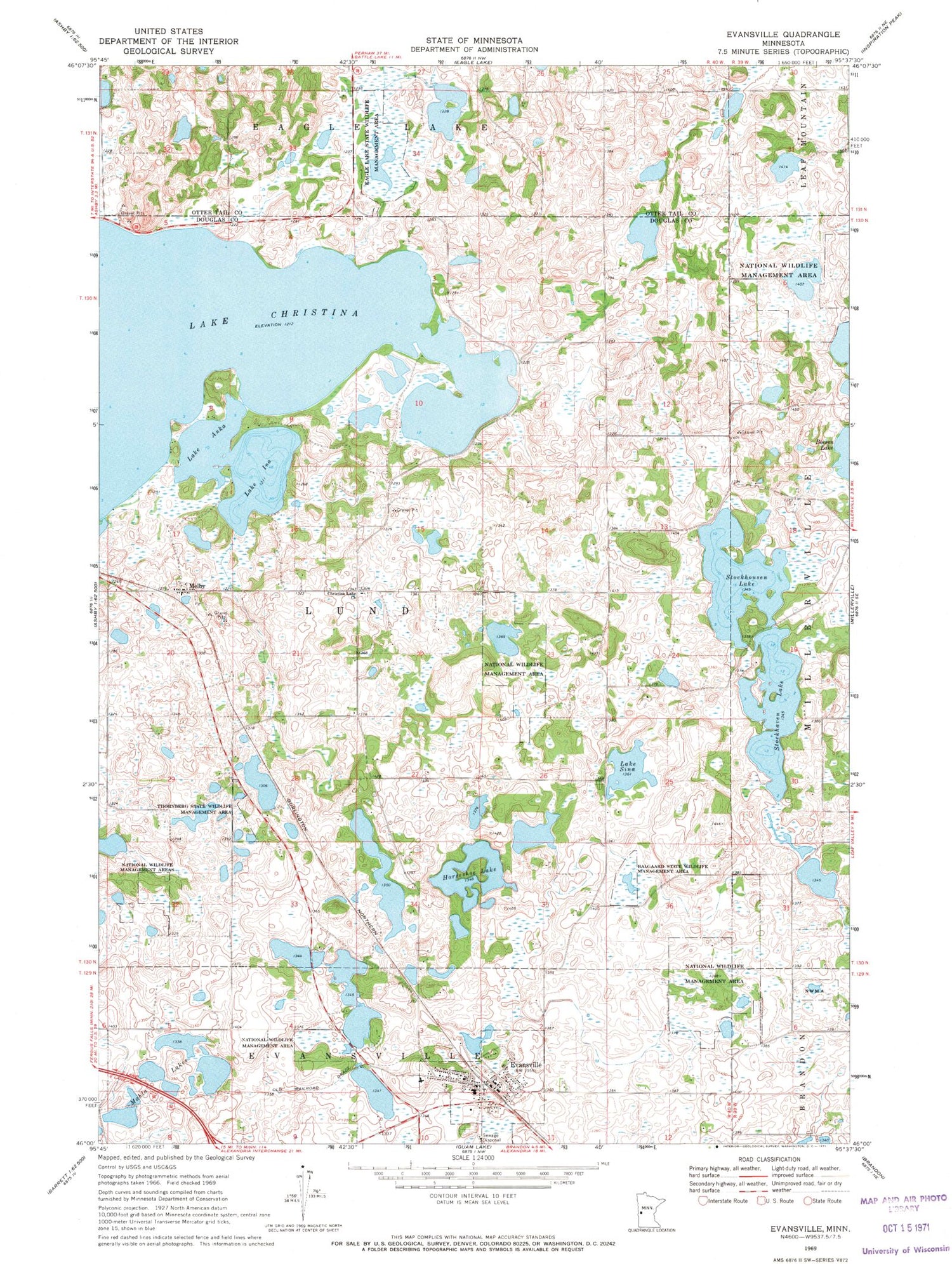
Classic USGS Evansville Minnesota 7.5'x7.5' Topo Map
Couldn't load pickup availability
Historical USGS topographic quad map of Evansville in the state of Minnesota. Map scale may vary for some years, but is generally around 1:24,000. Print size is approximately 24" x 27"
This quadrangle is in the following counties: Douglas, Otter Tail.
The map contains contour lines, roads, rivers, towns, and lakes. Printed on high-quality waterproof paper with UV fade-resistant inks, and shipped rolled.
Contains the following named places: Balgaard State Wildlife Management Area, Christina Lake Cemetery, Christina Lake Church, Chuck West Memorial Heliport, City of Evansville, Covenant Church, Crestview Manor Health Care, Douglas County Waterfowl Production Area, Eagle Lake State Wildlife Management Area, Elmer Airport, Evansville, Evansville Fire Department, Evansville Post Office, Faith Lutheran Church, Horseshoe Lake, Lake Anka, Lake Christina, Lake Ina, Lake Sina, Mahla Lakes, Melby, Melby Post Office, Mound Grove Memorial Park, Stockhaven Lake, Stockhousen Lake, Thornberg State Wildlife Management Area, Township of Lund, ZIP Code: 56326


