MyTopo
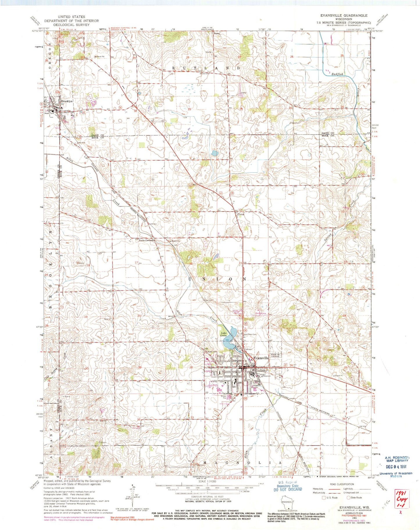
Classic USGS Evansville Wisconsin 7.5'x7.5' Topo Map
Couldn't load pickup availability
Historical USGS topographic quad map of Evansville in the state of Wisconsin. Map scale may vary for some years, but is generally around 1:24,000. Print size is approximately 24" x 27"
This quadrangle is in the following counties: Dane, Green, Rock.
The map contains contour lines, roads, rivers, towns, and lakes. Printed on high-quality waterproof paper with UV fade-resistant inks, and shipped rolled.
Contains the following named places: Brooklyn, Brooklyn Police Department, Brooklyn Post Office, Brooklyn Wastewater Treatment Plant, Brzezinski Park, Butts Corners, Butts Farm, City of Evansville, Congregational United Church of Christ, Dane County Waterfowl Production Area, Eager Free Public Library, Evansville, Evansville City Hall, Evansville Community Fire District, Evansville Emergency Medical Ambulance Services, Evansville High School, Evansville Historic District, Evansville Police Department, Evansville Post Office, Evansville Wastewater Treatment Plant, First Baptist Church, Franklin Street Park, Free Methodist Church, Grace Independent Baptist Church, Graves Cemetery, Holy Cross Cemetery, J C McKenna Middle School, Lake Leota, Lake Leota 3WR1965 Dam, Lake Leota Park, Leota School for Girls, Levi Leonard Elementary School, Maple Hill Cemetery, Millard Home School, Reindahl Quarries, Rock County Waterfowl Production Area, Saint Johns Episcopal Church, Saint Johns Lutheran Church, Saint Paul Catholic Church, Seventh Day Adventist Church, Stone, Theodore Robinson Intermediate School, Town of Union, Union, Village of Brooklyn, Wind Prairie Park, Wyler School for Boys, ZIP Code: 53536