
MyTopo
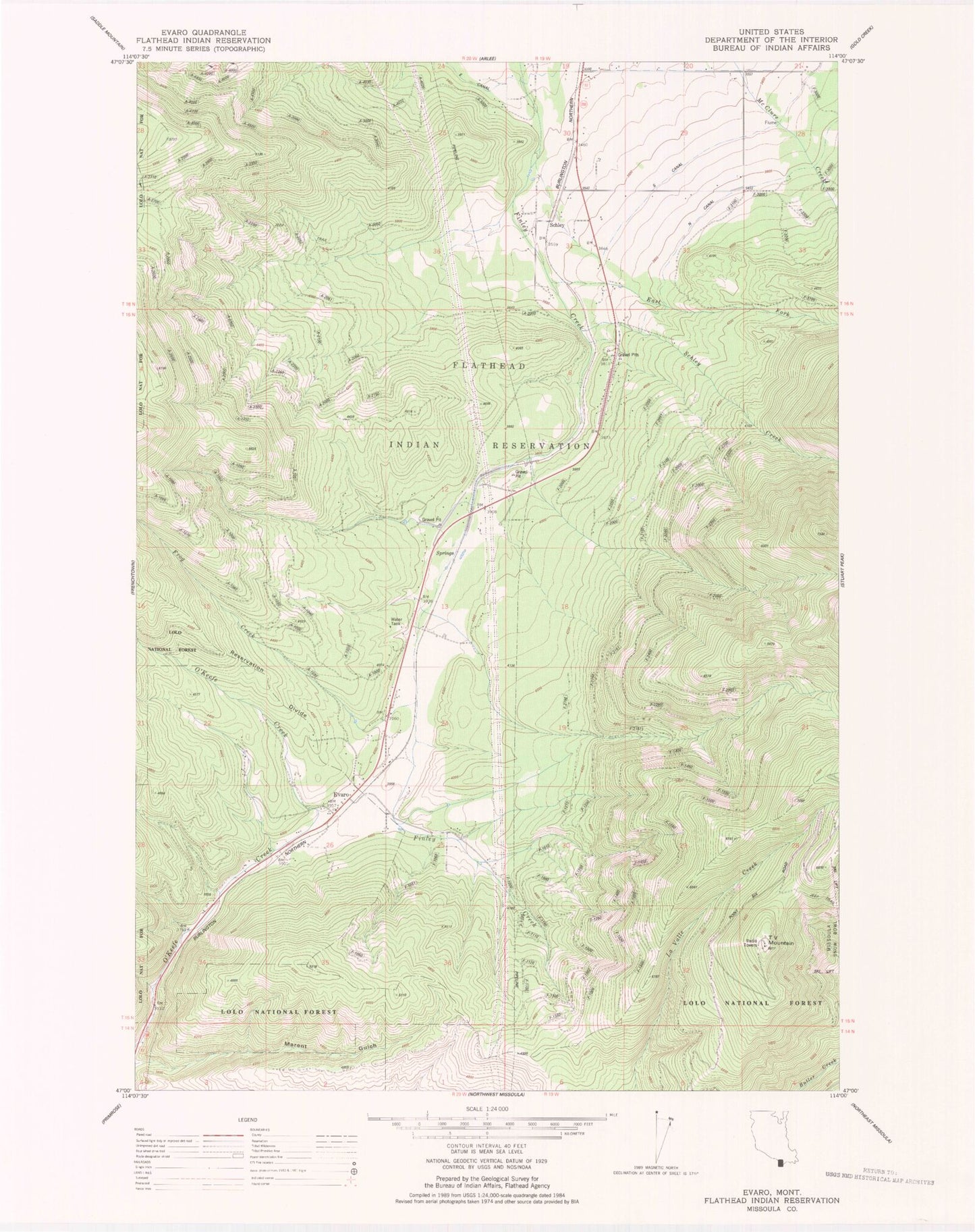
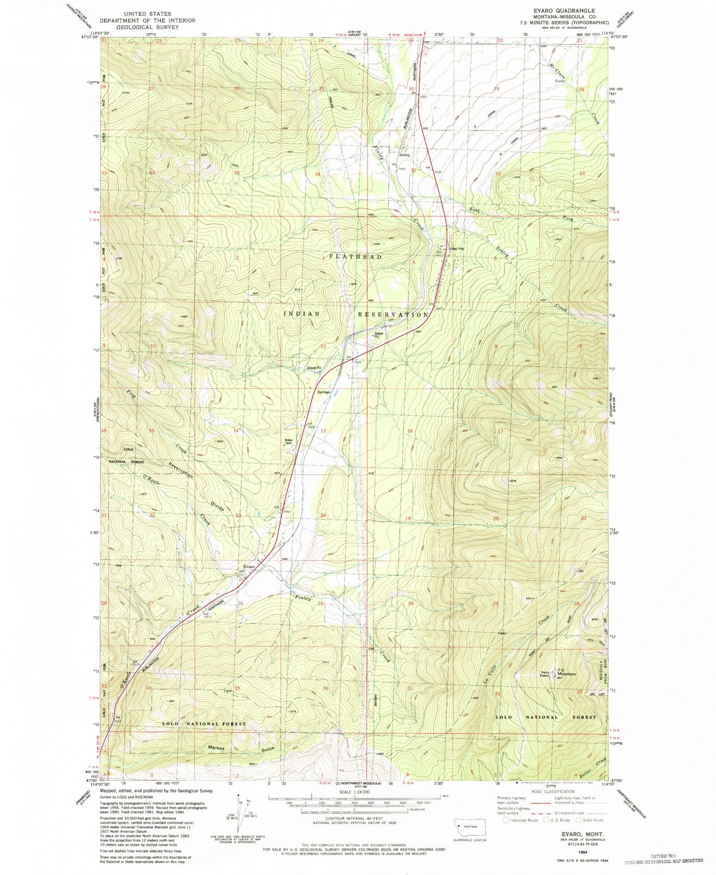
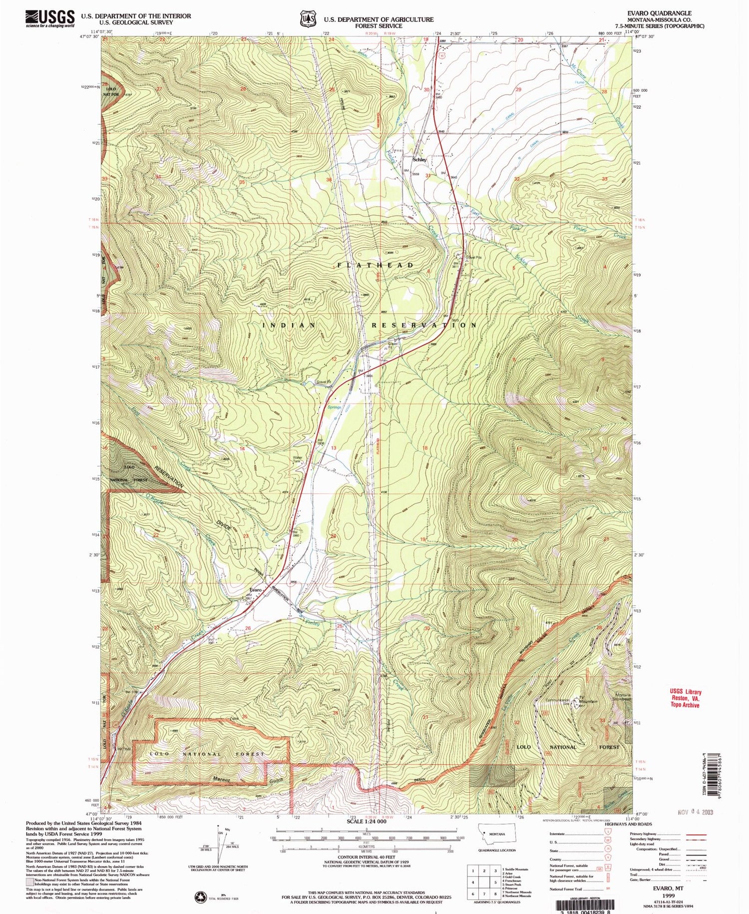
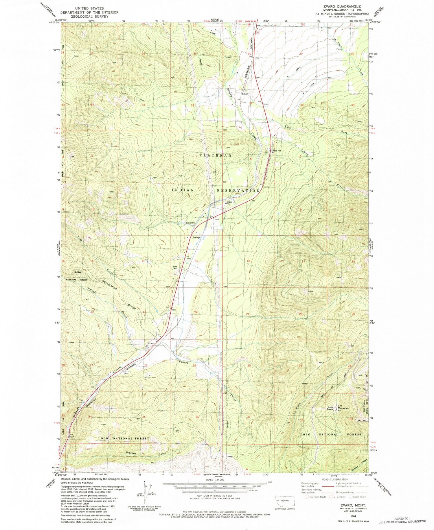
Classic USGS Evaro Montana 7.5'x7.5' Topo Map
Couldn't load pickup availability
Historical USGS topographic quad map of Evaro in the state of Montana. Map scale may vary for some years, but is generally around 1:24,000. Print size is approximately 24" x 27"
This quadrangle is in the following counties: Missoula.
The map contains contour lines, roads, rivers, towns, and lakes. Printed on high-quality waterproof paper with UV fade-resistant inks, and shipped rolled.
Contains the following named places: 14N20W03AA__01 Well, 15N19W05BBCC01 Well, 15N19W05BCCC01 Well, 15N19W07BCCC01 Well, 15N20W12CAAC01 Well, 15N20W12CAD_01 Well, 15N20W13BABB01 Well, 15N20W13BCCC01 Well, 15N20W13CADA01 Well, 15N20W13CADA02 Well, 15N20W13CADA03 Well, 15N20W13DCAA01 Well, 15N20W23DCAA01 Well, 15N20W24BCCB01 Well, 15N20W26ABC_01 Well, 16N19W30BCCD01 Well, 16N19W30CDBC01 Well, 16N19W30DBA_01 Well, 16N19W31BBBB01 Well, 16N19W31CBA_01 Well, 16N19W31DABB01 Well, 16N19W31DDAB01 Well, Coriacan Defile, East Fork Finley Creek, Evaro, Evaro Census Designated Place, Evaro Post Office, Evaro School, Frenchtown Rural Fire District Station 2, Frog Creek, KECI-TV (Missoula), KPAX-TV (Missoula), KTMF-TV (Missoula), Landon, Marent Gulch, Marent Trestle, N Canal, Schley, Schley Creek, Sim-heh Creek, Snow Park Ski Area, Spruce, TV Mountain