MyTopo
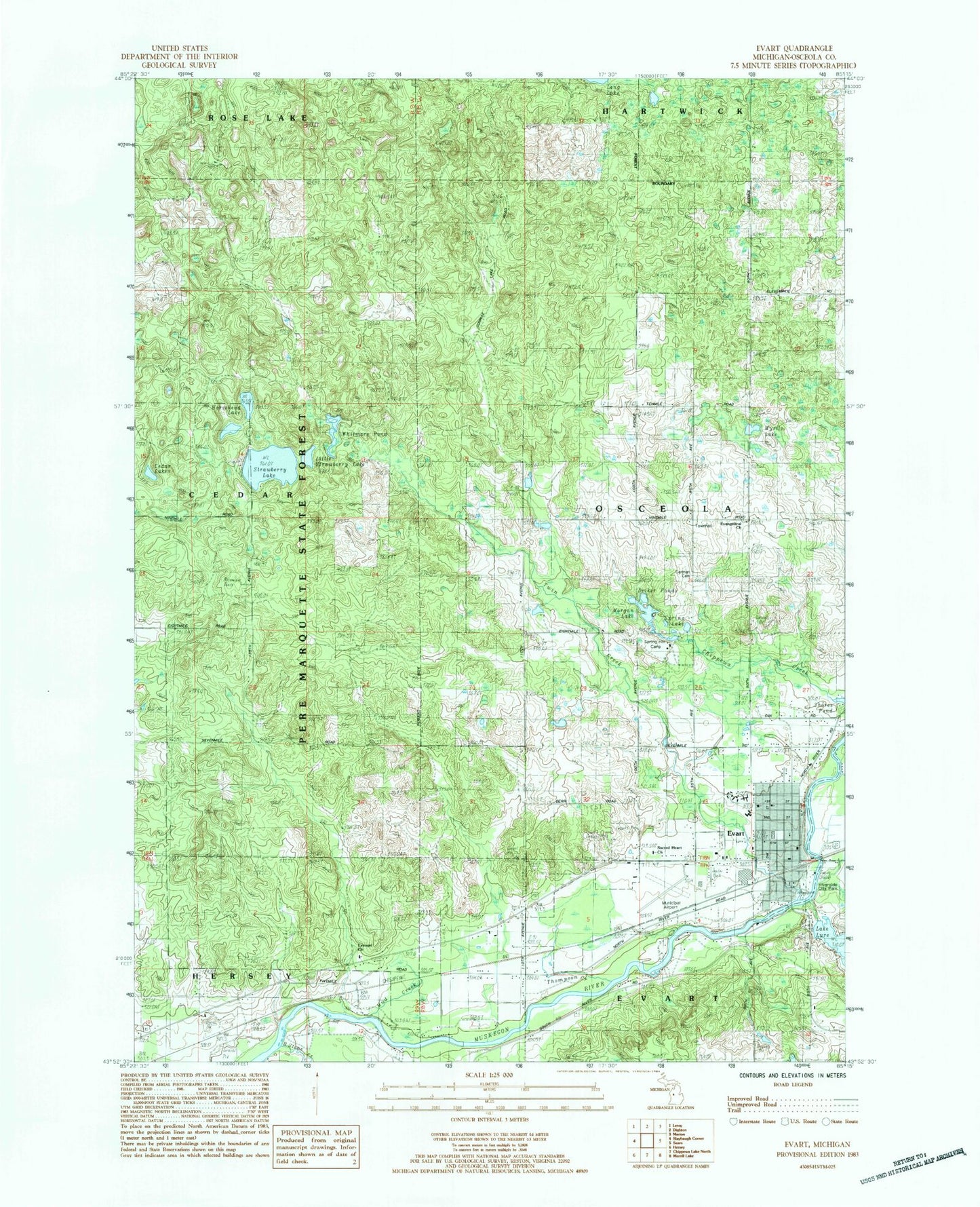
Classic USGS Evart Michigan 7.5'x7.5' Topo Map
Couldn't load pickup availability
Historical USGS topographic quad map of Evart in the state of Michigan. Map scale may vary for some years, but is generally around 1:24,000. Print size is approximately 24" x 27"
This quadrangle is in the following counties: Osceola.
The map contains contour lines, roads, rivers, towns, and lakes. Printed on high-quality waterproof paper with UV fade-resistant inks, and shipped rolled.
Contains the following named places: Big Stone Creek, Calvary Baptist Church, Chippewa River State Forest, City of Evart, Crossroads Community Church, Decker Ponds, Evangel Church, Evangelical Church, Evart, Evart Elementary School, Evart High School, Evart Middle School, Evart Municipal Airport, Evart Police Department, Evart Post Office, Evart Public Library, Evart Station, Evart United Methodist Church, Evart Volunteer Fire Department, First Baptist Church of Evart, Free Methodist Church, German Cemetery, Hartwick Lookout Tower, Holy Cross Catholic Cemetery, Horsehead Lake, Joseph W Guyton Historical Marker, Lake Lure, Little Strawberry Lake, Mid-Michigan Medical Center, Missionary Church, Morgan Lake, Mud Creek, Myrtle Lake, North Evart United Methodist Church Historical Marker, Osceola County, Posted Creek, Riverside City Park, Sacred Heart Church, Saint Paul's Lutheran Church, Shores Pond, Spectrum Health Evart Clinic, Spring Hill Camp, Spring Lake, Strawberry Lake, Thompson Creek, Township of Osceola, Twin Creek, Warson School, Whitmore Pond, ZIP Code: 49631