MyTopo
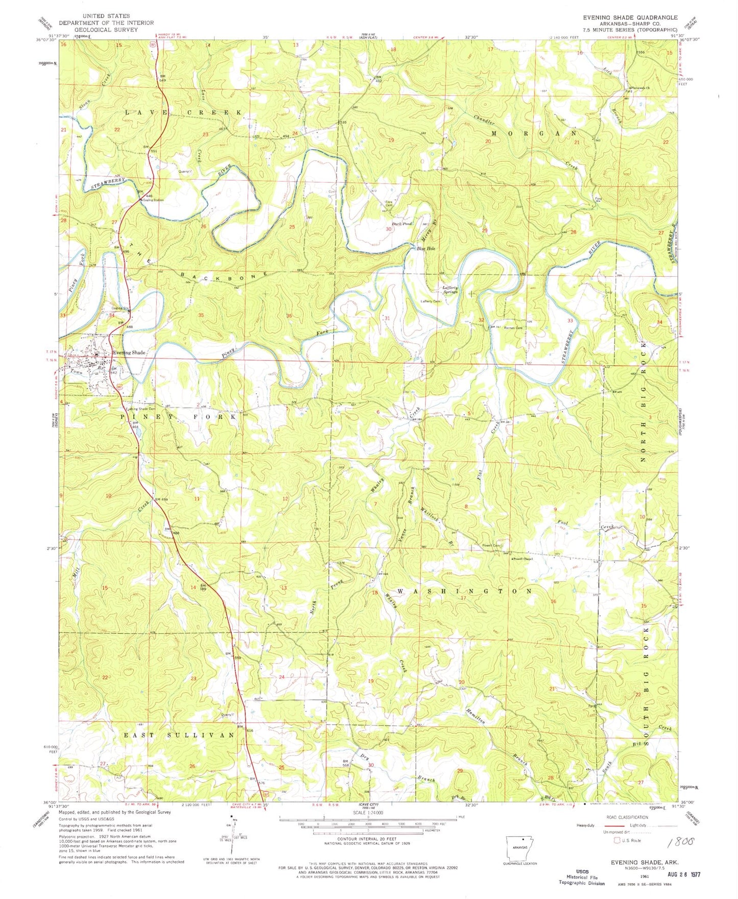
Classic USGS Evening Shade Arkansas 7.5'x7.5' Topo Map
Couldn't load pickup availability
Historical USGS topographic quad map of Evening Shade in the state of Arkansas. Map scale may vary for some years, but is generally around 1:24,000. Print size is approximately 24" x 27"
This quadrangle is in the following counties: Sharp.
The map contains contour lines, roads, rivers, towns, and lakes. Printed on high-quality waterproof paper with UV fade-resistant inks, and shipped rolled.
Contains the following named places: Amateur, Balboa, Barnes Cemetery, Blue Hole, City of Evening Shade, Dry Branch, Duck Pond, Evening Shade, Evening Shade Cemetery, Evening Shade Elementary School, Evening Shade High School, Evening Shade Police Department, Evening Shade Post Office, Evening Shade Volunteer Fire Station, Flat Creek, Flatwoods Church, Fore Cemetery, Hamilton Branch, Lafferty Cemetery, Lafferty Springs, Lave Creek, Mill Creek, Mirey Branch, North Prong Whaley Creek, Piney Fork, Powell Cemetery, Powell Chapel, Sloan Creek, The Backbone, Town Branch, Township of Sullivan, Township of Washington, Vance Branch, Whaley Creek, Whitlock Branch, ZIP Code: 72532