MyTopo
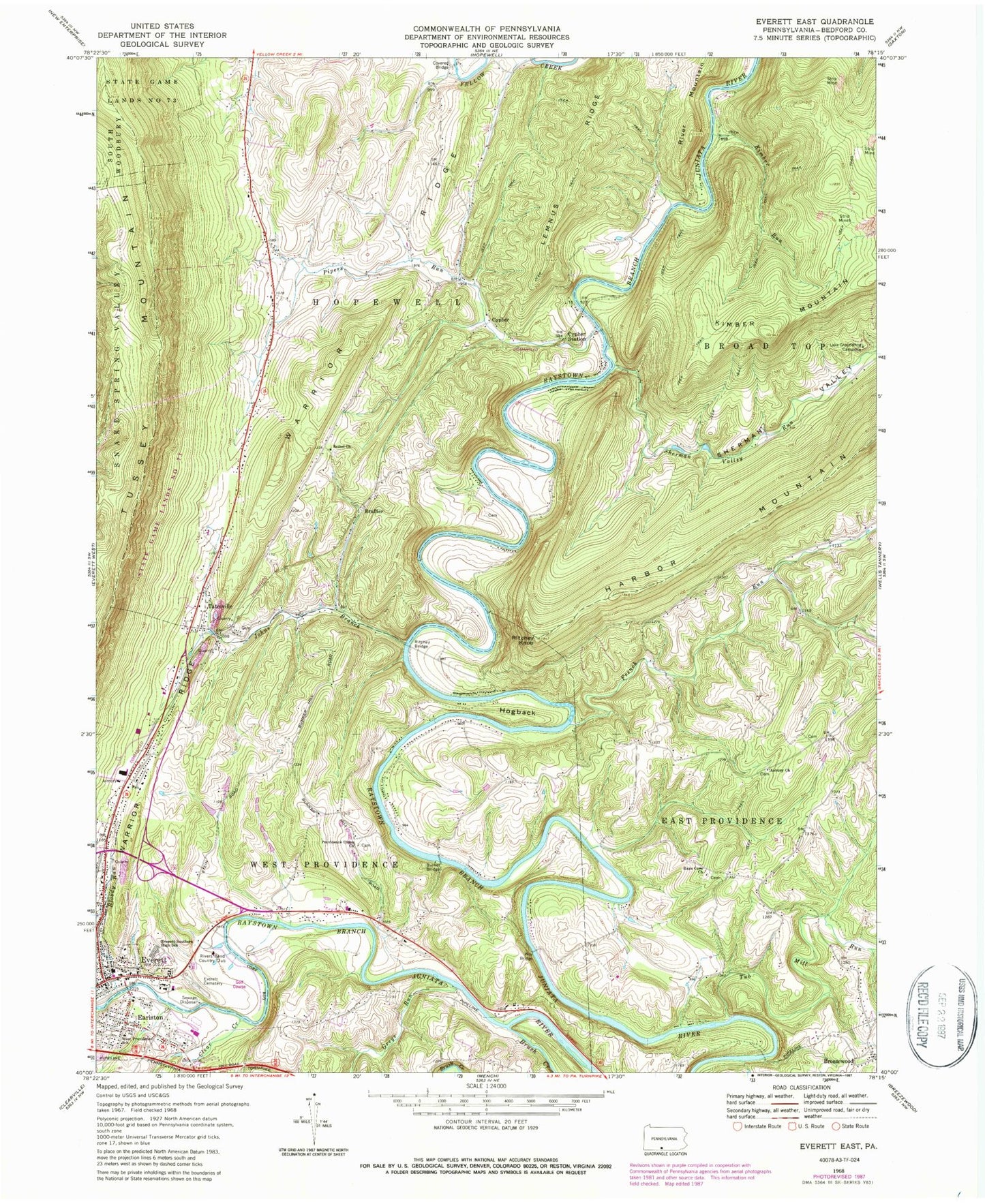
Classic USGS Everett East Pennsylvania 7.5'x7.5' Topo Map
Couldn't load pickup availability
Historical USGS topographic quad map of Everett East in the state of Pennsylvania. Map scale may vary for some years, but is generally around 1:24,000. Print size is approximately 24" x 27"
This quadrangle is in the following counties: Bedford.
The map contains contour lines, roads, rivers, towns, and lakes. Printed on high-quality waterproof paper with UV fade-resistant inks, and shipped rolled.
Contains the following named places: Asbury Church, Asbury Methodist Episcopal Church Cemetery, Bethel Brethren Cemetery, Bethel Church, Bloody Run, Borough of Everett, Brallier, Brush Creek, Burket Cemetery, Clear Creek, Cypher, Cypher Farm Cemetery, Cypher Station, Earlston, Earlston Census Designated Place, Everett, Everett Area Middle / High School, Everett Cemetery, Everett Post Office, French Run, Greys Run, Hall's Mill Covered Bridge, Hinish Family Cemetery, Hogback, Johns Branch, Kimber Run, Lake Groundhog Campsite, Lemnus Ridge, Morgart and Morgret Cemetery, Piper Cemetery, Pipers Run, Providence Union Church, Providence Union Church Cemetery, Rays Cove Christian Church Cemetery, Rays Cove Church, Raystown Ambulance Service - Unit 12, Rinard Cemetery, Ritchey Bridge, Ritchey Farm Cemetery, Ritchey Knob, Rivers Bend Country Club, Rivers Bend Golf Course, Sherman Valley, Sherman Valley Run, State Game Lands Number 261, State Game Lands Number 73, Tatesville, Tatesville United Methodist Church Cemetery, Township of East Providence, Township of Hopewell, Tub Mill Run, West Providence School, Woy Bridge, WSKE-AM (Everett), ZIP Codes: 15537, 16650