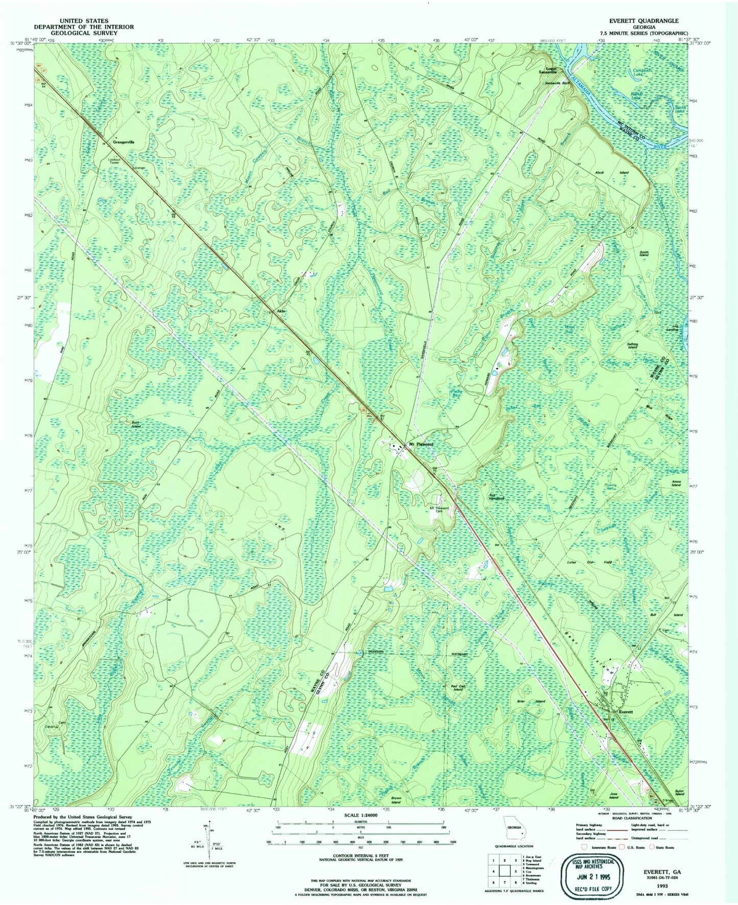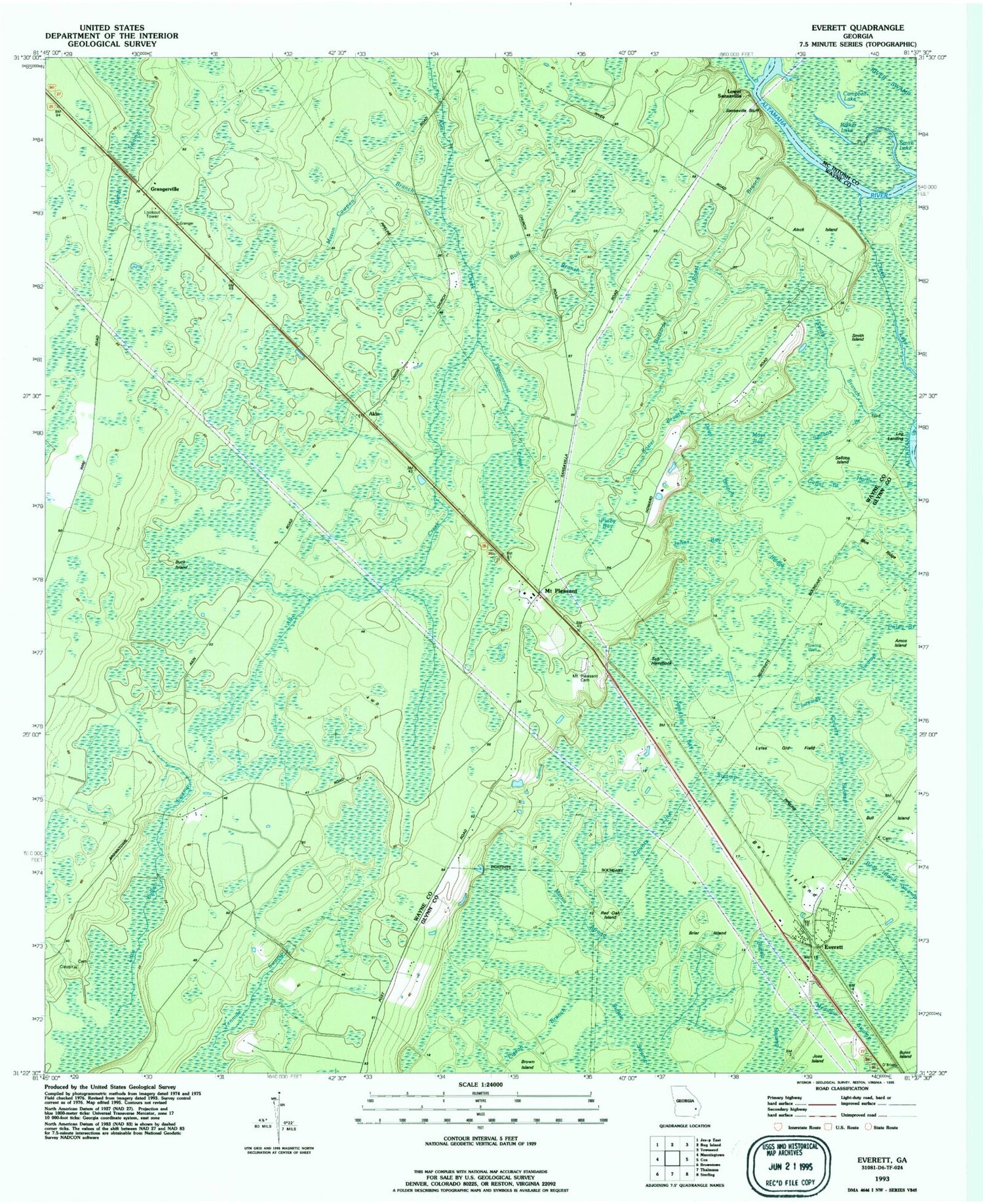
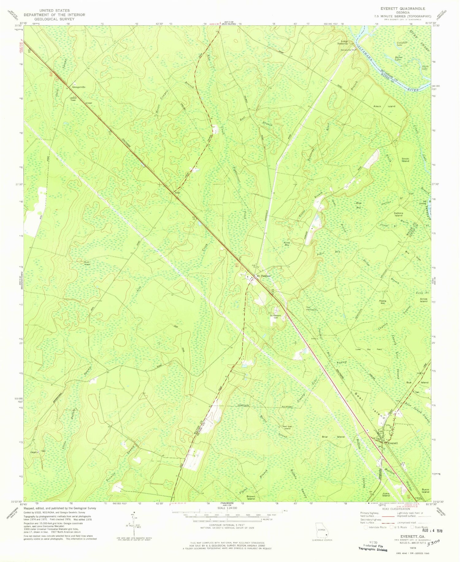
MyTopo
Classic USGS Everett Georgia 7.5'x7.5' Topo Map
Couldn't load pickup availability
Historical USGS topographic quad map of Everett in the state of Georgia. Typical map scale is 1:24,000, but may vary for certain years, if available. Print size: 24" x 27"
This quadrangle is in the following counties: Glynn, McIntosh, Wayne.
The map contains contour lines, roads, rivers, towns, and lakes. Printed on high-quality waterproof paper with UV fade-resistant inks, and shipped rolled.
Contains the following named places: Akin Church, Aleck Island, Barker Lake, Bear Island, Bear Island Swamp, Blue Ridge, Briar Island, Bridge Branch, Buck Island, Bull Branch, Buzzards Roost Branch, Campbell Lake, Canal Branch, County Line Swamp, Creels Lake, Deep Branch, Johns Bay, Layway Swamp, Lyles Old Field, Mason Cowpen Branch, Mays Bay, Mount Pleasant Cemetery, Pigeon Branch, Pigeonroost Creek, Piney Bay, Red Oak Island, Rozier Branch, Sallons Island, Saltons Branch, Sandhill Bay, Sansavilla Bluff, Smith Branch, Smith Island, Smith Lake, Tob Hammock, Akin, Log Landing, Lower Sansavilla, Mount Pleasant, Bull Island School (historical), Aleck Island Branch, Buck Pond (historical), Everett, Grangerville, Everett Church, Wayne County Fire Department Mount Pleasant Station, Everett Census Designated Place