
MyTopo
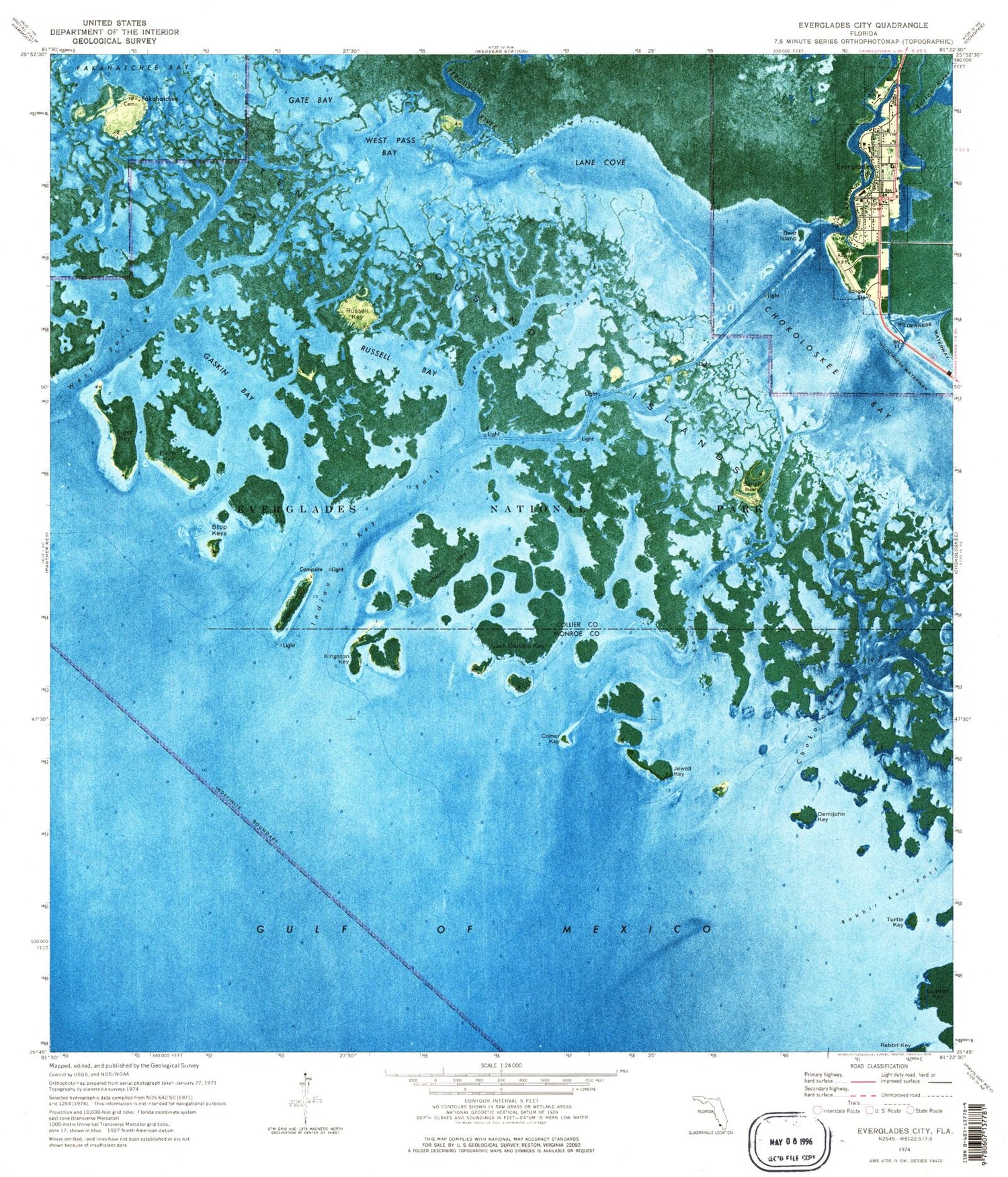
Classic USGS Everglades City Florida 7.5'x7.5' Topo Map
Couldn't load pickup availability
Historical USGS topographic quad map of Everglades City in the state of Florida. Typical map scale is 1:24,000, but may vary for certain years, if available. Print size: 24" x 27"
This quadrangle is in the following counties: Collier, Monroe.
The map contains contour lines, roads, rivers, towns, and lakes. Printed on high-quality waterproof paper with UV fade-resistant inks, and shipped rolled.
Contains the following named places: Barron River, Bear Island, Chokoloskee Bay, Chokoloskee Pass, Comer Key, Demijohn Key, Everglades City, Ferguson River, Gaskin Bay, Gate Bay, Halfway Creek, Indian Key, Indian Key Pass, Jack Daniels Key, Jenkins Key, Jewell Key, Kingston Key, Lane Cove, Picnic Key, Lake Placid, Rabbit Key, Russell Bay, Russell Key, Russell Pass, Sandfly Island, Sandfly Pass, Stop Keys, Ten Thousand Islands, Tiger Key, Turtle Key, West Pass, West Pass Bay, Fakahatchee, Everglades City School, Everglades Channel, First Baptist Church of Everglades City, Everglades Airpark, Ochopee Fire Rescue Station 60, Plantation Island Census Designated Place, City of Everglades, Everglades City Sewage Treatment Plant, Collier County Emergency Medical Services Station 60, Everglades City Post Office


