MyTopo
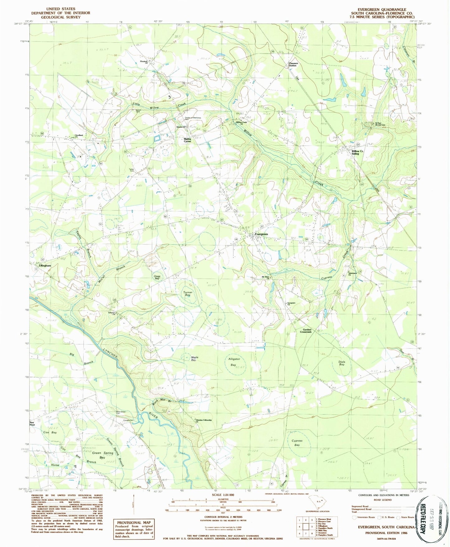
Classic USGS Evergreen South Carolina 7.5'x7.5' Topo Map
Couldn't load pickup availability
Historical USGS topographic quad map of Evergreen in the state of South Carolina. Map scale may vary for some years, but is generally around 1:24,000. Print size is approximately 24" x 27"
This quadrangle is in the following counties: Florence.
The map contains contour lines, roads, rivers, towns, and lakes. Printed on high-quality waterproof paper with UV fade-resistant inks, and shipped rolled.
Contains the following named places: Alligator Bay, Amada Church, Bay Branch, Big Branch, Christian Fellowship Church, Claussen Station, Coward Cemetery, Cox Bay, Cox Bay Branch, Cypress Bay, Cypress Creek, Dials Bay, Elizabeth Church, Elizabeth School, Evergreen, Evergreen Baptist Church, Evergreen Cemetery, Evergreen School, Florence County, Florence County Detention Center, Florence County Emergency Management Office, Florence County Emergency Medical Services, Florence County Sheriff's Office, Garden of Memories Cemetery, Gardner Crossroads, Goodland Church, Goodland School, Green Spring Bay, Gregg Bay, Hewitt Cemetery, Hopewell School, Howe Springs Fire Department Station 2, Lebanon Cemetery, Lebanon Church, Little Willow Creek, Maple Bay, Mathis Corner, McCall Branch, McKnight School, Mount Tabor Church, Olive Grove Baptist Church, Olive Grove Cemetery, Olive Grove Church, Olive Grove School, Othello School, Pentecostal United Apostolic Church of Christ, Saint Paul Cemetery, Saint Paul Church, Tabernacle Cemetery, Tabernacle Church, Tabernacle School, Taylor Branch, The House of God, Turner Bay, Turner Cemetery, Ward Mill Branch, Willow Creek Church, Willow Creek School, Willow Creek Siding, Wills Bay, ZIP Code: 29541