MyTopo
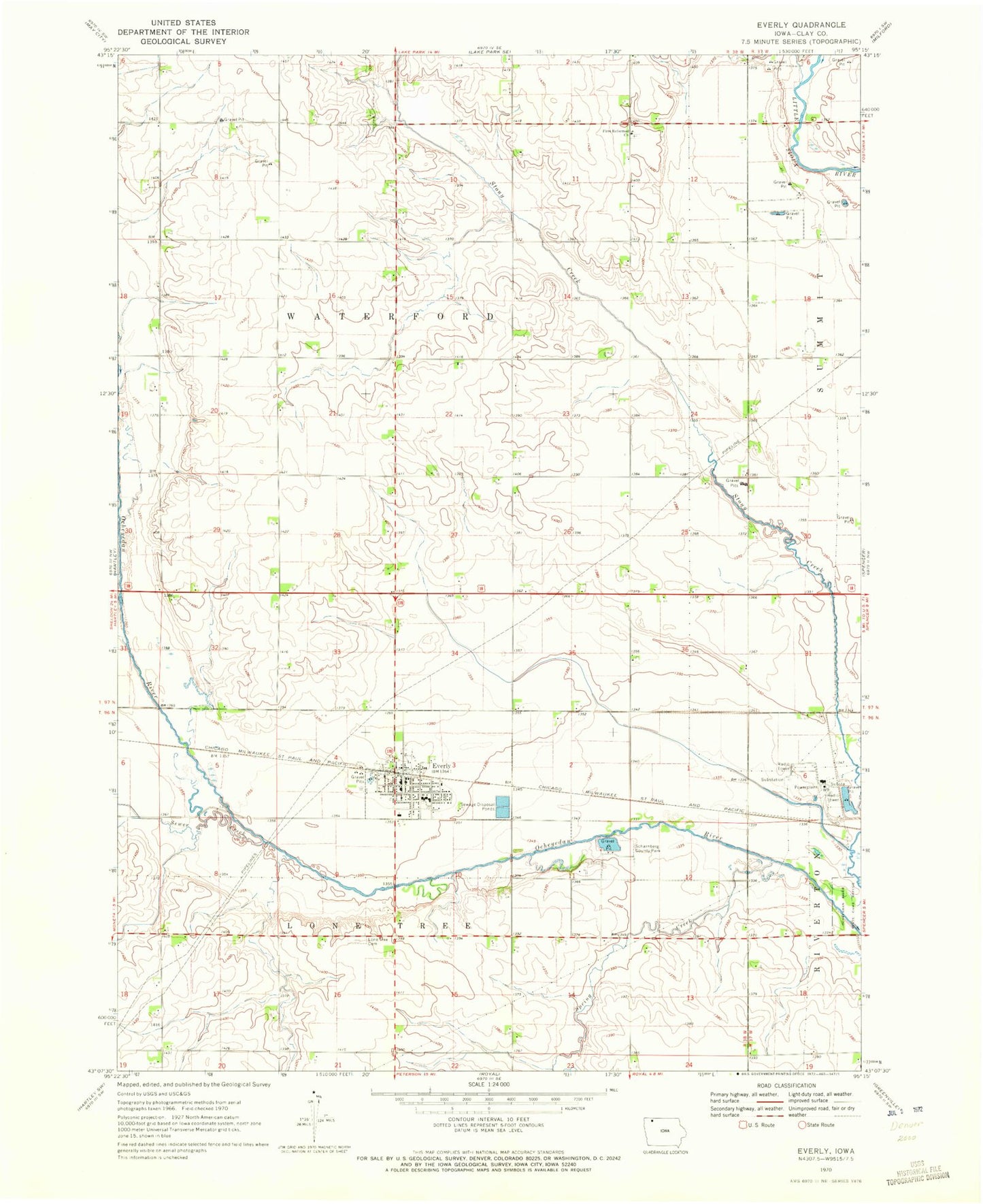
Classic USGS Everly Iowa 7.5'x7.5' Topo Map
Couldn't load pickup availability
Historical USGS topographic quad map of Everly in the state of Iowa. Map scale may vary for some years, but is generally around 1:24,000. Print size is approximately 24" x 27"
This quadrangle is in the following counties: Clay.
The map contains contour lines, roads, rivers, towns, and lakes. Printed on high-quality waterproof paper with UV fade-resistant inks, and shipped rolled.
Contains the following named places: Berends Farm, City of Everly, Clay Central - Everly Elementary School at Everly, Clay Central Everly Junior / Senior High School, Cromwell Center Post Office, Everly, Everly City Hall, Everly City Park, Everly Fire and Rescue, Everly Post Office, Everly Public Library, Fairchild Farm, Farmers Co-op Elevator, First Reformed Church, First Reformed Church Cemetery, Foss Farms, Geerdes Farm, Hildreth Farm, Hope Lutheran Church, Jensen Farms, Kirksey Farms, Kruse Farms, Lone Tree Cemetery, Ocheyedan River State Game Refuge, Q B Farm, Saint Marys Catholic Church, Scharnberg County Park, Schoeleman Farms, Sewer Creek, Spring Creek, Sunny Brooks School, Township of Lone Tree, Township of Waterford, Tuttle Marsh Area, United Methodist Church, ZIP Code: 51338