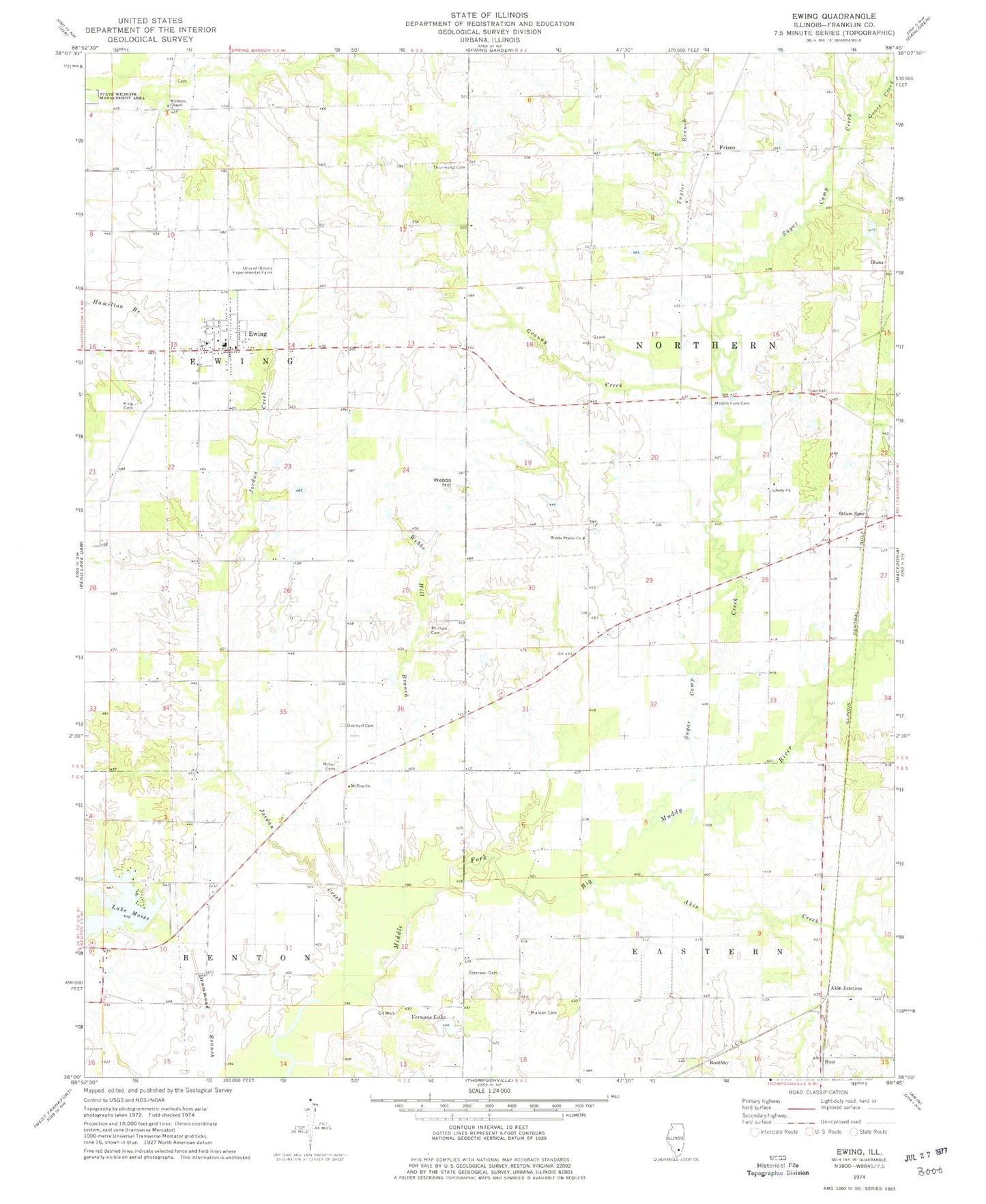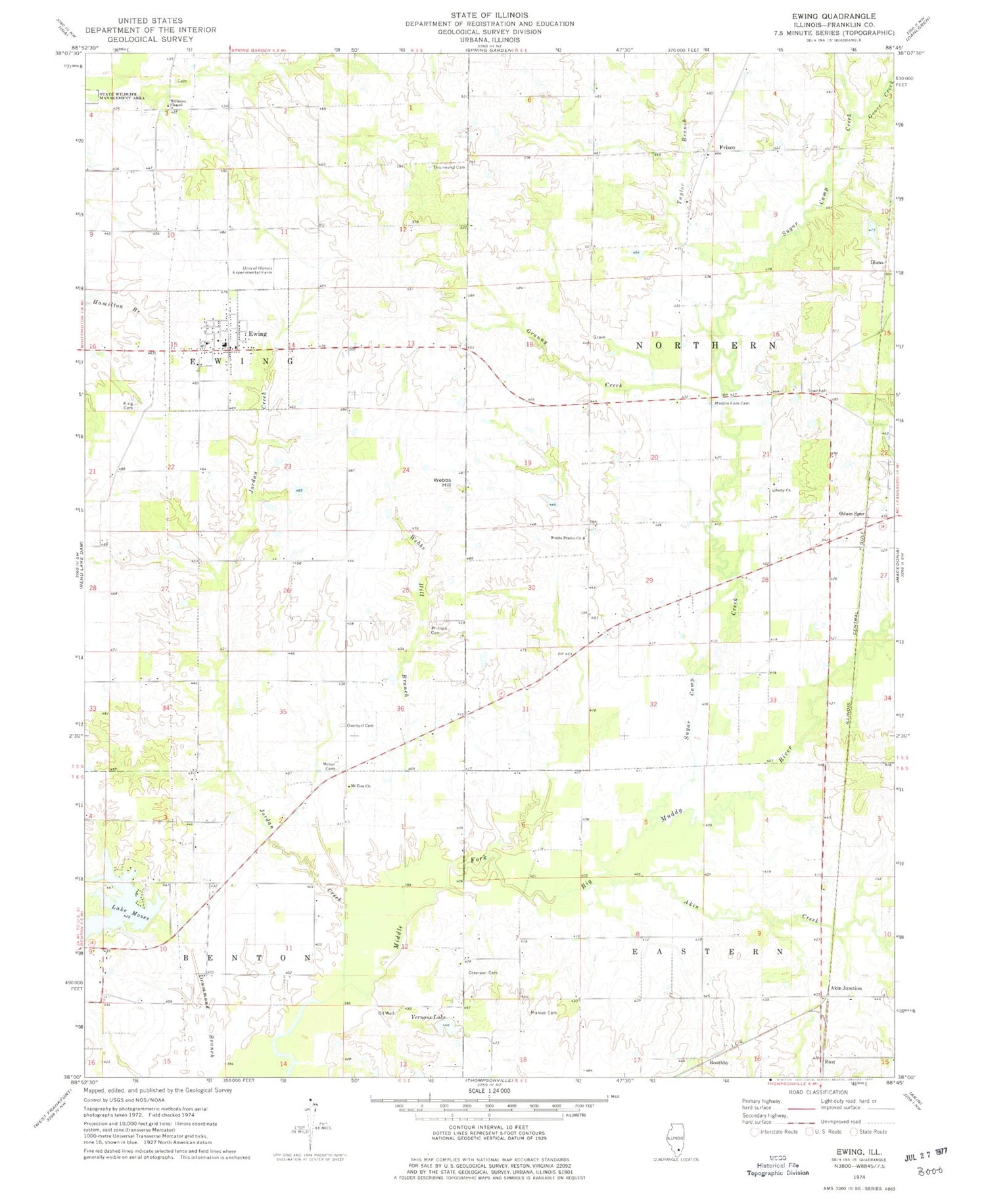
MyTopo
Classic USGS Ewing Illinois 7.5'x7.5' Topo Map
Couldn't load pickup availability
Historical USGS topographic quad map of Ewing in the state of Illinois. Map scale may vary for some years, but is generally around 1:24,000. Print size is approximately 24" x 27"
This quadrangle is in the following counties: Franklin.
The map contains contour lines, roads, rivers, towns, and lakes. Printed on high-quality waterproof paper with UV fade-resistant inks, and shipped rolled.
Contains the following named places: Akin Creek, Akin Junction, Boothby, Cuba School, Diana, Ewing, Ewing - Northern Fire Protection District Station 1, Ewing - Northern Fire Protection District Station 2, Ewing Cemetery, Ewing-Northern Elementary School, Franklin School, Frisco, Goose Creek, Granny Creek, Hickory Hill School, Independence School, Jordan Creek, Lake Moses, Lake Moses Dam, Liberty Church, Long Prairie School, Manion Cemetery, Manion School, Middle Fork Cemetery, Miller Cemetery, Mount Zion Church, Mount Zion School, Odum Spur, Old Akin School, Otterson Cemetery, Overturf Cemetery, Phillips Cemetery, Rust, Stockwell School, Sugar Camp Creek, Sugarcamp School, Taylor Branch, Taylor Hill, Taylor Hill Post Office, Taylor Hill School, Thurmond Cemetery, Township of Ewing, Township of Northern, University of Illinois Experimental Farm, Vernons Lake, Village of Ewing, Webbs Hill, Webbs Hill Branch, Webbs Prairie Church, Webbs Prairie Post Office, Webbs Prairie School, Williams Chapel, ZIP Code: 62836