
MyTopo
Classic USGS Excel Alabama 7.5'x7.5' Topo Map
Couldn't load pickup availability
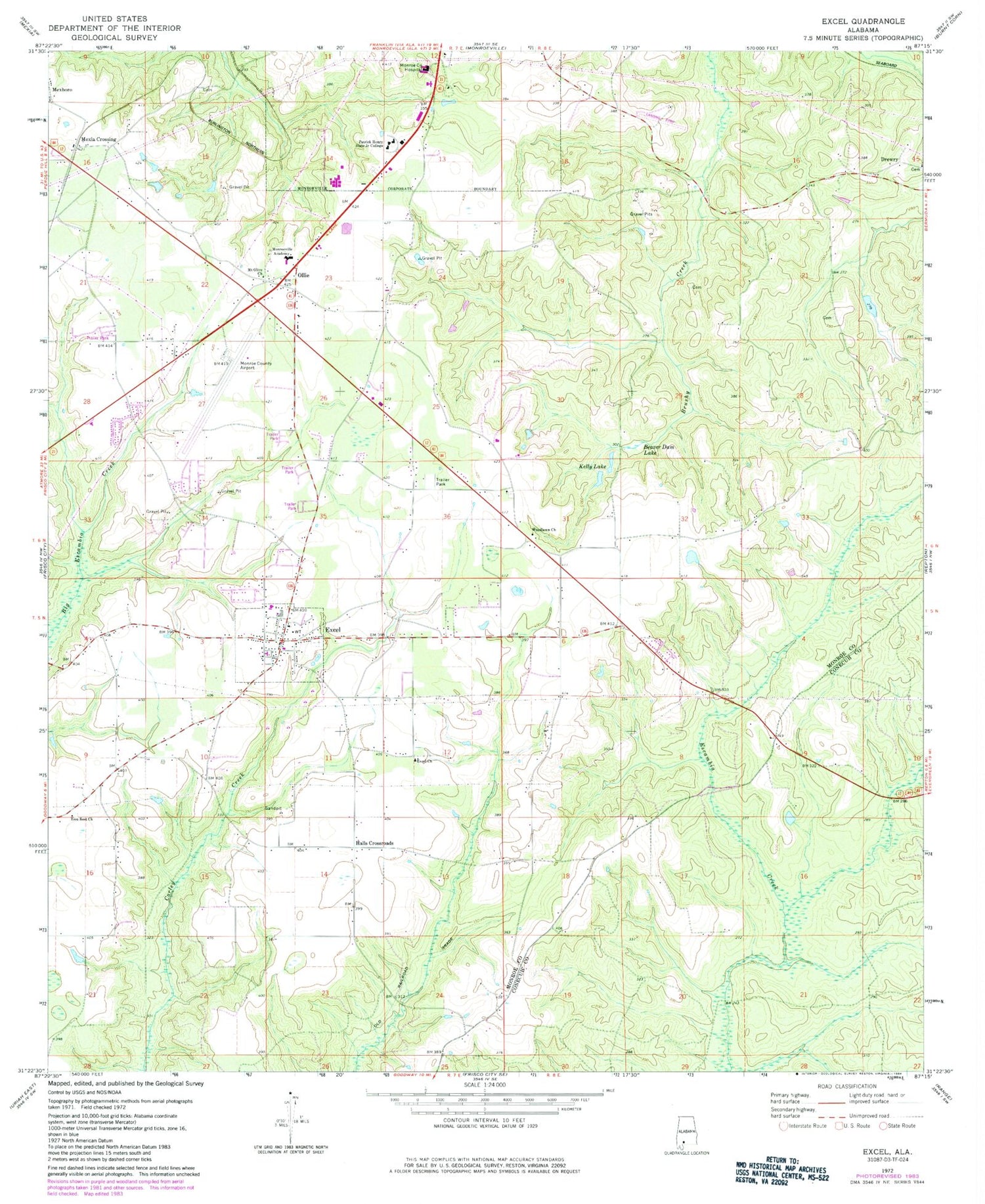
Historical USGS topographic quad map of Excel in the state of Alabama. Map scale may vary for some years, but is generally around 1:24,000. Print size is approximately 24" x 27"
This quadrangle is in the following counties: Conecuh, Monroe.
The map contains contour lines, roads, rivers, towns, and lakes. Printed on high-quality waterproof paper with UV fade-resistant inks, and shipped rolled.
Contains the following named places: Alabama Southern Community College, Auburn University of Agricultural Experiment Station, Beaula Camp Grounds, Beaver Dam Lake, Central Church of Christ, Christian Tabernacle Church, Church of Christ, City of Monroeville Industrial Park, Coleman School, Conoly, Daily Cemetery, Doctor Walter Nicholas Dam, Doctor Walter Nicholas Lake, Dotel Church, Drewry, Englewood Nursing Home, Excel, Excel Baptist Church, Excel Cemetery, Excel Church, Excel High School, Excel Nazarene Church, Excel Police Department, Excel Post Office, Excel Volunteer Fire Department, First Assembly of God Church, First United Pentecostal Church, Hall School, Halls Crossroads, Harrison Store, Kelly Lake, Kingdom Hall of Jehovah's Witnesses, Marks School, McMillan Cemetery, Mexboro, Mexia Crossing, Monroe County Aeroplex, Monroe County Area Vocational Center, Monroe County Hospital, Monroeville Academy, Monroeville Fire Rescue Station 3, Mount Olive Baptist Church, Mount Olive Church, Mount Sinai Baptist Church, Nations Outreach Center Church, New Beginnings Church of God In Christ, New Home Cemetery, New Home Primitive Baptist Church, NEW-AM (Monroeville), Oliver Church, Ollie, Pine Grove School, Pleasant Grove Church, Sunnyside School, Town of Excel, Unity and Charity Church, Woodlawn Church, Zion Rest Church, ZIP Code: 36439


