MyTopo
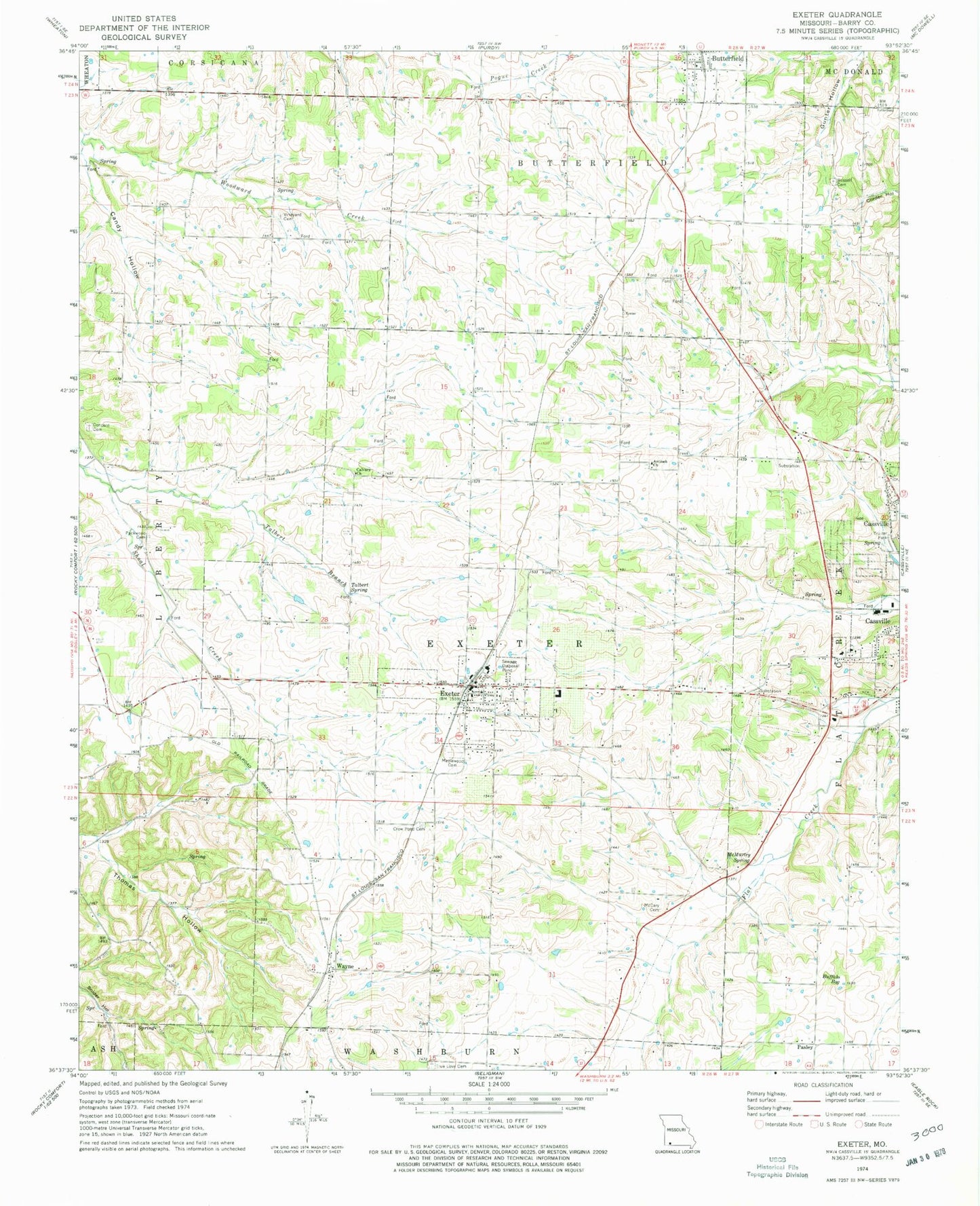
Classic USGS Exeter Missouri 7.5'x7.5' Topo Map
Couldn't load pickup availability
Historical USGS topographic quad map of Exeter in the state of Missouri. Map scale may vary for some years, but is generally around 1:24,000. Print size is approximately 24" x 27"
This quadrangle is in the following counties: Barry.
The map contains contour lines, roads, rivers, towns, and lakes. Printed on high-quality waterproof paper with UV fade-resistant inks, and shipped rolled.
Contains the following named places: Antioch Church, Buffalo Bog, Butterfield Fire and Rescue, Butterfield School, Calvary Church, Candy Hollow, Cassville Municipal Airport, City of Butterfield, City of Exeter, Concord Cemetery, Concord Church, Crow Pond Cemetery, Doss School, Exeter, Exeter Elementary School, Exeter Fire Protection District, Exeter High School, Exeter Police Department, Exeter Post Office, Hazel Dell School, House School, Independence School, Maplewood Cemetery, Mc Cary Cemetery, McMurtry Spring, Packwood Cemetery, Pasley, Pasley School, Russell Cemetery, Shady Grove School, Stony Point School, Talbert Branch, Talbert Spring, Township of Butterfield, Township of Exeter, True Love Cemetery, Van Zandt School, Vineyard Cemetery, Wayne, Wayne School, ZIP Code: 65623