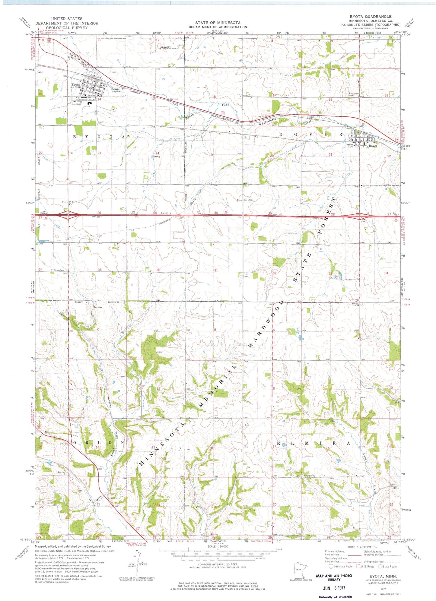
MyTopo
Classic USGS Eyota Minnesota 7.5'x7.5' Topo Map
Couldn't load pickup availability
Historical USGS topographic quad map of Eyota in the state of Minnesota. Map scale may vary for some years, but is generally around 1:24,000. Print size is approximately 24" x 27"
This quadrangle is in the following counties: Olmsted.
The map contains contour lines, roads, rivers, towns, and lakes. Printed on high-quality waterproof paper with UV fade-resistant inks, and shipped rolled.
Contains the following named places: City of Dover, City of Eyota, Clemens Farms, Cline Cemetery, Dover, Dover - Eyota Elementary School, Dover - Eyota High School, Dover Fire Department, Dover Post Office, Edith Wright Farm Cemetery, Elmira Church, Evergreen Cemetery, Eyota, Eyota Airport, Eyota Police Department, Eyota Post Office, Eyota Volunteer Fire Department, Faith United Methodist Church, Franke Farms, Gar Lin Dairy Farm, Grace Church, Holy Redeemer Catholic Church, Olmstead County Road 10 Dam, Our Saviour's Lutheran Church, Peace Lutheran Church, Township of Dover, Township of Elmira, Wendt Farms of Eyota, ZIP Code: 55929