MyTopo
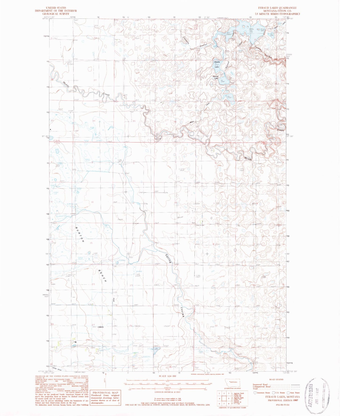
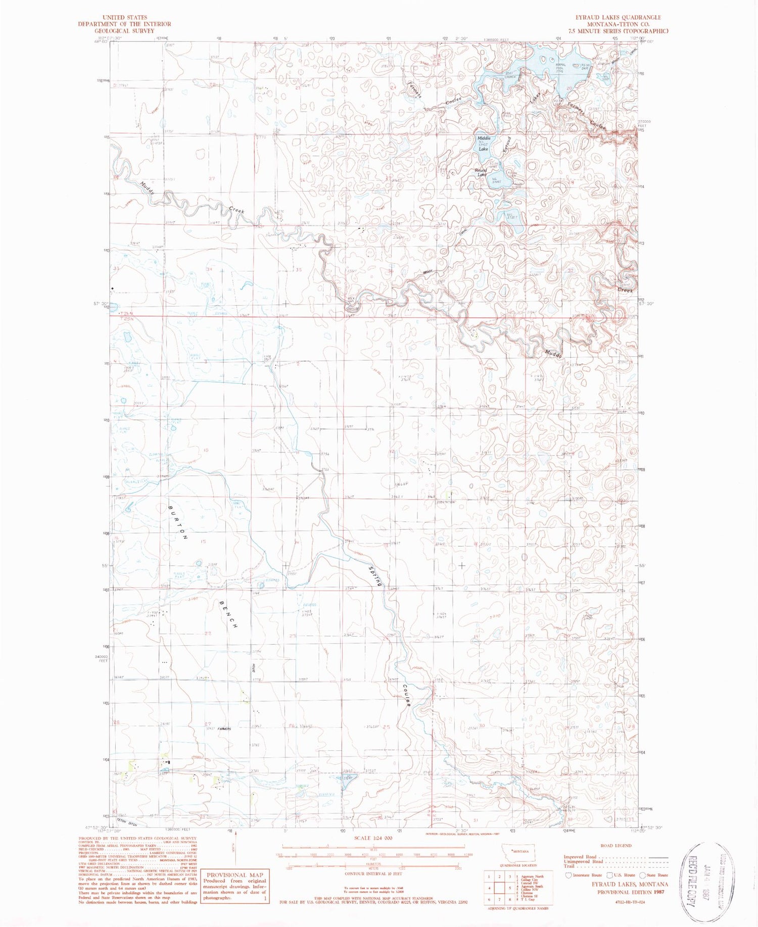
Classic USGS Eyraud Lakes Montana 7.5'x7.5' Topo Map
Couldn't load pickup availability
Historical USGS topographic quad map of Eyraud Lakes in the state of Montana. Map scale may vary for some years, but is generally around 1:24,000. Print size is approximately 24" x 27"
This quadrangle is in the following counties: Teton.
The map contains contour lines, roads, rivers, towns, and lakes. Printed on high-quality waterproof paper with UV fade-resistant inks, and shipped rolled.
Contains the following named places: 25N04W02B___01 Well, 25N04W02C___01 Well, 25N04W03____01 Well, 25N04W03____02 Well, 25N04W03____03 Well, 25N04W03____04 Well, 25N04W03____05 Well, 25N04W03____06 Well, 25N04W03____07 Well, 25N04W03D___01 Well, 25N04W03D___02 Well, 25N04W11A___01 Well, 25N04W11C___01 Well, 25N04W11C___02 Well, 25N04W11D___01 Well, 25N04W11D___02 Well, 25N04W23C___01 Well, 25N04W28D___01 Well, 26N04W21D___01 Well, 26N04W23D___01 Well, 26N04W35B___01 Well, 26N04W35C___01 Well, 26N04W36DCDB01 Well, Arod Lake Fishing Access Site, Brady Canal, Brady Lakes Number 4 Dam, Burton, Burton Post Office, East Farmington Number 5 School, Eyraud Lakes, Middle Lake, Round Lake, Teton County Waterfowl Production Area, Trinity Cemetery