MyTopo
Classic USGS Fail Ranch Montana 7.5'x7.5' Topo Map
Couldn't load pickup availability
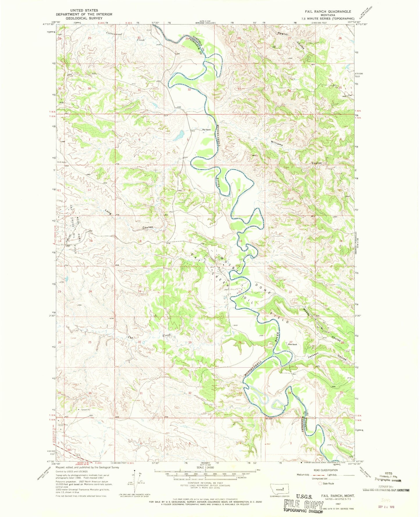
Historical USGS topographic quad map of Fail Ranch in the state of Montana. Map scale may vary for some years, but is generally around 1:24,000. Print size is approximately 24" x 27"
This quadrangle is in the following counties: Garfield, Petroleum.
The map contains contour lines, roads, rivers, towns, and lakes. Printed on high-quality waterproof paper with UV fade-resistant inks, and shipped rolled.
Contains the following named places: 15N29E11DD__01 Well, 15N30E21BAC_01 Well, 15N30E27CAAA01 Well, Brown School, Cat Creek, Cottonwood Creek, Dobson School, Fail Ranch, Jackson Coulee, Long Coulee, Mosby Dome Cat Creek Oil Field, Moss Ranch, Sage Hen Creek, US Number 44 Dam, West Dome Cat Creek Oil Field, Williams Coulee, Woods Coulee