MyTopo
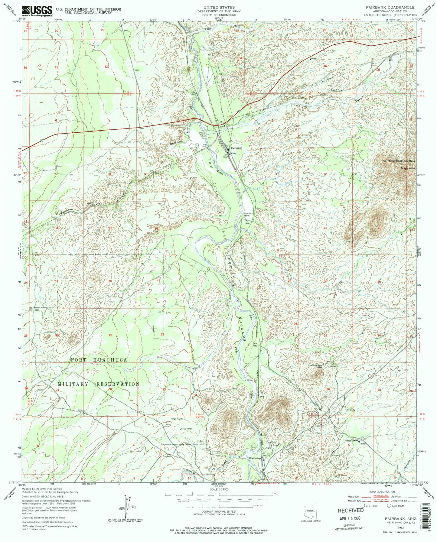
Classic USGS Fairbank Arizona 7.5'x7.5' Topo Map
Couldn't load pickup availability
Historical USGS topographic quad map of Fairbank in the state of Arizona. Map scale may vary for some years, but is generally around 1:24,000. Print size is approximately 24" x 27"
This quadrangle is in the following counties: Cochise.
The map contains contour lines, roads, rivers, towns, and lakes. Printed on high-quality waterproof paper with UV fade-resistant inks, and shipped rolled.
Contains the following named places: Babocomari River, Benson Junction, Benson Junction Railroad Station, Boquillas Ranch, Buffalo Soldier Electronic Testing Range, Charleston, Charleston Lead Mine, Charleston Post Office, Fairbank, Fairbank Railroad Station, Four Pillars Airport, Graveyard Gulch, Lindsey Ranch, Mays Hills, San Juan de las Boguillas y Nogales, Sierra Vista Division, The Three Brothers Hills, Tombstone Territories Recreational Vehicle Resort, Walnut Gulch, Willow Wash