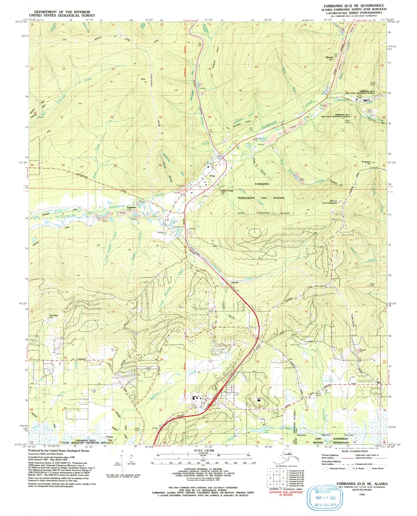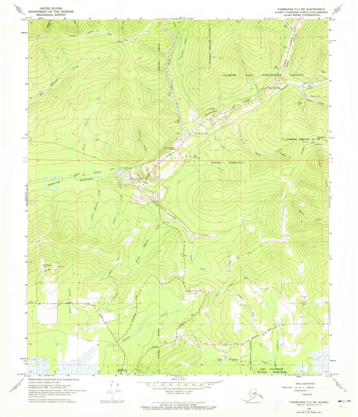
MyTopo
Classic USGS Fairbanks D-2 NE Alaska 7.5'x7.5' Topo Map
Couldn't load pickup availability
Historical USGS topographic quad map of Fairbanks D-2 NE in the state of Alaska. Map scale may vary for some years, but is generally around 1:24,000. Print size is approximately 24" x 27"
This quadrangle is in the following counties: Fairbanks North Star.
The map contains contour lines, roads, rivers, towns, and lakes. Printed on high-quality waterproof paper with UV fade-resistant inks, and shipped rolled.
Contains the following named places: Calder Creek, Engineer, Engineer Creek, Fairbanks Number 2 NASA Data Aquisition Facility, Fairbanks Permafrost Test Station, Farmers Loop Census Designated Place, First Chance Creek, Flume Creek, Fox, Fox Census Designated Place, Fox Creek, Fox Spring, French Gulch, Gilmore, Gilmore Creek, Glenn Creek, Gold Run, Goldstream Lakes, Grace and Truth Chapel, Irish Gulch, Jessila Creek, KAYY-FM (Fairbanks), KBCN-AM (Fairbanks), KIAK-AM (Fairbanks), KIAK-FM (Fairbanks), Little Blanche Creek, Little Queenie Creek, Liwa Lake, Moen's Ranch Airport, Mount Lulu Fairbanks, Pedro Creek, Rose Creek, Silver Creek, Silver Gulch, Ski Boot Hill, Steese Area Volunteer Fire Department Station 1, Steese Area Volunteer Fire Department Station 2, Steese Area Volunteer Fire Department Station 3, Steese Contract Postal Unit, Tungsten Gulch, Tungsten Hill, Wigwam Creek