


MyTopo
Classic USGS Fairbanks Indiana 7.5'x7.5' Topo Map
Couldn't load pickup availability
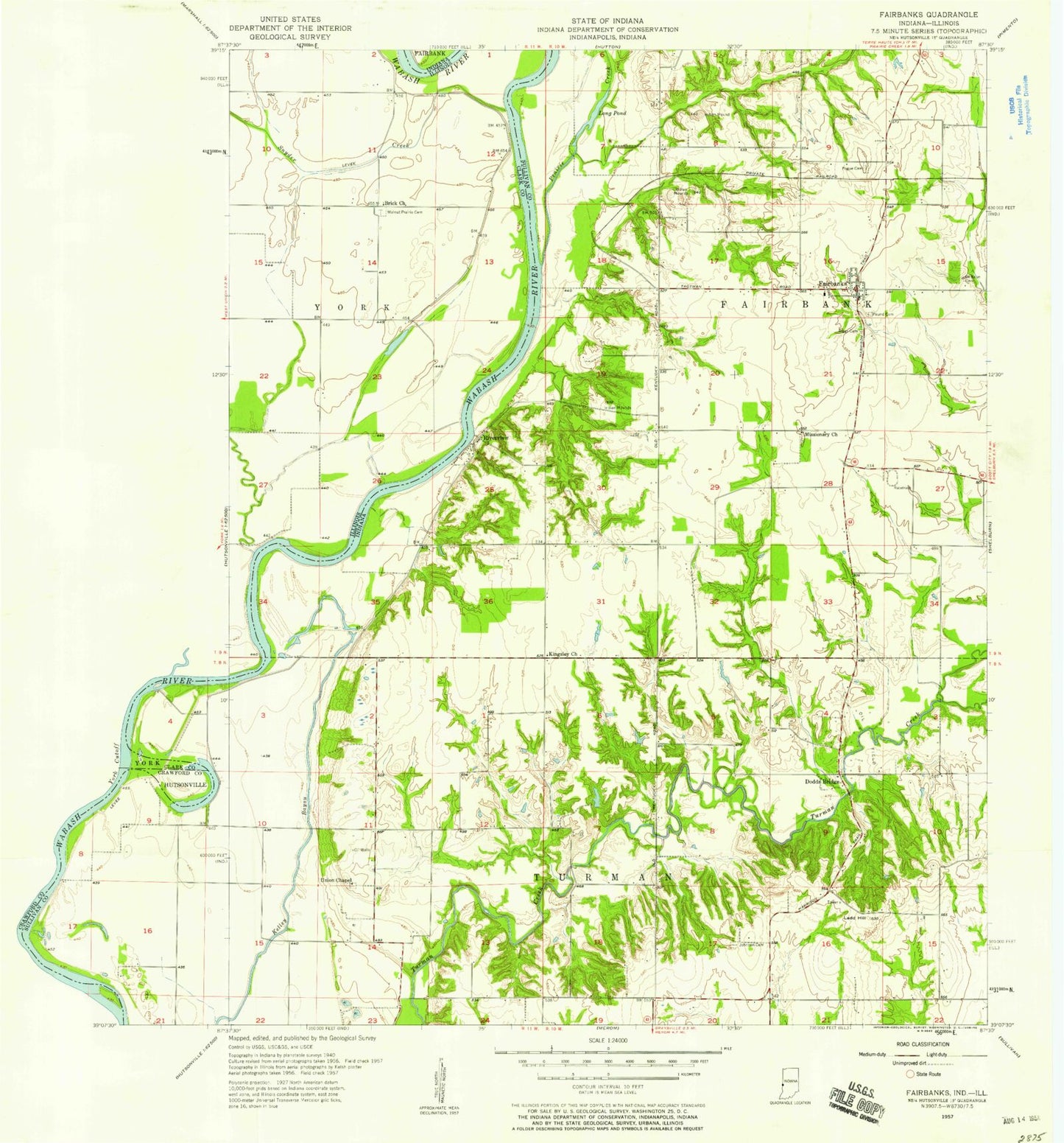
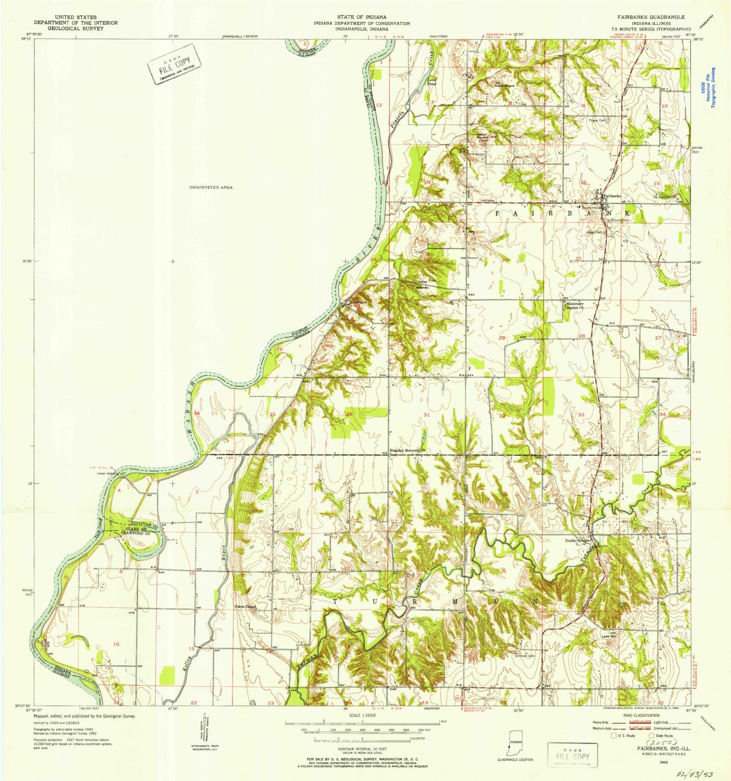
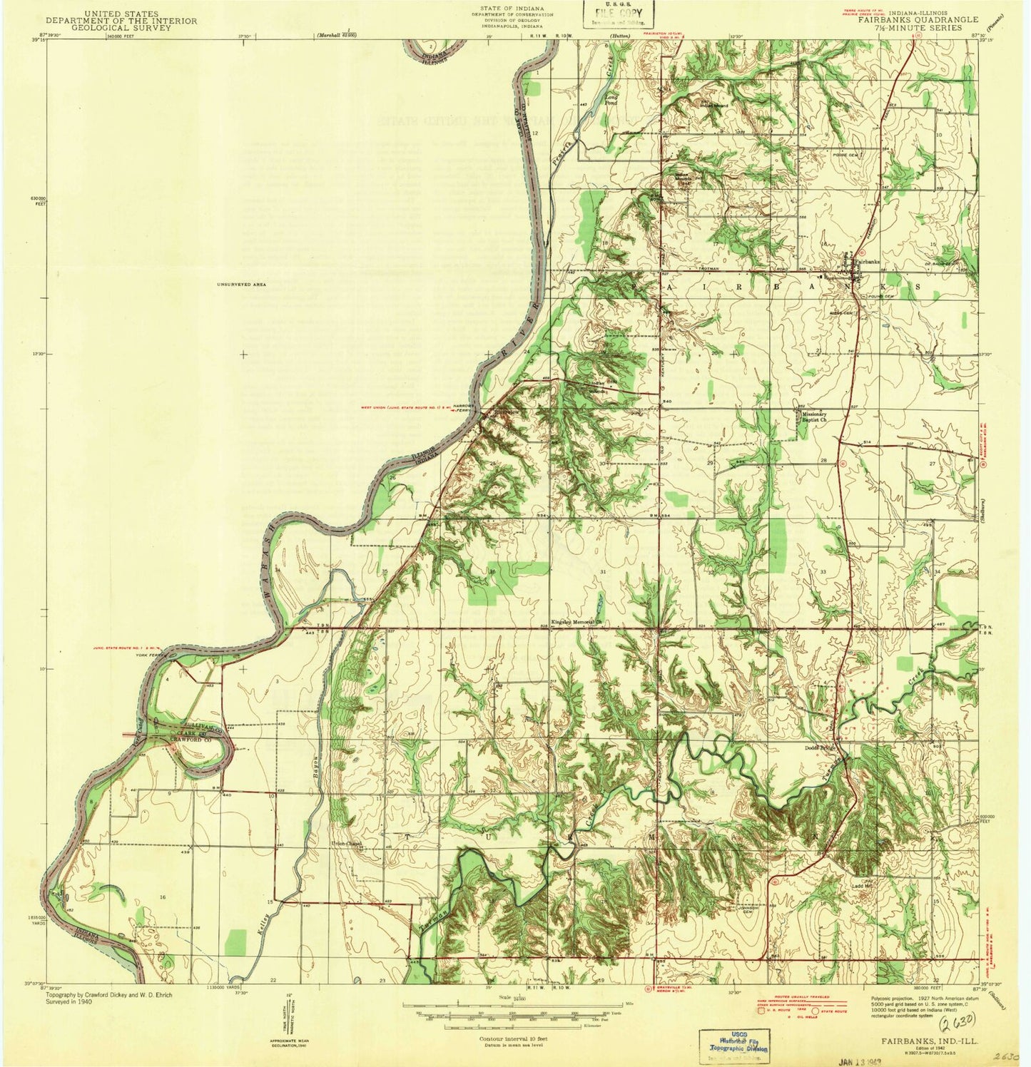
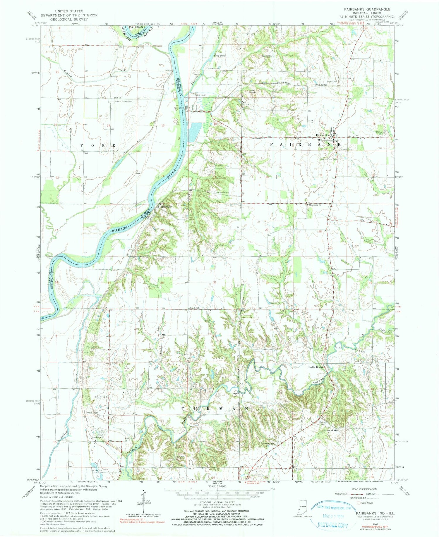
Historical USGS topographic quad map of Fairbanks in the states of Indiana, Illinois. Map scale may vary for some years, but is generally around 1:24,000. Print size is approximately 24" x 27"
This quadrangle is in the following counties: Clark, Sullivan.
The map contains contour lines, roads, rivers, towns, and lakes. Printed on high-quality waterproof paper with UV fade-resistant inks, and shipped rolled.
Contains the following named places: Brick United Methodist Church, DeBaun Cemetery, Dodds Bridge, Fairbanks, Fairbanks Elementary School, Fairbanks Mound, Fairbanks Post Office, Fairbanks Volunteer Fire Rescue, Graysville Pit, Ingle Pond, Johnson Cemetery, Kingsley Church, Ladd Hill, Long Pond, Missionary Church, Narrows Ferry, Pogue Cemetery, Prairie Creek, Riggs - Ernest Cemetery, Riverview, Roll-N-Ridge Airport, Snyder Creek, Sugar Creek, Township of Fairbanks, Township of Turman, Union Chapel, Walnut Prairie Cemetery, Welsh Creek, ZIP Code: 47849