MyTopo
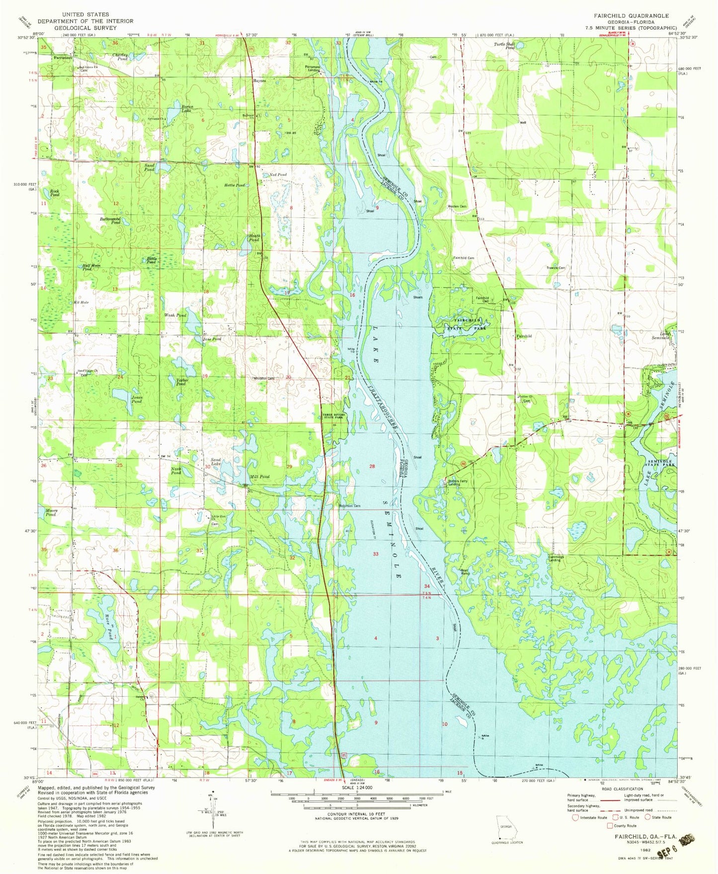
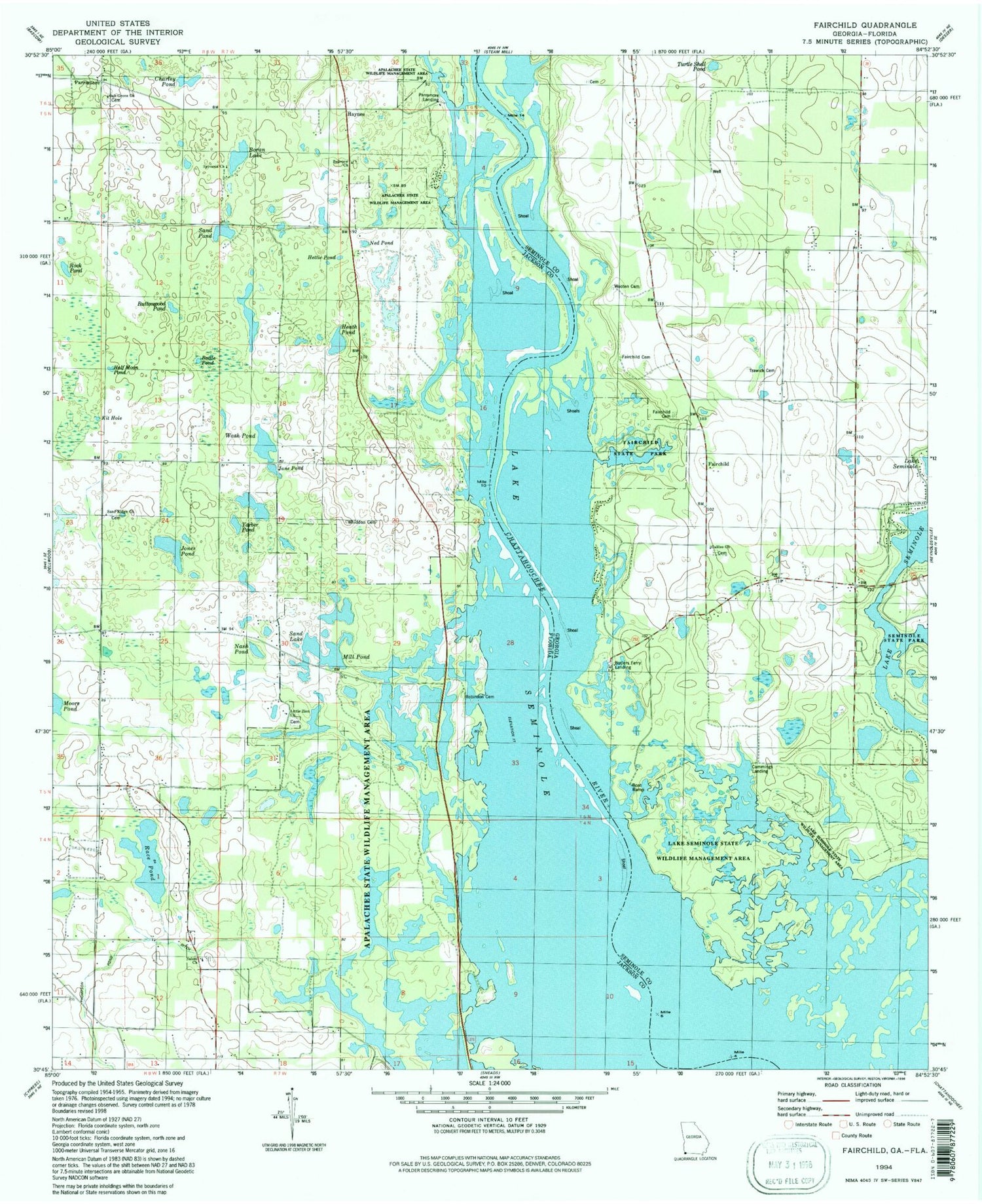
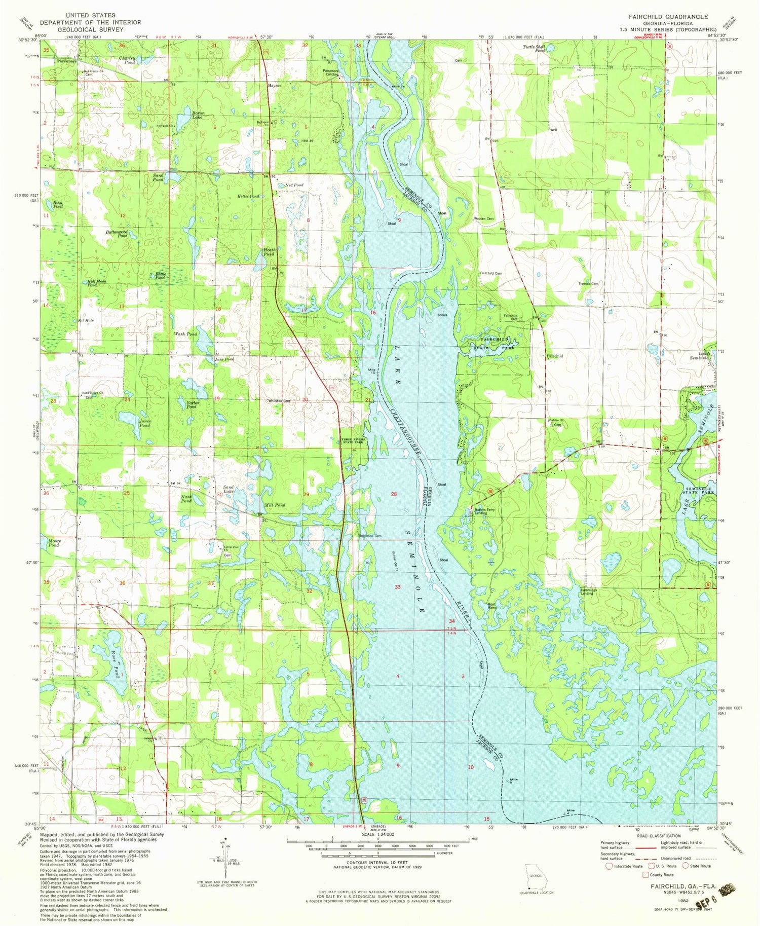
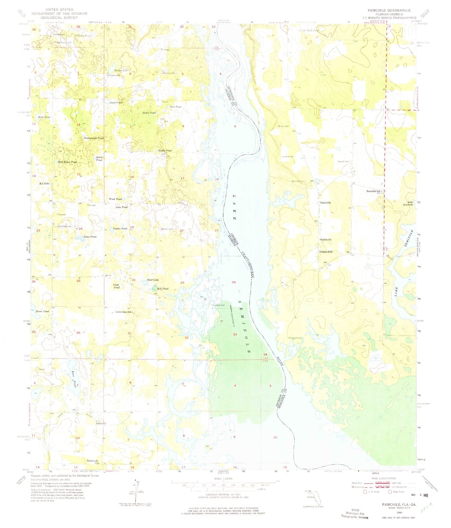
Classic USGS Fairchild Georgia 7.5'x7.5' Topo Map
Couldn't load pickup availability
Historical USGS topographic quad map of Fairchild in the states of Georgia, Florida. Map scale may vary for some years, but is generally around 1:24,000. Print size is approximately 24" x 27"
This quadrangle is in the following counties: Jackson, Seminole.
The map contains contour lines, roads, rivers, towns, and lakes. Printed on high-quality waterproof paper with UV fade-resistant inks, and shipped rolled.
Contains the following named places: Apalachee Wildlife Management Area, Battle Pond, Bellview Church, Boram Lake, Butler, Butlers Ferry, Butlers Ferry Landing, Buttonwood Pond, Charley Pond, Cummings Landing, Drakes Still, Fairchild, Fairchild Cemetery, Fairchild Landing, Fairchild School, Fairchild State Park, Galilee Church, Half Moon Pond, Haynes, Heath Pond, Hettie Pond, Jane Pond, Jones Pond, Kit Hole, Little Zion School, Mill Pond, Moore Pond, Nash Pond, Ned Pond, Oak Grove Church, Paradise Acres, Parramore, Race Pond, Robinson Cemetery, Rock Pond, Salem Church, Sand Lake, Sand Pond, Sand Ridge Cemetery, Sand Ridge Church, Seminole State Park, Simpsons Cemetery, Sylvania School, Tabernacle Church, Thompson Pond Ditch, Tocktoethla, Trawick Cemetery, Turtle Shell Pond, Wash Pond, Whiddon Cemetery, Wooten Cemetery, Yarber Pond, ZIP Code: 32460