MyTopo
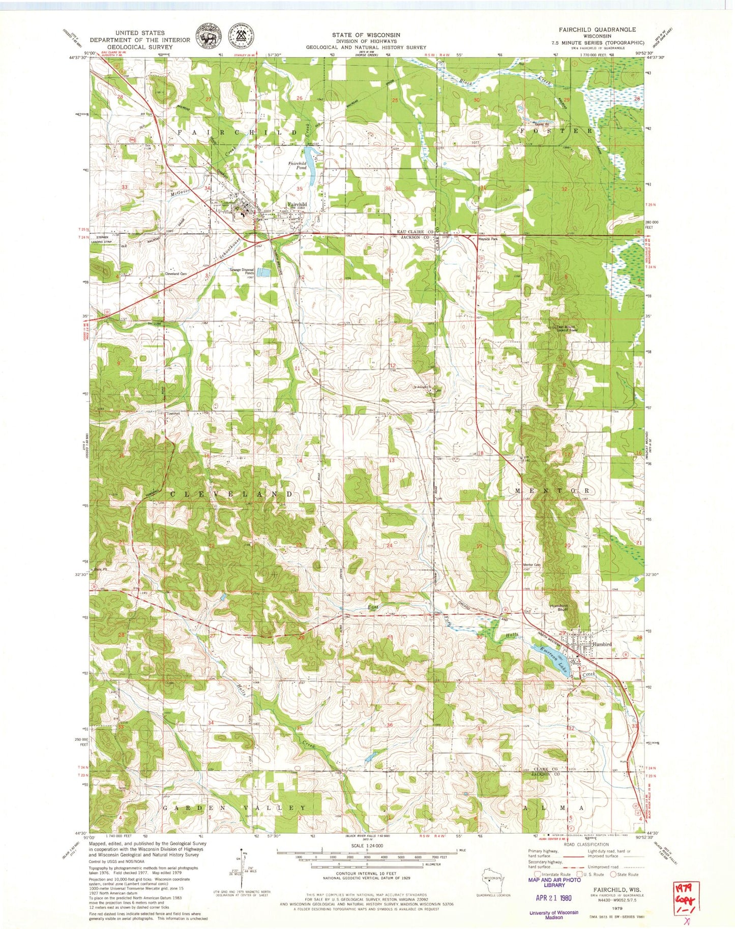
Classic USGS Fairchild Wisconsin 7.5'x7.5' Topo Map
Couldn't load pickup availability
Historical USGS topographic quad map of Fairchild in the state of Wisconsin. Map scale may vary for some years, but is generally around 1:24,000. Print size is approximately 24" x 27"
This quadrangle is in the following counties: Clark, Eau Claire, Jackson.
The map contains contour lines, roads, rivers, towns, and lakes. Printed on high-quality waterproof paper with UV fade-resistant inks, and shipped rolled.
Contains the following named places: Cleveland Cemetery, Emerson Lake, Fairchild, Fairchild C4772 Dam, Fairchild Elementary School, Fairchild Fire Protection District, Fairchild Police Department, Fairchild Pond, Fairchild Post Office, Humbird, Humbird Bluff, Humbird Census Designated Place, Humbird Dam, Humbird Post Office, Humbird Volunteer Fire Department, Lone Pine School, McGaver Creek, Mentor Cemetery, Saint Joseph Church, Sunnybrook School, Sunnyside School, Town of Cleveland, Twin Mound Lookout Tower, Van Horn School, Village of Fairchild, ZIP Codes: 54741, 54746