MyTopo
Classic USGS Fairdale Oregon 7.5'x7.5' Topo Map
Couldn't load pickup availability
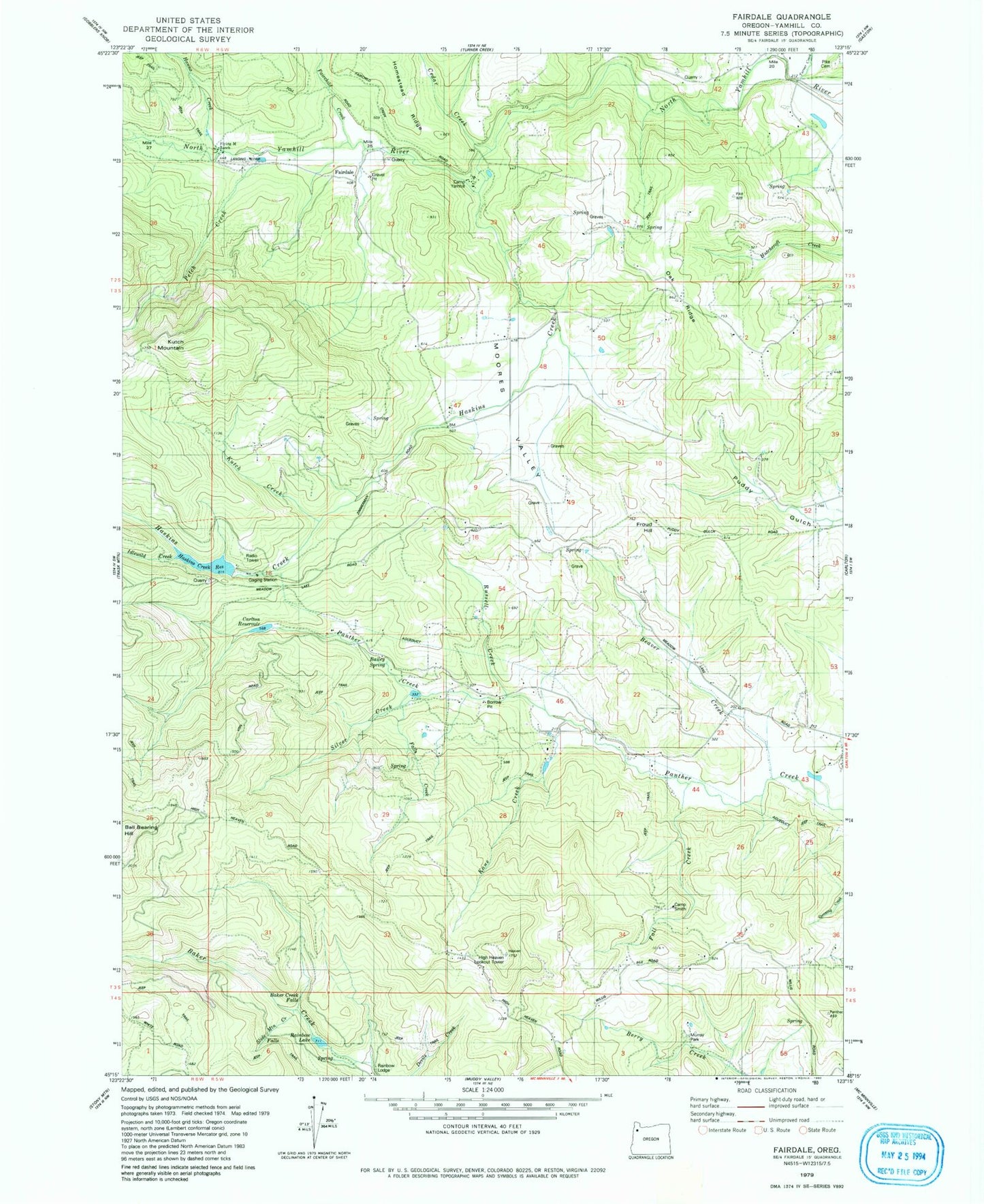
Historical USGS topographic quad map of Fairdale in the state of Oregon. Map scale may vary for some years, but is generally around 1:24,000. Print size is approximately 24" x 27"
This quadrangle is in the following counties: Yamhill.
The map contains contour lines, roads, rivers, towns, and lakes. Printed on high-quality waterproof paper with UV fade-resistant inks, and shipped rolled.
Contains the following named places: Bailey Spring, Baker Creek Falls, Beaver Creek, Beltview Reservoir, Bolton Creek, Browns Spring, Camp Smith, Camp Yamhill, Carlton Division, Carlton Reservoir, Carlton Water Treatment Plant, Cedar Creek, Chesterbrook, Chesterbrook Post Office, Dawson Spring, Fairchild Creek, Fairchilds, Fairdale, Fairdale Mineral Spring, Fairdale Post Office, Fall Creek, Falls Creek, Flying M Airport, Flying M Ranch, Flying M Reservoir, Froud Hill, Hanna Creek, Haskins Creek, Haskins Creek Dam, Haskins Creek Reservoir, High Heaven Lookout Tower, Idlewild Creek, Kane Creek, Kutch Creek, Kutch Mountain, Manila Post Office, McCall Spring, Moores Valley, Moores Valley Cemetery, Mountain House, Mountain House Post Office, Murray Creek, Murray Park, Oak Ridge, Panther Creek Dam, Panther Creek Reservoir, Petch Creek, Pike Cemetery, Puddy Gulch, Rainbow Lake, Rainbow Lodge, Russel Creek, Silver Creek, Slide Mountain Creek, Tillamook Gate, Turek Reservoir, Turner Creek, Vincent Pond, Von Reservoir, Vons Airstrip, Yamhill Encampment Corporation Wastewater Treatment Facility