MyTopo
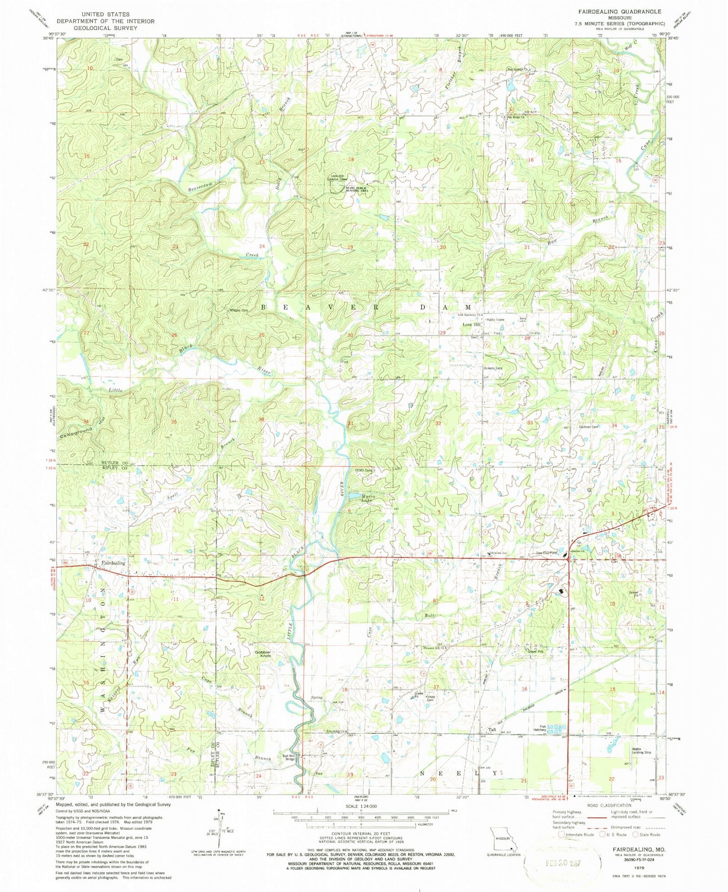
Classic USGS Fairdealing Missouri 7.5'x7.5' Topo Map
Couldn't load pickup availability
Historical USGS topographic quad map of Fairdealing in the state of Missouri. Map scale may vary for some years, but is generally around 1:24,000. Print size is approximately 24" x 27"
This quadrangle is in the following counties: Butler, Ripley.
The map contains contour lines, roads, rivers, towns, and lakes. Printed on high-quality waterproof paper with UV fade-resistant inks, and shipped rolled.
Contains the following named places: Ball Mill Bridge, Bay Springs Cemetery, Bay Springs Church, Beaverdam Creek, Belcher, Belcher Post Office, Bethel Church, Burnham School, Butler County Fire Protection District Hillview Station, Campground Hollow, Case Bolt Branch, Cochran Cemetery, Cope Branch, Corinth Church, Dickens Cemetery, Dolly Branch, Fairdealing, Fairdealing Census Designated Place, Fairdealing Post Office, Forest Grove School, Fox Branch, Friendship Church, Gobbler Knob, Haw Branch, Hickory Grove School, Hillview School, Kenner Spring Branch, Kinsey Cemetery, Kremlin Mill, Kremlin School, Lone Hill, Lone Hill Cemetery, Lone Hill Church, Lone Hill Lookout Tower, Lone Hill School, Military Cemetery, Myers Lake, New Harmony Church, Oak Ridge Church, Oak Ridge School, Pleasant Hill School, Pleasant Valley School, Powers Mill, Resnick Lake, Resnik Lake Dam, Roxie, Russell Lake Dam, SEMO Camp, Spell Branch, Spell School, State Public Hunting Area, Taft, Township of Beaver Dam, Wattle Landing Strip, Wolf Creek, ZIP Code: 63945