MyTopo
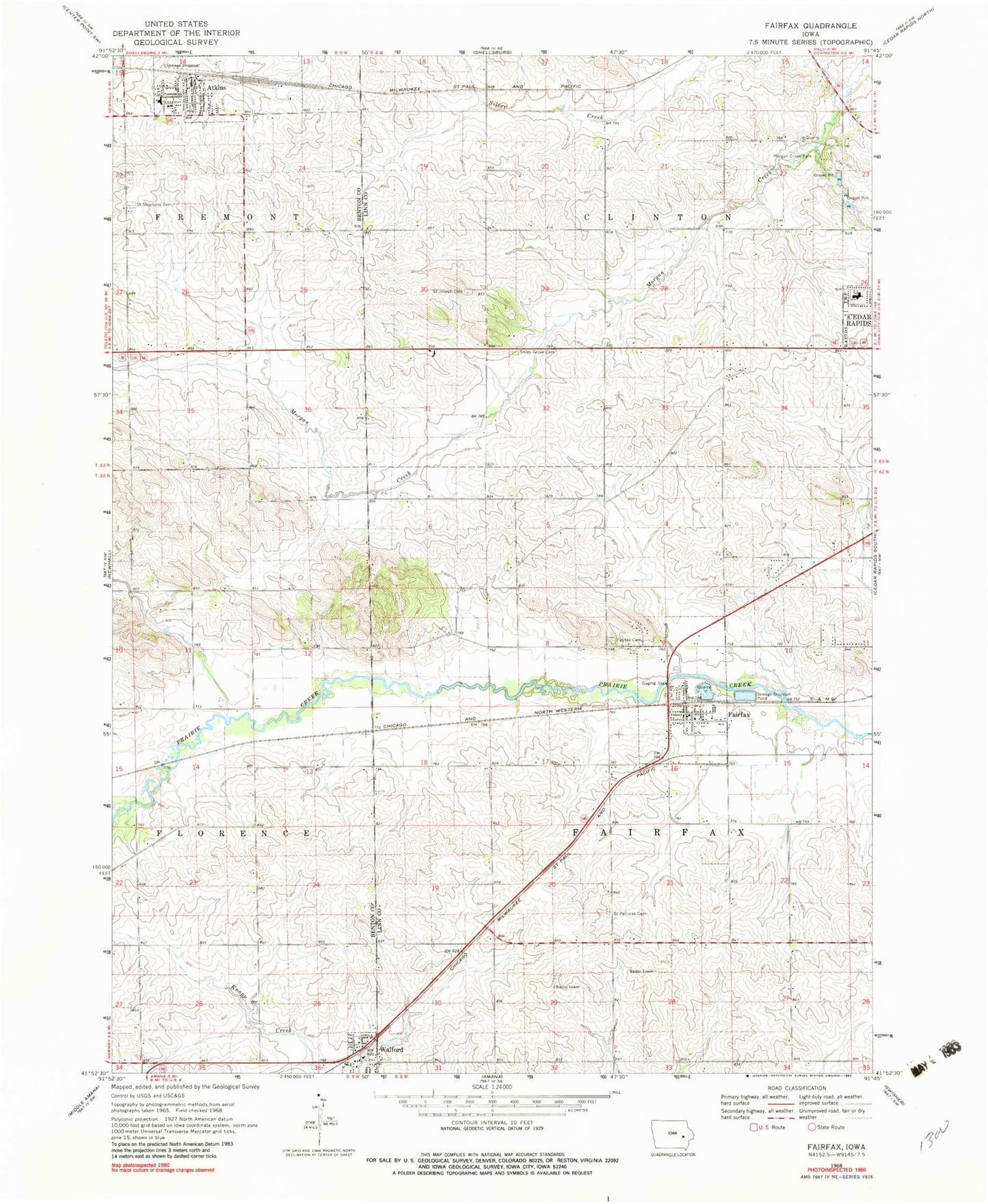
Classic USGS Fairfax Iowa 7.5'x7.5' Topo Map
Couldn't load pickup availability
Historical USGS topographic quad map of Fairfax in the state of Iowa. Map scale may vary for some years, but is generally around 1:24,000. Print size is approximately 24" x 27"
This quadrangle is in the following counties: Benton, Linn.
The map contains contour lines, roads, rivers, towns, and lakes. Printed on high-quality waterproof paper with UV fade-resistant inks, and shipped rolled.
Contains the following named places: Atkins, Atkins City Hall, Atkins Elementary School, Atkins Fire Department and First Responders, Atkins Library, Atkins Memorial Union Hall, Atkins Post Office, Atkins Roundhouse Area, Cherry Hill Park, City of Atkins, City of Fairfax, City of Walford, Clover Ridge United Methodist Church, Coolidge Elementary School, Country Aire Home Park, Fairfax, Fairfax Cemetery, Fairfax City Hall, Fairfax Fire and Rescue Department, Fairfax Library, Fairfax Post Office, Fairfax Volunteer Fire and Rescue Department, Holy Trinity Catholic Church, John XXIII Church, Morgan Creek Park, Pleasant Hill Presbyterian Church, Robin Post Office, Saint Joseph Cemetery, Saint Patrick's Catholic Church, Saint Patricks Cemetery, Saint Stephens Lutheran Cemetery, Saint Stephens Lutheran Church, Shellsburg Elevator, Sisley Grove Cemetery, Sisley's Grove Post Office, Stonebridge Church, Township of Clinton, Township of Fairfax, Walford, Walford City Hall, Walford Post Office, ZIP Codes: 52228, 52351