MyTopo
Classic USGS Fairfield Bay Arkansas 7.5'x7.5' Topo Map
Couldn't load pickup availability
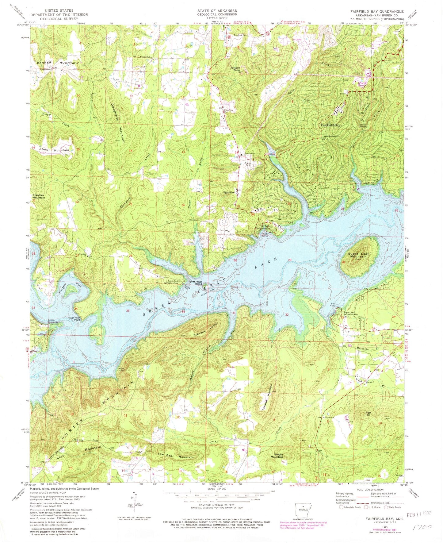
Historical USGS topographic quad map of Fairfield Bay in the state of Arkansas. Map scale may vary for some years, but is generally around 1:24,000. Print size is approximately 24" x 27"
This quadrangle is in the following counties: Van Buren.
The map contains contour lines, roads, rivers, towns, and lakes. Printed on high-quality waterproof paper with UV fade-resistant inks, and shipped rolled.
Contains the following named places: Bailey Hollow, Banner Mountain, Bloomington, Boat Ridge Island, Bradford Cemetery, Burnt Ridge Fire Station Banner Mountain, Choctaw Creek, Choctaw Pines, City of Fairfield Bay, Clinton Waterworks, Dave Creek, Dougherty Mountain, Eglantine, Eglantine Cemetery, Fairfield Bay, Fairfield Bay EMS, Fairfield Bay Marina, Fairfield Bay Police Department, Fairfield Bay Volunteer Fire Department Station 1, Fairfield Bay Volunteer Fire Department Station 2, Green Creek, Harpers Cove, High Top, Hooten Hollow, Hunter Mountain, Lazy Creek, Lewallen Mountain, Low Gap Mountain, Lynn Creek, Moccasin Branch, Palisades, Peter Rock Point, Pine Grove Church, Pleasant Valley Church, South Fork Recreation Area, Standley Church, Stevens Point, Sugar Loaf Mountain, Sugar Loaf Recreation Area, Thompson Creek, Township of Davis, Township of Indian Rock, Township of Red River, Township of Sulphur Springs, United Methodist Church, Van Buren Recreation Area, Wild Goose Branch, Williams Rocks, Wright Mountain, ZIP Code: 72088