MyTopo
Classic USGS Fairfield NE North Carolina 7.5'x7.5' Topo Map
Couldn't load pickup availability
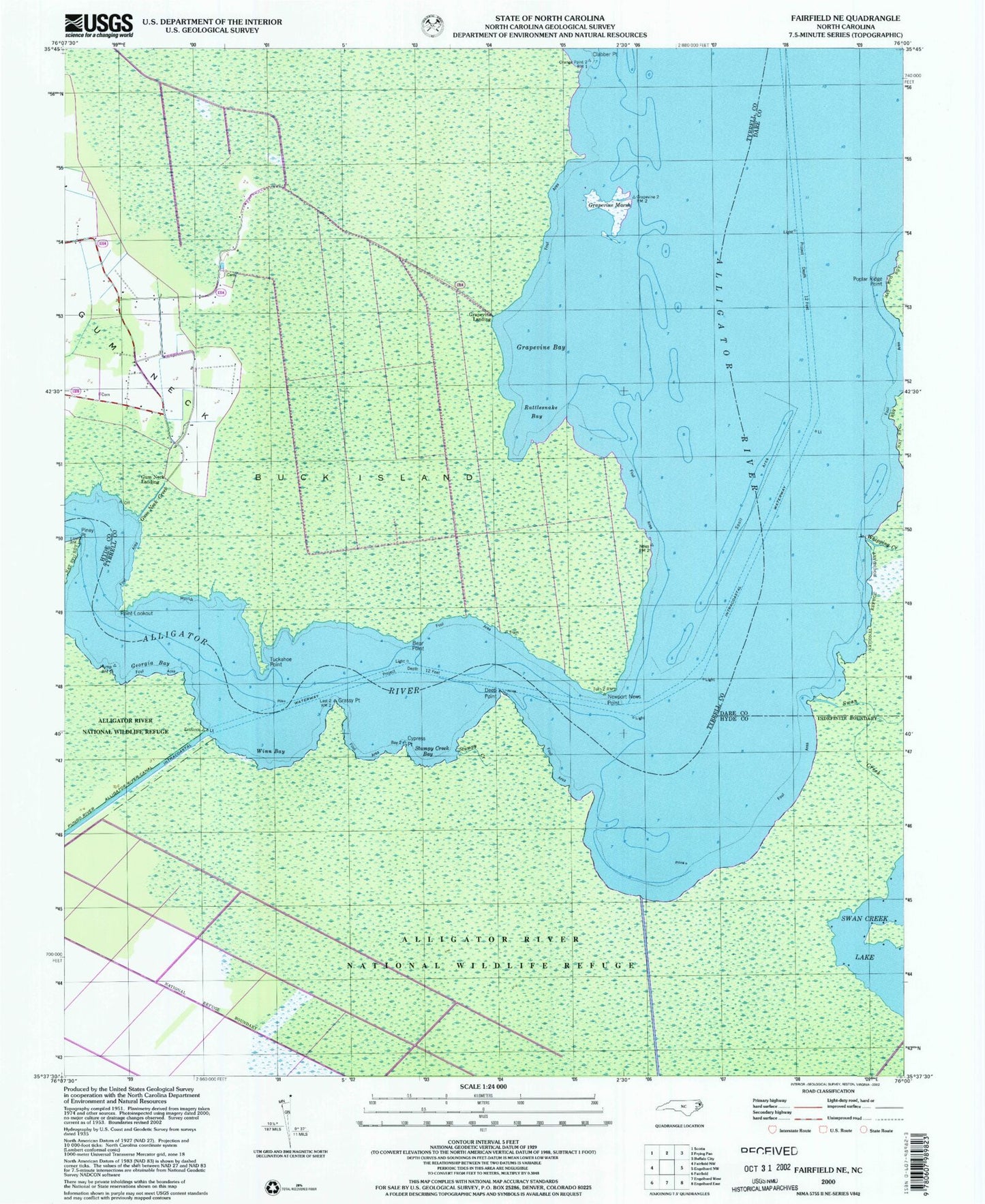
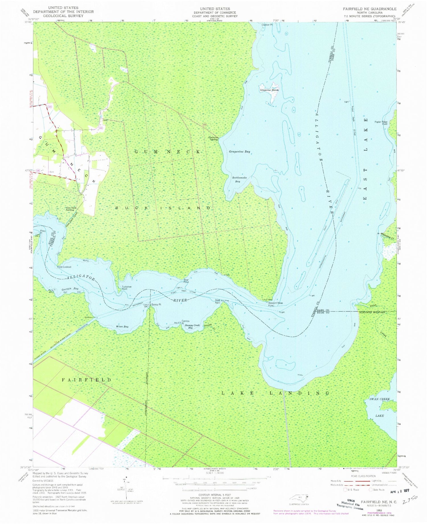
Historical USGS topographic quad map of Fairfield NE in the state of North Carolina. Map scale may vary for some years, but is generally around 1:24,000. Print size is approximately 24" x 27"
This quadrangle is in the following counties: Dare, Hyde, Tyrrell.
The map contains contour lines, roads, rivers, towns, and lakes. Printed on high-quality waterproof paper with UV fade-resistant inks, and shipped rolled.
Contains the following named places: Bear Point, Buck Island, Clabber Point, Cypress Point, Deep Point, Georgia Bay, Grapevine Bay, Grapevine Landing, Grapevine Marsh, Grassy Point, Gum Neck Creek, Gum Neck Landing, Newport News Point, Piney Point, Point Lookout, Poplar Ridge Point, Rattlesnake Bay, Stumpy Creek, Stumpy Creek Bay, Swan Creek, Swan Creek Lake, Swindells Store, Tuckahoe Point, Whipping Creek, Winn Bay