MyTopo
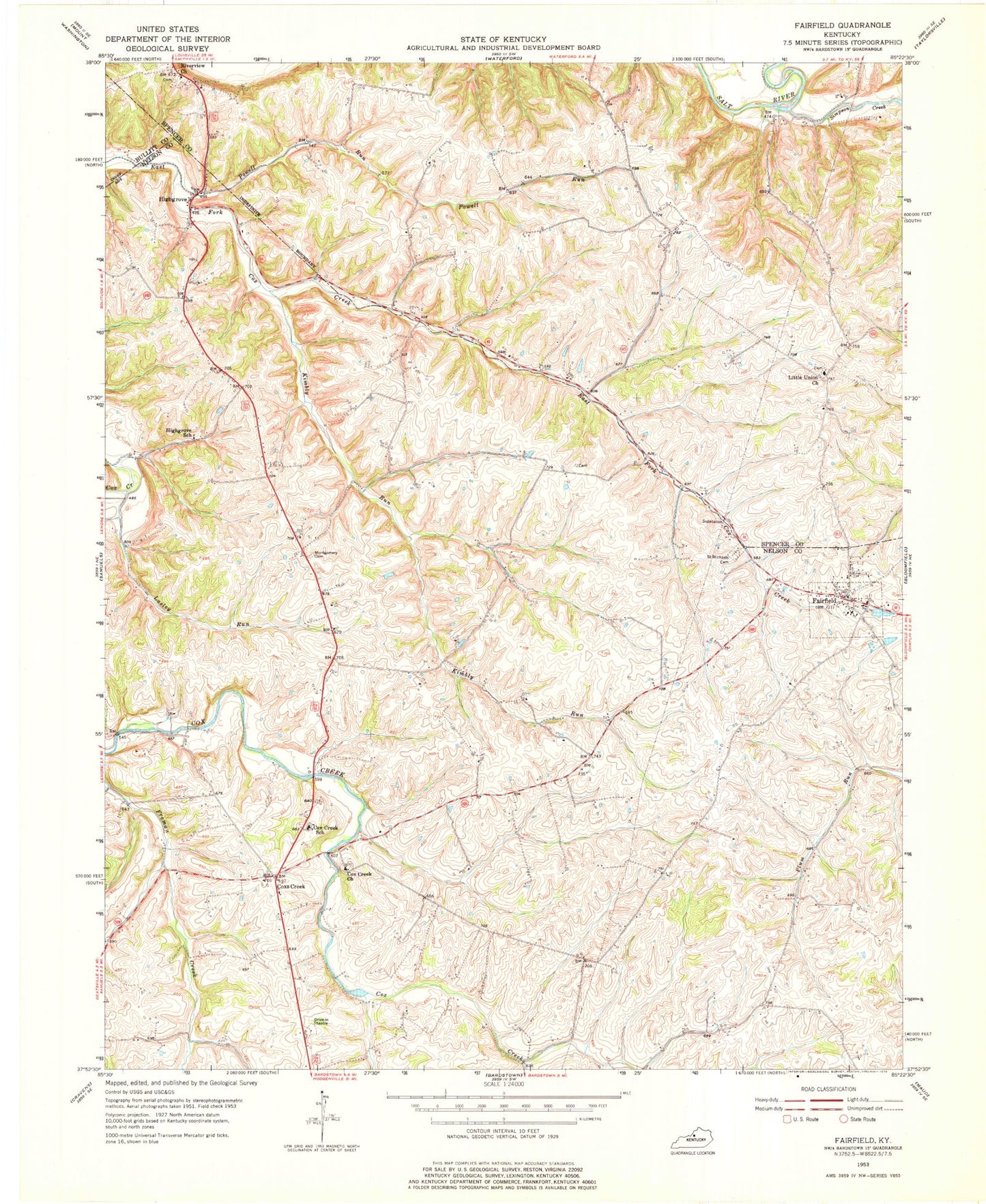
Classic USGS Fairfield Kentucky 7.5'x7.5' Topo Map
Couldn't load pickup availability
Historical USGS topographic quad map of Fairfield in the state of Kentucky. Map scale may vary for some years, but is generally around 1:24,000. Print size is approximately 24" x 27"
This quadrangle is in the following counties: Bullitt, Nelson, Spencer.
The map contains contour lines, roads, rivers, towns, and lakes. Printed on high-quality waterproof paper with UV fade-resistant inks, and shipped rolled.
Contains the following named places: Caney Fork, City of Fairfield, Cox Creek Baptist Church, Cox Creek School, Coxs Creek, Coxs Creek Division, Coxs Creek Post Office, Coxs Station Historical Marker, Downs Ford, Fairfield, Fairfield Post Office, Goodwin Spring, Highgrove, Highgrove School, Kimbly Run, Lasley Run, Lily Branch, Little Union Church, Montgomery Cemetery, Nelson County Fire and Rescue Station 82, Plum Run, Powell Run, Riverview Church, Rogers Run, Saint Michaels Cemetery, Samuels Creek, School Number Fifteen, Simpson Creek, Taylorsville - Spencer County Fire Protection District Station 6, Upper Grove, ZIP Codes: 40013, 40020