
MyTopo
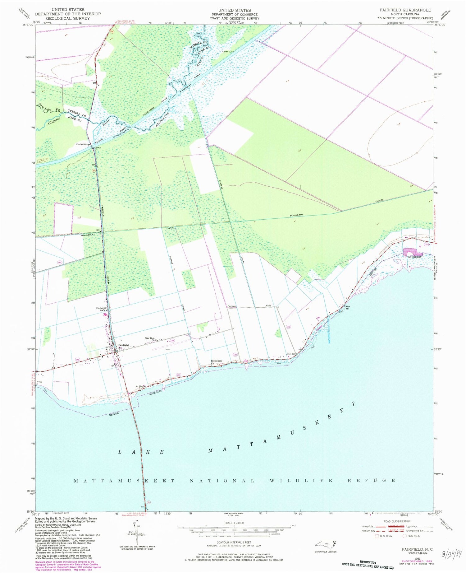
Classic USGS Fairfield North Carolina 7.5'x7.5' Topo Map
Couldn't load pickup availability
Historical USGS topographic quad map of Fairfield in the state of North Carolina. Map scale may vary for some years, but is generally around 1:24,000. Print size is approximately 24" x 27"
This quadrangle is in the following counties: Hyde, Tyrrell.
The map contains contour lines, roads, rivers, towns, and lakes. Printed on high-quality waterproof paper with UV fade-resistant inks, and shipped rolled.
Contains the following named places: Bethlehem Church, Boundary Canal, Burus Canal, Carmur, Carters Canal, Fairfield, Fairfield Bridge, Fairfield Canal, Fairfield Census Designated Place, Fairfield Post Office, Fairfield Volunteer Fire Department, Lake Mattamuskeet, Mattamuskeet National Wildlife Refuge, New Lake Fork, Number 1 East Canal, Star Zion Church, Township of Fairfield, Unorganized Territory of Lake Mattamuskeet, Whitfield's East Airport, ZIP Code: 27826


