MyTopo
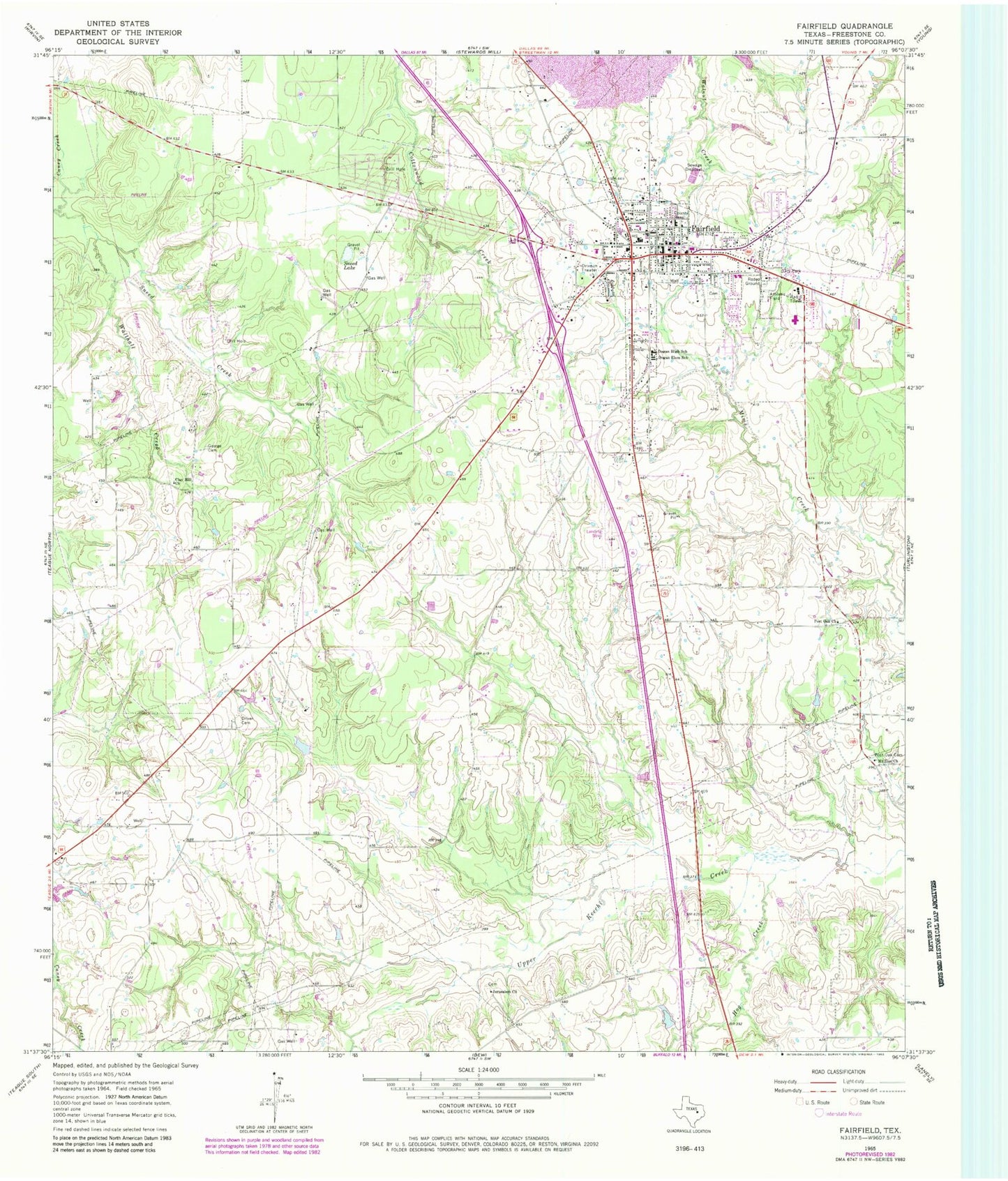
Classic USGS Fairfield Texas 7.5'x7.5' Topo Map
Couldn't load pickup availability
Historical USGS topographic quad map of Fairfield in the state of Texas. Map scale may vary for some years, but is generally around 1:24,000. Print size is approximately 24" x 27"
This quadrangle is in the following counties: Freestone.
The map contains contour lines, roads, rivers, towns, and lakes. Printed on high-quality waterproof paper with UV fade-resistant inks, and shipped rolled.
Contains the following named places: Calvary Baptist Church, City of Fairfield, Clay Hill Church, Dogan Elementary School, Dogan High School, Driver Cemetery, East Texas Medical Center - Fairfield, Fairfield, Fairfield Arena, Fairfield City Hall, Fairfield Elementary School, Fairfield Emergency Medical Service Ambulance, Fairfield Fire Department, Fairfield High School, Fairfield Intermediate School, Fairfield Junior High School, Fairfield Police Department, Fairfield Post Office, Fairfield Volunteer Fire Department, Faith Hope Love Baptist Church, First Baptist Church, Freestone County, Freestone County Constable's Office Precinct 1, Freestone County Constable's Office Precinct 3, Freestone County Historical Museum, Freestone County Jail, Freestone County Sheriff's Office, George Cemetery, Hog Creek, Jehovahs Witnesses Church, Jerusalem Church, KNES-FM (Fairfield), Mount Zion Church, Post Oak Cemetery, Post Oak Church, Round Prairie Baptist Church, Sneed Creek, Sneed Lake, Texas Department of Criminal Justice William R Boyd Unit, Trinity Lutheran Church, Walthall Creek