MyTopo
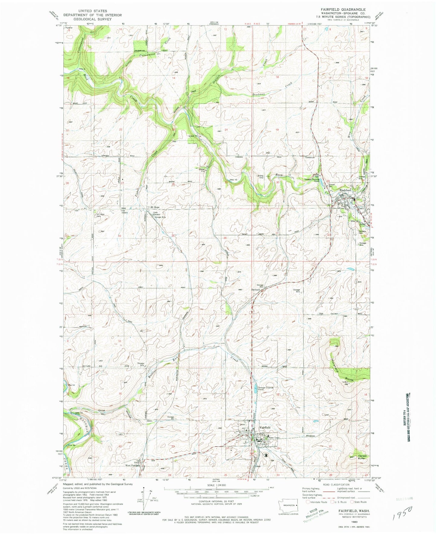
Classic USGS Fairfield Washington 7.5'x7.5' Topo Map
Couldn't load pickup availability
Historical USGS topographic quad map of Fairfield in the state of Washington. Map scale may vary for some years, but is generally around 1:24,000. Print size is approximately 24" x 27"
This quadrangle is in the following counties: Spokane.
The map contains contour lines, roads, rivers, towns, and lakes. Printed on high-quality waterproof paper with UV fade-resistant inks, and shipped rolled.
Contains the following named places: Cottonwood Creek, Darknell, Deadman Creek, Fairfield, Fairfield Ambulance, Fairfield Post Office, Fairfield Seventh Day Adventist School, Fairfield Sheriff's Office, Fairview Cemetery, Fisher Creek, Hansen Butte, Little Cottonwood Creek, Mica Creek, Morefield Butte, Mount Hope, Mount Hope Cemetery, Ochlare Creek, Rattler Run Creek, Rockford, Rockford Division, Rockford Fire Department, Rockford Post Office, Spokane County Fire District 2 - Station 23, Spokane County Fire District 2 Station 21, Town of Fairfield, Town of Rockford, ZIP Code: 99012