MyTopo
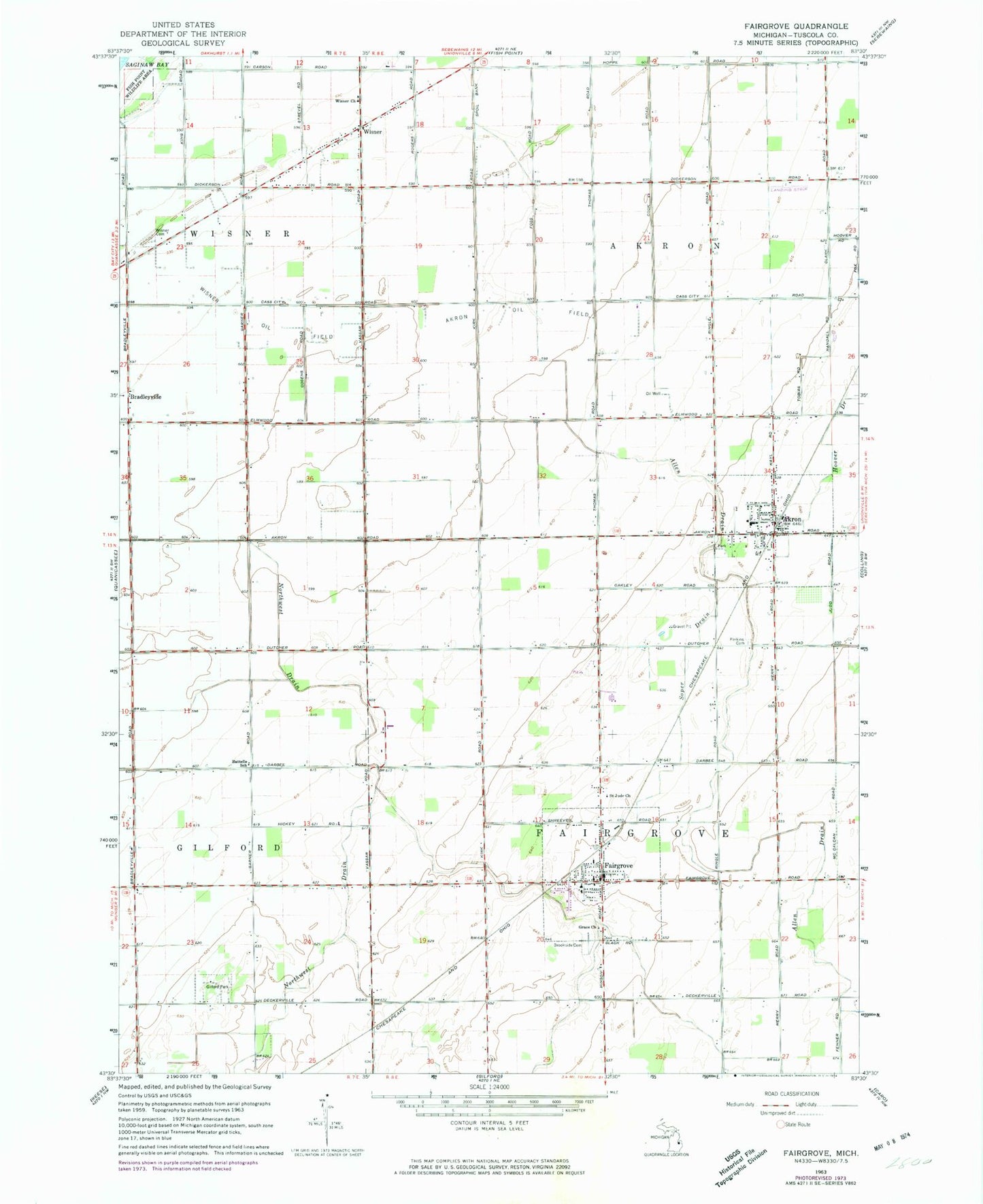
Classic USGS Fairgrove Michigan 7.5'x7.5' Topo Map
Couldn't load pickup availability
Historical USGS topographic quad map of Fairgrove in the state of Michigan. Map scale may vary for some years, but is generally around 1:24,000. Print size is approximately 24" x 27"
This quadrangle is in the following counties: Tuscola.
The map contains contour lines, roads, rivers, towns, and lakes. Printed on high-quality waterproof paper with UV fade-resistant inks, and shipped rolled.
Contains the following named places: Akron, Akron Church of Christ, Akron Community Church of God, Akron Fire Department, Akron Oil Field, Akron Police Department, Akron Post Office, Akron Station, Akron-Fairgrove Elementary School, Akron-Fairgrove High School, Allen Drain, Battelle School, Bradleyville, Brookside Cemetery, Fairgrove, Fairgrove Fire Department, Fairgrove Medical Clinic, Fairgrove Mobile Medical Response, Fairgrove Post Office, Fairgrove Station, Fairgrove Township Library, First Presbyterian Church, Fish Point Wildlife Area, Gilford Park, Grace Church, Indian Dave Historical Marker, Kinter Post Office, Perkins Cemetery, Saint Jude Church, Soper Drain, Township of Fairgrove, United Methodist Church, Village of Akron, Village of Fairgrove, Village of Fairgrove Police Department, Villageside Mobile Home Park, Wisner, Wisner Cemetery, Wisner Church, Wisner Oil Field, Wisner Post Office, ZIP Codes: 48701, 48733