MyTopo
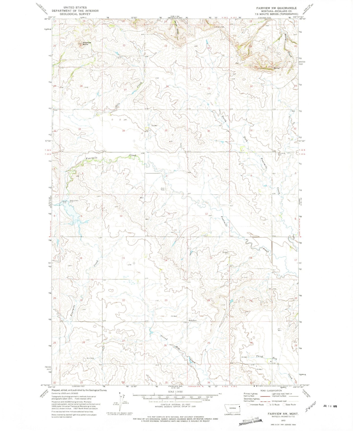
Classic USGS Fairview NW Montana 7.5'x7.5' Topo Map
Couldn't load pickup availability
Historical USGS topographic quad map of Fairview NW in the state of Montana. Map scale may vary for some years, but is generally around 1:24,000. Print size is approximately 24" x 27"
This quadrangle is in the following counties: Richland.
The map contains contour lines, roads, rivers, towns, and lakes. Printed on high-quality waterproof paper with UV fade-resistant inks, and shipped rolled.
Contains the following named places: 25N58E03BBCC01 Well, 25N58E12DCCB01 Well, 25N58E13ADD_01 Well, 25N58E21DDDC01 Well, 25N58E24CCC_01 Well, 25N58E24CCCB01 Well, 25N58E27CCBD01 Well, 25N59E18CBDC01 Well, 25N59E18DC__01 Well, 26N58E21CCCC01 Well, 26N59E32BAAA01 Well, 59221, Antelope Butte, Fourmile Cemetery, Leo Delaney Dam