
MyTopo
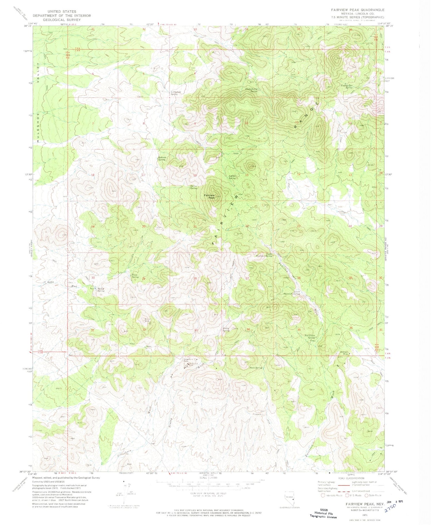
Classic USGS Fairview Peak Nevada 7.5'x7.5' Topo Map
Couldn't load pickup availability
Historical USGS topographic quad map of Fairview Peak in the state of Nevada. Map scale may vary for some years, but is generally around 1:24,000. Print size is approximately 24" x 27"
This quadrangle is in the following counties: Lincoln.
The map contains contour lines, roads, rivers, towns, and lakes. Printed on high-quality waterproof paper with UV fade-resistant inks, and shipped rolled.
Contains the following named places: Bailey Spring, Cactus Spring, Chokecherry Spring, Fairview Mine, Fairview Mining District, Fairview Peak, Fairview Perlite Mine, Fairview Range, Fence Spring, Fox Cabin Spring, Frying Pan Spring, Hornsilver Spring, Indian Spring, Littlefield Spring, Lower Fairview Spring, Lower Frying Pan Spring, Peers Spring, Robison Mine, Robison Spring, Scotty Spring, Silver Dale Mine, Silverhorn Mine, Silverhorn Mining District, Upper Fairview Spring, West Frying Pan Spring


