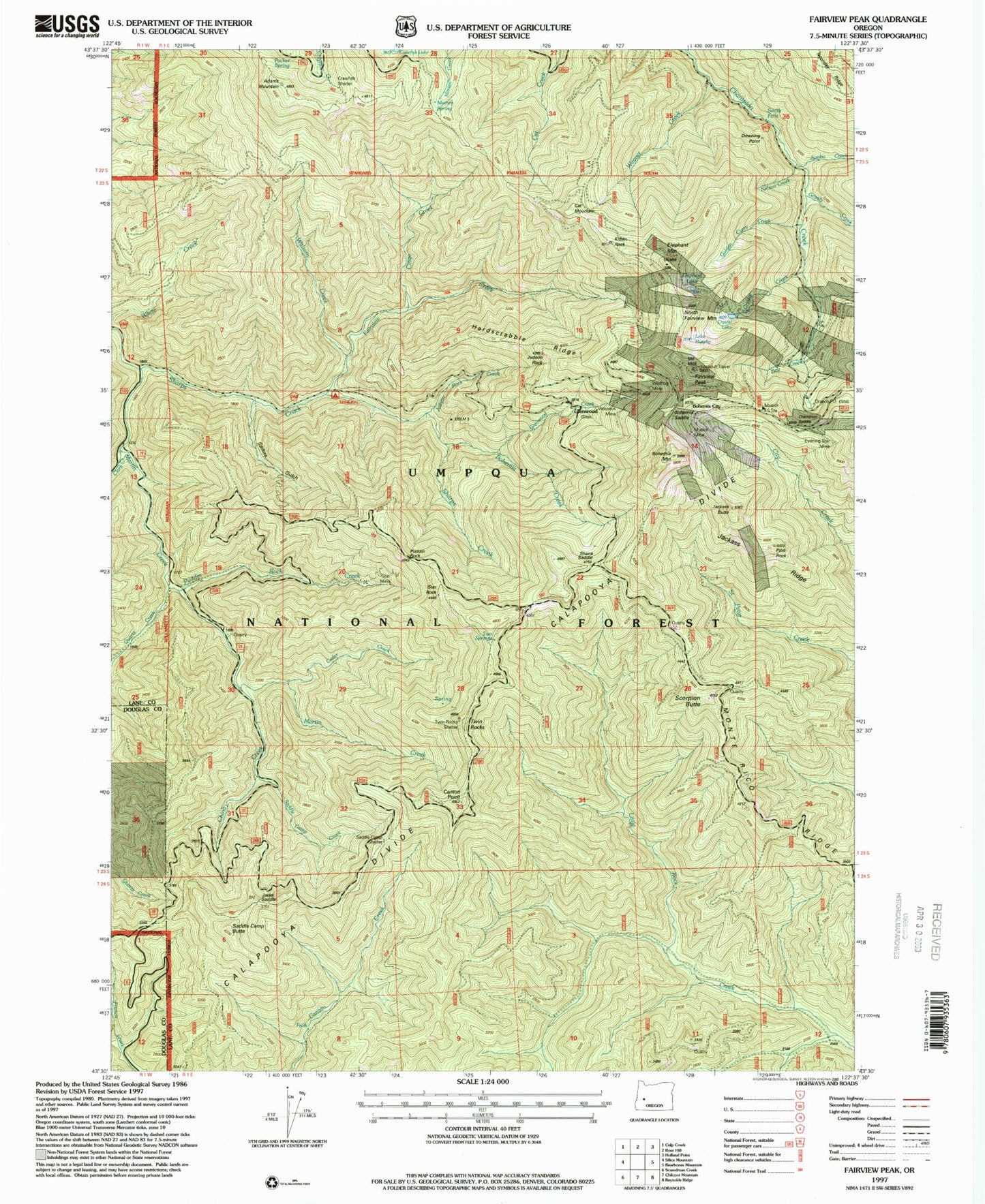
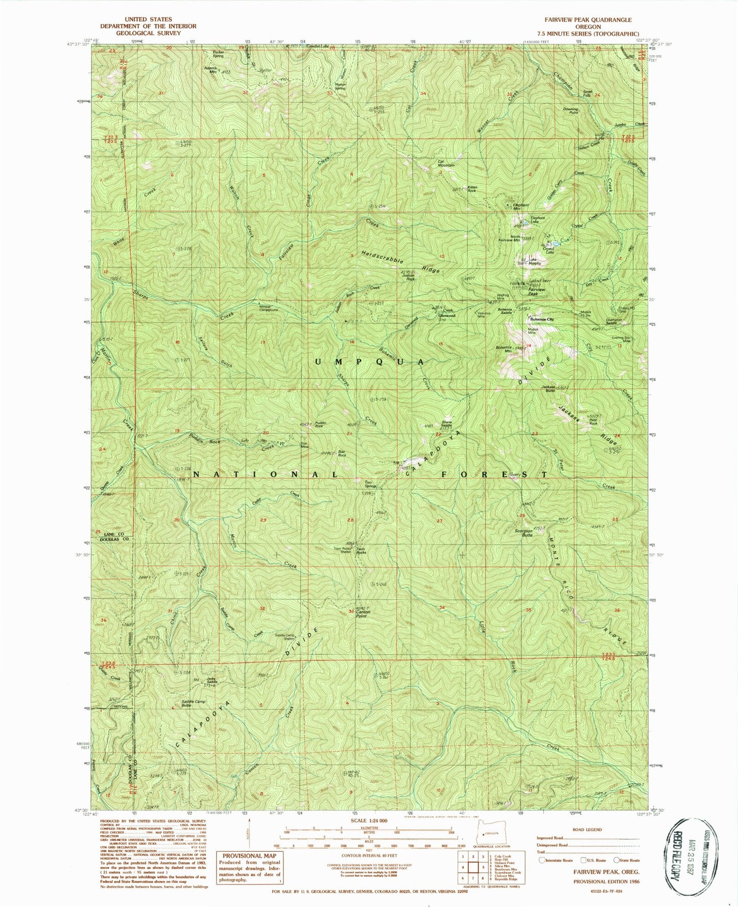
MyTopo
Classic USGS Fairview Peak Oregon 7.5'x7.5' Topo Map
Couldn't load pickup availability
Historical USGS topographic quad map of Fairview Peak in the state of Oregon. Map scale may vary for some years, but is generally around 1:24,000. Print size is approximately 24" x 27"
This quadrangle is in the following counties: Douglas, Lane.
The map contains contour lines, roads, rivers, towns, and lakes. Printed on high-quality waterproof paper with UV fade-resistant inks, and shipped rolled.
Contains the following named places: Adams Mountain, Bohemia, Bohemia Creek, Bohemia Mountain, Bohemia Post Office, Bohemia Saddle, Bohemia Saddle County Park, Bohemia Trail, Calapooya Divide, Canton Creek Trail, Canton Point, Cat Mountain, Cedar Creek, Champion Mine, Champion Saddle, China Creek, China Creek Trail, Cinge Creek, Clark Creek, Crawfish Shelter, Crystal Basin, Crystal Creek, Crystal Lake, Day Creek, Downing Point, Elephant Lake, Elephant Mountain, Evening Star Mine, Fairview Camp, Fairview Creek, Fairview Peak, Francis Way, Fugowee Creek, Glenwood, Glenwood Creek, Golden Curry Creek, Grizzly Creek, Hardscrabble Ridge, Jackass Butte, Jackass Ridge, Jacks Saddle, Judson Rock, Judson Rock Creek, Jumbo Creek, Kitten Rock, Lake Murphy, Marten Spring, Martin Creek, Mattox Creek, Mineral Post Office, Mineral Recreation Site, Monte Rico Ridge, Musick Guard Station, Musick Mine, Nelson Creek, North Fairview Mountain, Orseco Post Office, Packer Spring, Pilot Rock, Puddin Creek, Puddin Rock, Puddin Rock Creek, Quartz Creek, Saddle Camp, Saddle Camp Butte, Saddle Camp Creek, Sailors Gulch, Scorpion Butte, Shane Saddle, Smith Falls, Star Mine, Star Rock, Twin Rocks, Twin Rocks Shelter, Two Springs, Utopian Saddle, Vesuvius Mine, Walton Creek, Weaver Creek, Wildhog Mine, ZIP Code: 97434