MyTopo
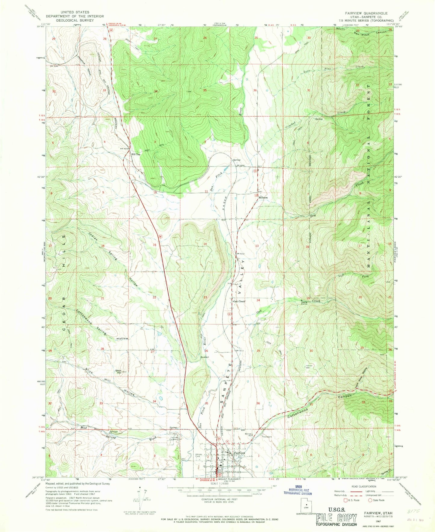
Classic USGS Fairview Utah 7.5'x7.5' Topo Map
Couldn't load pickup availability
Historical USGS topographic quad map of Fairview in the state of Utah. Map scale may vary for some years, but is generally around 1:24,000. Print size is approximately 24" x 27"
This quadrangle is in the following counties: Sanpete.
The map contains contour lines, roads, rivers, towns, and lakes. Printed on high-quality waterproof paper with UV fade-resistant inks, and shipped rolled.
Contains the following named places: City of Fairview, Cottonwood Spring Hollow, Crooked Creek, Dry Creek, Fairview, Fairview Ambulance Association, Fairview Canyon, Fairview Elementary School, Fairview Lower Cemetery, Fairview Police Department, Fairview Post Office, Fairview Upper Cemetery, Fairview Volunteer Fire Department, Hill Top, Hilltop Wildlife Management Area, Indian Spring Hollow, Josephine Hollow, Left Fork Oak Creek, Lone Pine Creek, Lone Rock Ravine, Maple Fork, Milburn, Mud Spring Wash, North Fork Mud Spring Wash, Oak Creek, Slick Hill, Slick Hill Hollow, The Church of Jesus Christ of Latter Day Saints