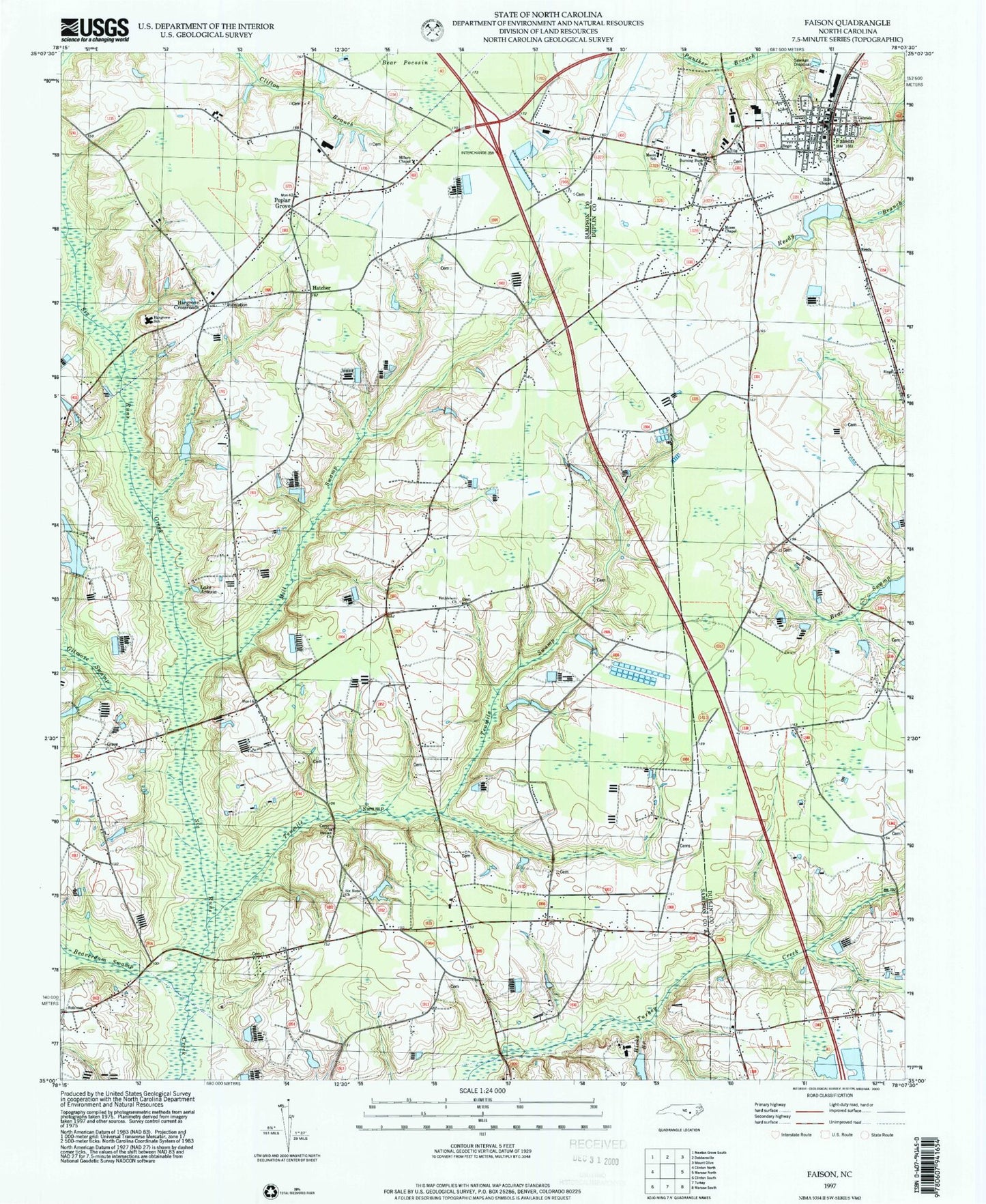
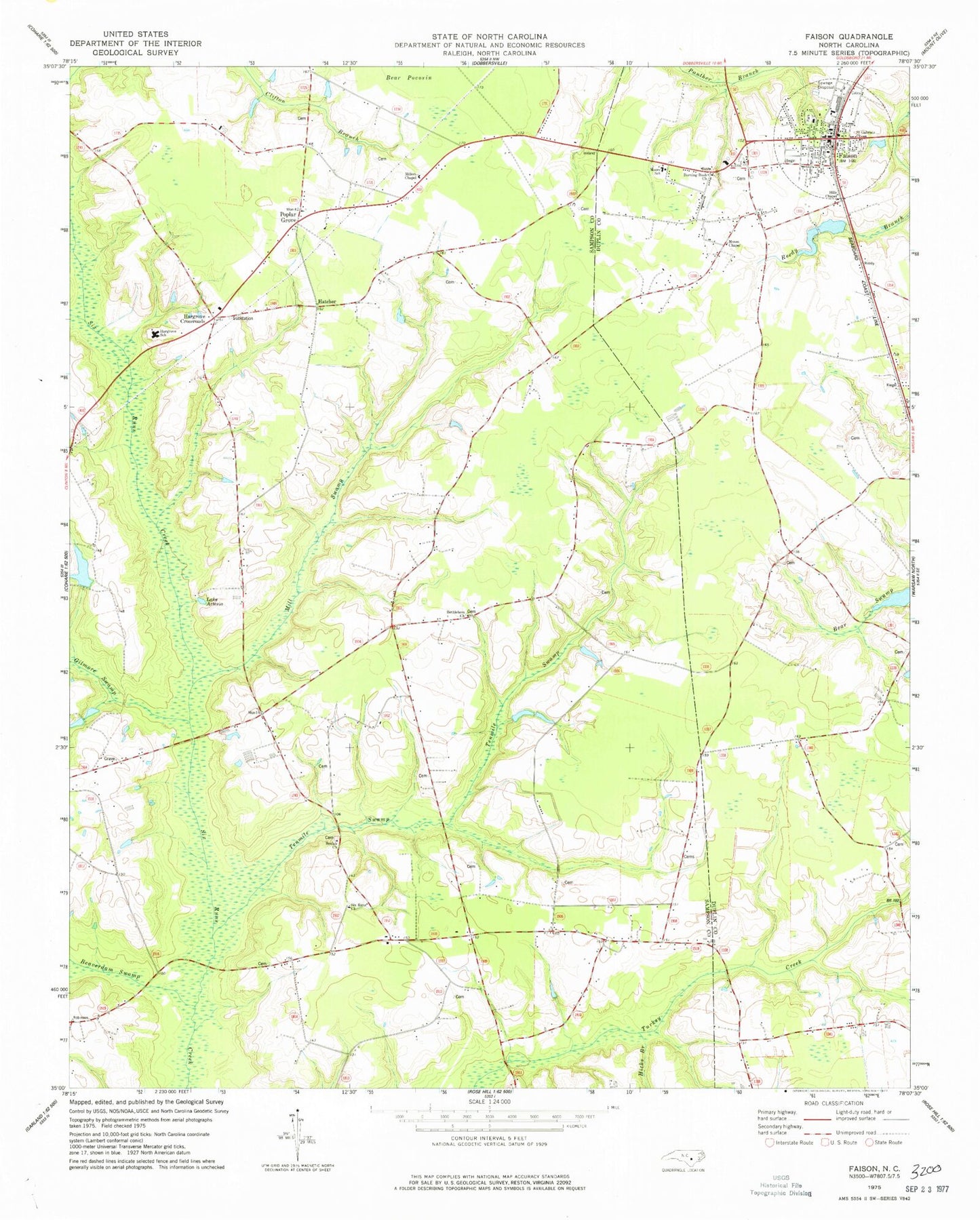
MyTopo
Classic USGS Faison North Carolina 7.5'x7.5' Topo Map
Couldn't load pickup availability
Historical USGS topographic quad map of Faison in the state of North Carolina. Map scale may vary for some years, but is generally around 1:24,000. Print size is approximately 24" x 27"
This quadrangle is in the following counties: Duplin, Sampson.
The map contains contour lines, roads, rivers, towns, and lakes. Printed on high-quality waterproof paper with UV fade-resistant inks, and shipped rolled.
Contains the following named places: Beaverdam Swamp, Bethlehem Church, Beulah Church, Burning Bush Church, Carolina Fish Hatchery, Faison, Faison Baptist Church, Faison Fire and Rescue, Faison Post Office, Faison Sheriff's Department Substation, Faison United Methodist Church, Gilmore Swamp, Hargrove Bridge, Hargrove Crossroads, Hargrove School, Hatcher, Hicks Branch, Hills Chapel, Lake Artesia, Line Academy, Mill Swamp, Millers Chapel, Moore School, Moses Chapel, Poplar Grove, Poplar Grove Baptist Church, Saint Gabriels Church, Six Runs Church, Tenmile Swamp, Town of Faison, ZIP Code: 28341