MyTopo
Classic USGS Faith South Dakota 7.5'x7.5' Topo Map
Couldn't load pickup availability
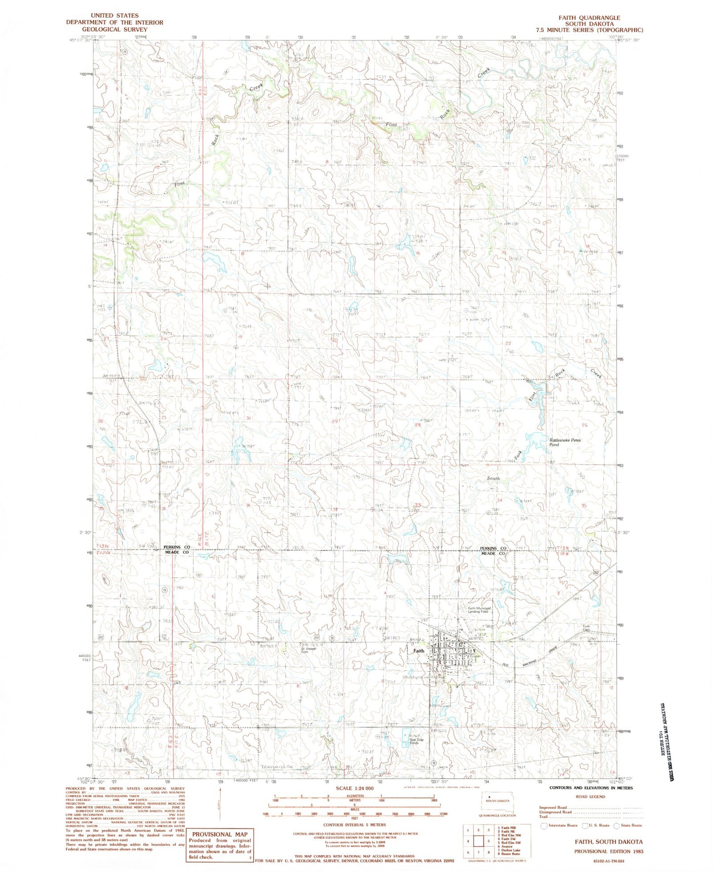
Historical USGS topographic quad map of Faith in the state of South Dakota. Map scale may vary for some years, but is generally around 1:24,000. Print size is approximately 24" x 27"
This quadrangle is in the following counties: Meade, Perkins, Ziebach.
The map contains contour lines, roads, rivers, towns, and lakes. Printed on high-quality waterproof paper with UV fade-resistant inks, and shipped rolled.
Contains the following named places: Arrow Head School, City of Faith, D Ulrich Dam, Faith, Faith Ambulance Service, Faith Cemetery, Faith City Police Department, Faith Community Center, Faith Community Center - City Hall, Faith Elementary School, Faith Fire Department, Faith High School, Faith Junior High School, Faith Municipal Airport, Faith Post Office, Faith Public/School Library, Prairie Oasis Mall, Rattlesnake Petes Pond, S Baxter Number 1 Dam, Saint Joseph Cemetery, Township of Flint Rock, Unorganized Territory of Flint Rock, V Anders Dam, W Reedy Dam, William Baxter Dam, Z Drum Dam