MyTopo
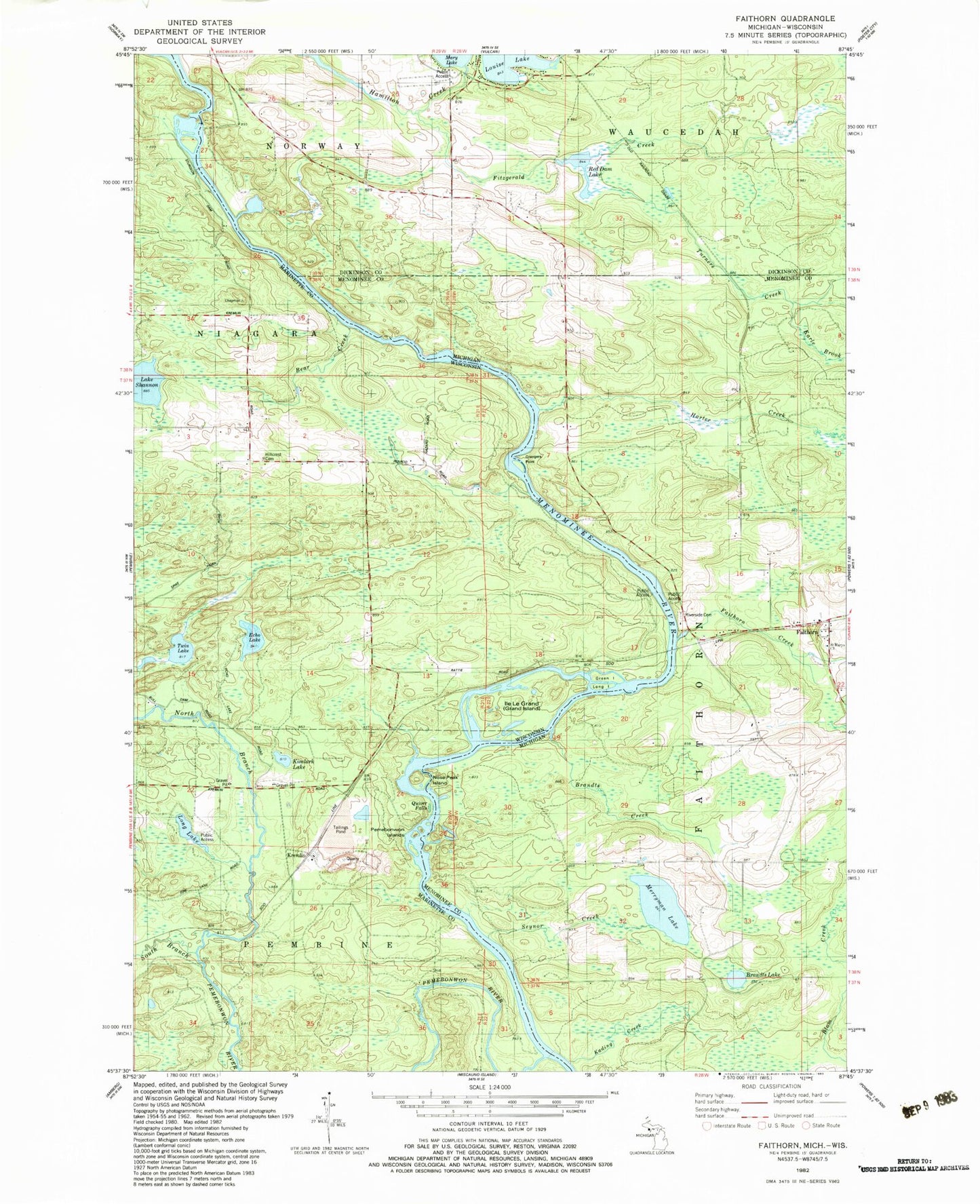
Classic USGS Faithorn Michigan 7.5'x7.5' Topo Map
Couldn't load pickup availability
Historical USGS topographic quad map of Faithorn in the states of Michigan, Wisconsin. Typical map scale is 1:24,000, but may vary for certain years, if available. Print size: 24" x 27"
This quadrangle is in the following counties: Dickinson, Marinette, Menominee.
The map contains contour lines, roads, rivers, towns, and lakes. Printed on high-quality waterproof paper with UV fade-resistant inks, and shipped rolled.
Contains the following named places: Brandts Creek, Brandts Lake, Earle Brook, Emebonwon Dam, Faithorn, Faithorn Creek, Fitzgerald Creek, Grangers Point, Harter Creek, Kading Creek, Louise Lake, Merryman Lake, Red Dam Lake, Seynor Creek, Turners Creek, Saint Mary's Church Cemetery, Riverside Cemetery, Lake Mary Park, Faithorn Post Office (historical), Faithorn Station, Faithorn Township Volunteer Fire Department Storage, Faithorn Township Volunteer Fire Department, Faithorn Rescue Squad, Quiver Falls, Bear Creek, Echo Lake, Green Island, Hillcrest Cemetery, Ile Le Grand, Kimlark Lake, Long Island, Long Lake, Mission Chapel, North Branch Pemebonwon River, Nose Peak Island, Pemebonwon Dam (historical), Pemebonwon Islands, Pemebonwon River, Lake Shannon, South Branch Pemebonwon River, Twin Lake, Kremlin, Chapman School (historical), Sturgeon Falls (historical), Sturgeon Falls Flowage