MyTopo
Classic USGS Falcon Arkansas 7.5'x7.5' Topo Map
Couldn't load pickup availability
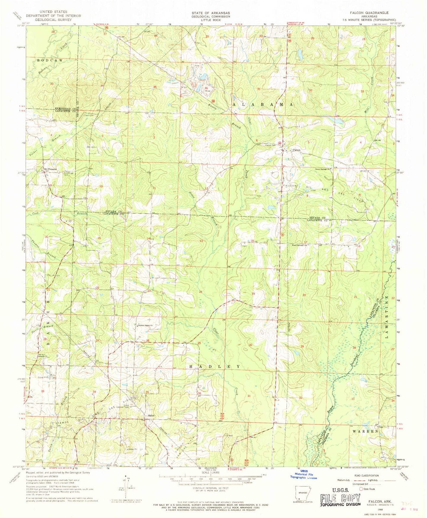
Historical USGS topographic quad map of Falcon in the state of Arkansas. Map scale may vary for some years, but is generally around 1:24,000. Print size is approximately 24" x 27"
This quadrangle is in the following counties: Columbia, Hempstead, Lafayette, Nevada.
The map contains contour lines, roads, rivers, towns, and lakes. Printed on high-quality waterproof paper with UV fade-resistant inks, and shipped rolled.
Contains the following named places: Clark Cemetery, Clevet Springs Cemetery, Clevet Springs Church, Cummings Cemetery, Falcon, Falcon Cemetery, Falcon Oil and Gas Field, Jones Branch, Knotts Branch, KZHE-FM (Stamps), Lone Pine School, Marlers Lake, Marlers Lake Dam, Mount Pleasant, Pleasant Grove Church, Sardis Church, Shiloh, Shiloh Lookout Tower, Shiloh Oil and Gas Field, Stamps Oil and Gas Field, Township of Alabama, Wilson Lake, Wilson Lake Dam, Wood Springs Church, ZIP Code: 71827